Landmark: Eschnerberg Hiking Trail
City: Ruggell
Country: Liechtenstein
Continent: Europe
Eschnerberg Hiking Trail, Ruggell, Liechtenstein, Europe
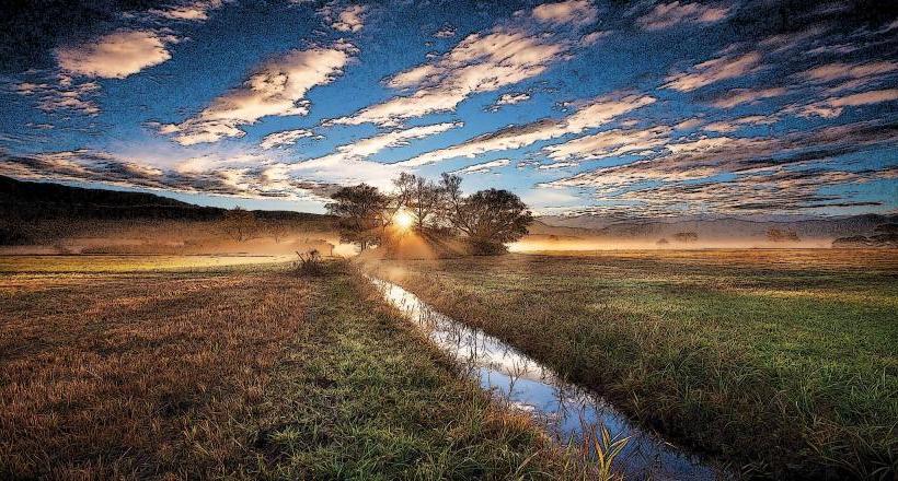
The Eschnerberg Hiking Trail is a circular route traversing the Eschnerberg hill, located primarily within the municipality of Ruggell, Liechtenstein.
Visual Characteristics
The trail consists of compacted earth and gravel paths, winding through mixed deciduous and coniferous forests, open meadows, and agricultural land. Elevations provide panoramic views of the Rhine Valley, the Austrian Alps, and the Swiss mountains. The vegetation varies with altitude and exposure, featuring typical Central European flora.
Location & Access Logistics
The primary access point for the Eschnerberg Hiking Trail is near the Ruggeller Riet nature reserve, approximately 1.5 kilometers east of Ruggell's town center. Designated parking lots are available at the Ruggeller Riet information center. Public transport is accessible via LIEmobil bus line 31, with stops in Ruggell village within walking distance of various trailheads.
Historical & Ecological Origin
The Eschnerberg is an isolated hill, a geological formation composed primarily of molasse rock, shaped by glacial activity during the Ice Ages. The area holds significant archaeological importance, with evidence of human settlement dating back to the Neolithic period, making it one of the oldest continuously inhabited regions in Liechtenstein.
Key Highlights & Activities
The main activity is hiking the approximately 15-kilometer circular trail, which can be completed in sections. Points of interest include the archaeological sites of Bürglen and Malanser, and the ruins of Schellenberg Castle. Interpretive signs along the route provide information on the region's history, geology, and ecology.
Infrastructure & Amenities
Restroom facilities are available at the Ruggeller Riet information center near the main trailhead. Sections of the trail offer natural shade from tree cover. Cell phone signal (4G/5G) is generally reliable along the entire route. Limited food and beverage options are available in Ruggell village; there are no direct vendors on the trail itself.
Best Time to Visit
The trail is best visited from April to October for optimal weather conditions and clear visibility. Early mornings or late afternoons offer favorable lighting for photography, particularly for views over the Rhine Valley. While generally accessible year-round, winter conditions may present icy sections requiring appropriate footwear.
Facts & Legends
The Eschnerberg is considered the cradle of Liechtenstein's settlement history, with archaeological findings providing a continuous timeline from the Stone Age through the Roman period. A practical tip for visitors is to carry sufficient water and snacks, as amenities are not directly available on the trail.
Nearby Landmarks
- Ruggeller Riet: 0.5km West
- Schellenberg Castle Ruins: 3km South
- Historischer Höhenweg (part of the Eschnerberg trail network): 1km South-East
- Gampriner Seele: 4km South-West
- Liechtenstein National Museum (Vaduz): 12km South