Information
Landmark: Grindelwald FirstCity: Grindelwald
Country: Switzerland
Continent: Europe
Grindelwald First, Grindelwald, Switzerland, Europe
First is a minor summit and ridge located at 2,168 meters on the Schwarzhorn slope above Grindelwald, Switzerland. It serves as a primary hub for adventure tourism and high-alpine recreation in the Jungfrau Region.
Visual Characteristics
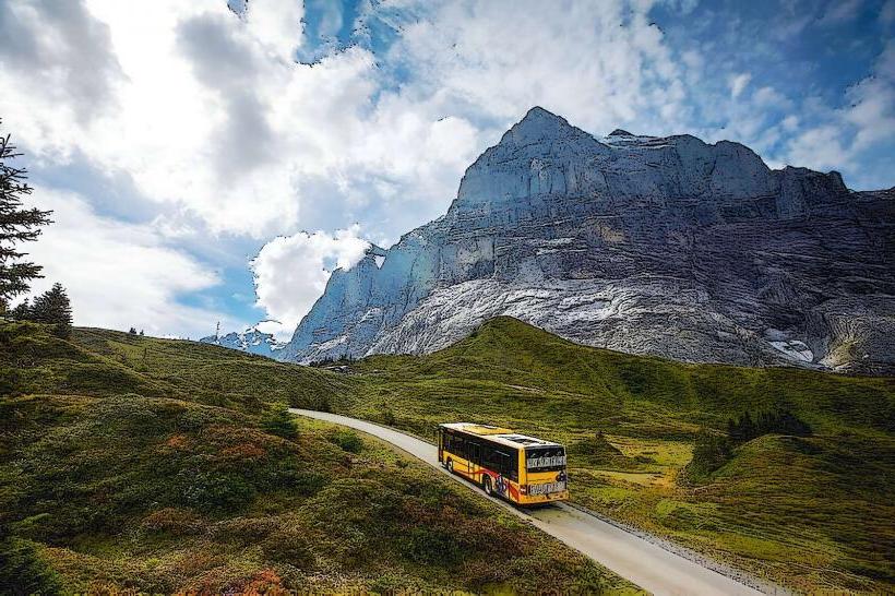
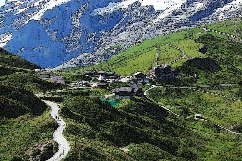
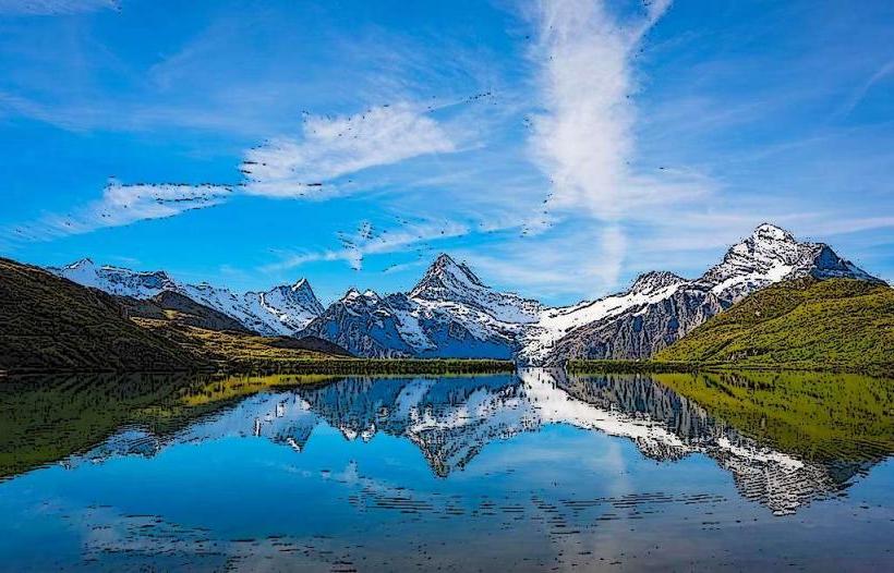
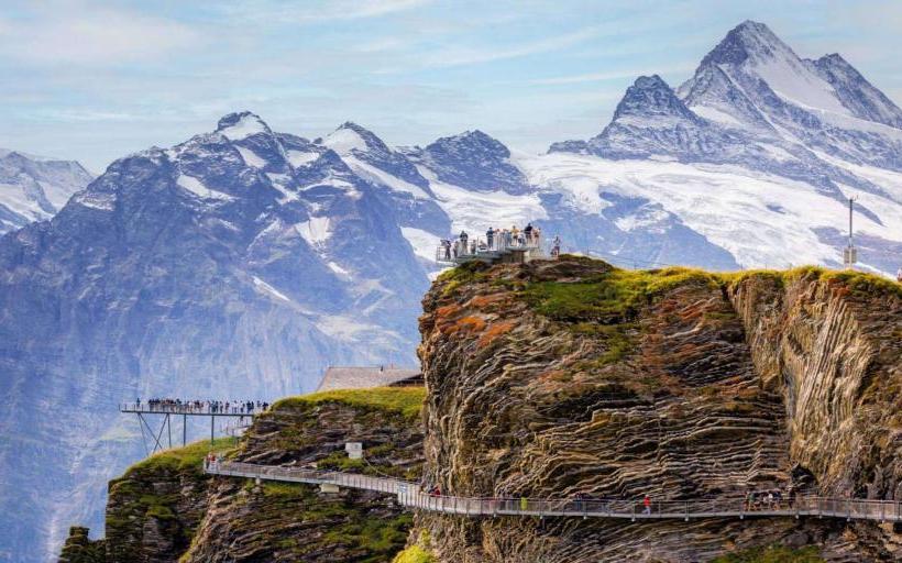
The site is characterized by steep, grassy alpine slopes and sheer limestone precipices. The terrain is marked by the presence of modern steel adventure structures, including the "First Cliff Walk." The observation platform provides a direct, eye-level view of the North Face of the Eiger, the Schreckhorn, and the Wetterhorn. In summer, the area features green pastures and the turquoise Bachalpsee lake; in winter, it is a fully integrated ski sector.
Location & Access Logistics
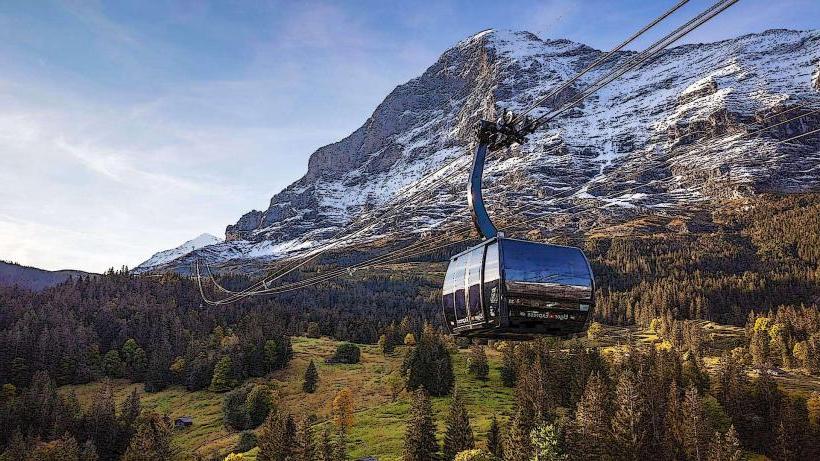
Access is via a three-stage gondola lift (Grindelwald-First BGF) starting from the upper end of Grindelwald village. The transit time is approximately 25 minutes.
Station 1: Grindelwald (1,034m)
Station 2: Bort (1,570m)
Station 3: Schreckfeld (1,955m)
Station 4: First (2,168m)
There is no road access for private vehicles. Hikers can reach the summit from the valley in approximately 3 to 4 hours via steep, well-marked alpine paths.
Historical & Ecological Origin
The first chairlift to First opened in 1947 and was at the time the longest in Europe. The mountain is part of the Helvetic nappes, composed primarily of sedimentary rock. The ecological zone is high-alpine, supporting marmot colonies and specialized flora such as alpine anemones. The Bachalpsee, located 50 minutes from the station, is a natural moorland lake formed by glacial recession.
Key Highlights & Activities
First Cliff Walk by Tissot: A steel walkway bolted to the cliff face, concluding in a 45-meter long cantilever bridge.
First Flyer & First Glider: High-speed zip line attractions reaching up to 80 km/h.
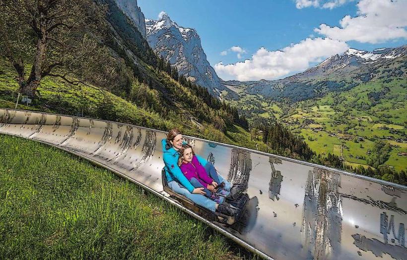
Mountain Cart & Trottibike: Downhill gravity-vehicle tracks from Schreckfeld to Bort and Bort to Grindelwald.
Bachalpsee Hike: A relatively flat, high-altitude trail leading to one of Switzerland's most photographed lakes.
Skiing/Snowboarding: Offers wide, sun-exposed slopes and a world-class halfpipe.
Infrastructure & Amenities
The summit station houses a large mountain restaurant with a panoramic terrace, a souvenir shop, and public restrooms. 5G cellular coverage is available across the ridge. While the gondola and the main station area are wheelchair accessible, the hiking trails and some adventure attractions involve steep gradients or steps. Natural shade is non-existent at the summit; sunscreen is required.
Best Time to Visit
Optimal photography of the Eiger occurs in the early morning when the sun illuminates the north-east faces. For hiking, July through September is the primary season. Winter sports operate from December to late March. To avoid peak queues for the Cliff Walk and zip lines, arrival at the Grindelwald base station by 08:30 is recommended.
Facts & Legends
The First area is often referred to as "Top of Adventure" to distinguish it from the nearby "Top of Europe" (Jungfraujoch). A verified geological fact: the mirror-like reflection of the Schreckhorn in the Bachalpsee only occurs during early morning hours when the wind is at its minimum, creating a "perfect double" image.
Nearby Landmarks
Bachalpsee – 3.0km Northwest
Faulhorn Summit – 6.0km Northwest
Grosse Scheidegg – 5.5km East
Eiger North Face – 6.5km South (Visual distance)
Schreckfeld Station – 1.2km Southwest