Information
Landmark: Huascarán National ParkCity: Huaraz
Country: Peru
Continent: South America
Huascarán National Park, Huaraz, Peru, South America
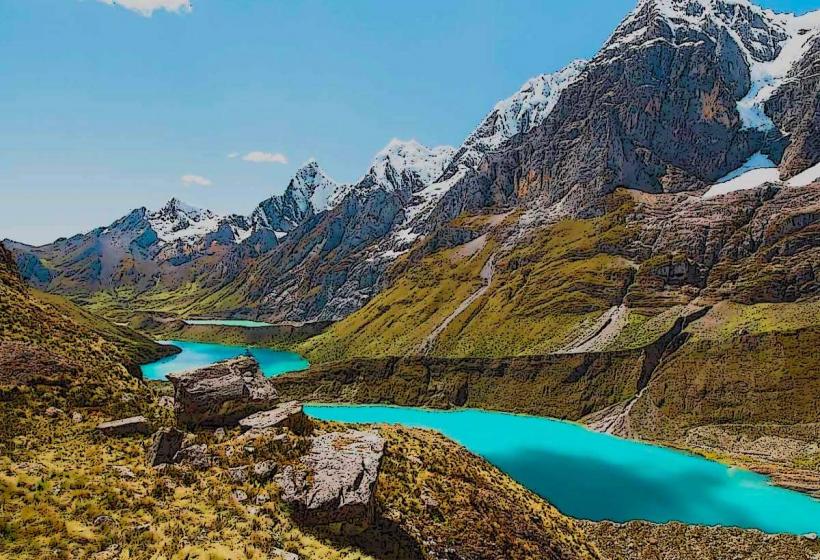
Huascarán National Park is a protected area in the Cordillera Blanca mountain range of Peru. It encompasses the country's highest peak, Nevado Huascarán.
Visual Characteristics
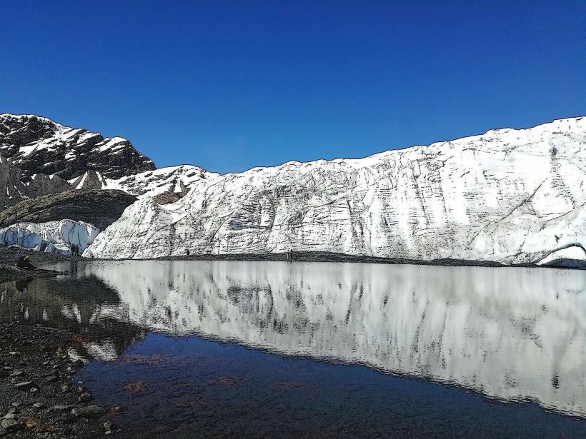
The park features a high-altitude Andean ecosystem dominated by glaciated peaks, alpine meadows, and glacial lakes. Elevations range from 2,500 meters (8,200 ft) to over 6,700 meters (22,000 ft). Rock types include granite and sedimentary formations. Vegetation includes ichu grass, polylepis trees, and various high-altitude flora. Glacial ice covers significant portions of the higher elevations.
Location & Access Logistics
Huascarán National Park is located in the Ancash region of Peru. The nearest major city is Huaraz, approximately 20 kilometers (12 miles) west of the park's main access points. Access is primarily via the Huaraz-Chacas road (PE-16) and secondary unpaved roads leading into the park. Several entrances exist, including those near the Llanganuco Lakes and the town of Yungay. Private vehicle transport is common; public transport options are limited to local buses to nearby towns, requiring onward private arrangements. Parking is available at designated trailheads and visitor areas, often unpaved.
Historical & Ecological Origin
Huascarán National Park was established on January 1, 1975, to protect its unique biodiversity and geological features. Ecologically, it is part of the Puna grassland and Andean dry puna ecoregions. The glaciated peaks are remnants of past ice ages, with ongoing glacial retreat due to climate change. The park's geological formations are primarily the result of tectonic uplift and glacial erosion.
Key Highlights & Activities
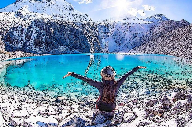
Hiking is a primary activity, with trails ranging from short walks to multi-day treks. Specific trails include the hike to Laguna 69, the Llanganuco Lakes circuit, and access routes for climbing Nevado Huascarán. Rock climbing and mountaineering are possible on numerous peaks. Birdwatching is also a notable activity. Photography opportunities are abundant, particularly of glacial landscapes and alpine flora.
Infrastructure & Amenities
Basic infrastructure exists at some trailheads and visitor centers, including rudimentary restrooms and designated camping areas. Shade is limited in open alpine areas; natural shade is found in lower elevation forest zones. Cell phone signal is generally absent within most of the park, with intermittent reception near park entrances or towns. Food vendors are not typically found within the park itself; provisions should be carried in or purchased in nearby towns like Huaraz or Yungay.
Best Time to Visit
The dry season, from May to September, offers the most favorable weather conditions with clear skies and less precipitation. The best time of day for photography is generally early morning or late afternoon for optimal lighting on the peaks. High tide is not a relevant factor for this terrestrial park. Altitude sickness can affect visitors at any time; acclimatization in Huaraz is recommended.
Facts & Legends
Nevado Huascarán is named after the Inca emperor Huascar. Local legends speak of mountain spirits guarding the peaks. A significant historical event was the 1970 Ancash earthquake, which triggered a massive debris avalanche from the north peak of Huascarán, burying the town of Yungay. A specific tip for visitors is to carry sufficient water and high-energy snacks, as services are scarce.
Nearby Landmarks
- Laguna Llanganuco (0.5km East)
- Yungay town (5km Southwest)
- Nevado Pisco (8km Northwest)
- Cordillera Blanca mountain range (Extends throughout the region)
- Huaraz city (20km West)