Landmark: Kigeme Refugee Camp Viewpoint
City: Nyamagabe
Country: Rwanda
Continent: Africa
Kigeme Refugee Camp Viewpoint, Nyamagabe, Rwanda, Africa
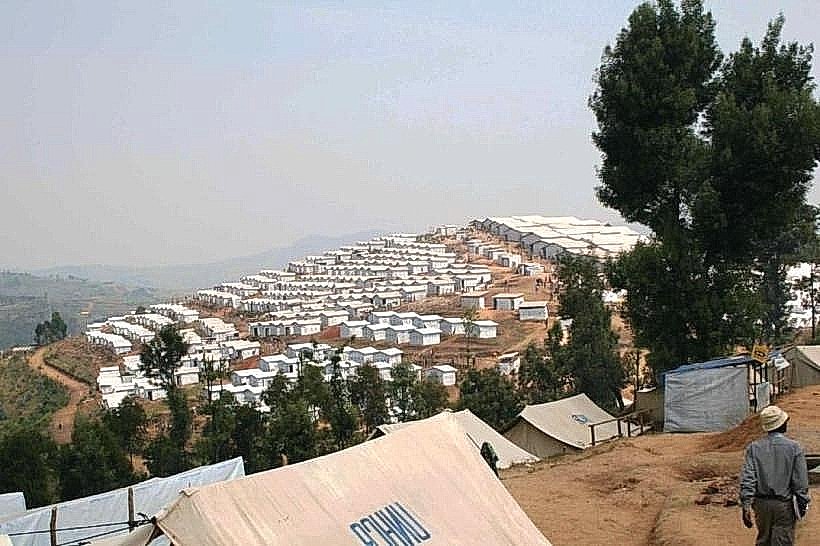
The Kigeme Refugee Camp Viewpoint is an elevated observation area in the Nyamagabe District of Southern Province, Rwanda, overlooking a high-density humanitarian settlement. It provides a panoramic perspective of the camp’s terraced shelters and the surrounding rugged topography of the Congo-Nile Divide.
Visual Characteristics
The viewpoint offers a clear sightline of approximately 34 hectares of steep, terraced hillsides covered in small, uniform shelters with corrugated iron roofing. The landscape is characterized by severe soil erosion, deep drainage channels, and limited clusters of eucalyptus trees intended for slope stabilization. From this elevation, the grid-like organization of the camp’s seven quarters and 19 villages is visible against the backdrop of the verdant, mist-prone southern highlands.
Location & Access Logistics
The site is located approximately 5km west of Nyamagabe town center and is accessed via the RN6 highway. Visitors must turn onto the secondary unpaved road leading toward the Kigeme District Hospital and the camp administrative offices managed by MINEMA. Public transport is available via "motto" (motorcycle taxis) from the Nyamagabe bus terminal. Access to specific areas within the camp perimeter may require authorization from the Ministry of Emergency Management or UNHCR officials.
Historical & Ecological Origin
The Kigeme Refugee Camp was established in 2012 to host Congolese refugees fleeing conflict in North and South Kivu. The site was originally a wooded hillside before being repurposed into a high-density settlement. Ecologically, the area is part of the Albertine Rift montane region, sitting at an elevation of roughly 2,000 meters, which makes it highly susceptible to landslides and environmental degradation due to high rainfall intensity.
Key Highlights & Activities
The viewpoint serves primarily for logistical observation, humanitarian monitoring, and photography of the settlement's unique terraced architecture. Authorized visitors can observe the "Smart Agriculture" projects in the nearby Mushishito marshlands. The site is a key location for understanding the challenges of hill-side urban planning and disaster risk management in refugee contexts.
Infrastructure & Amenities
Infrastructure at the viewpoint is minimal, consisting of open-air gravel shoulders along the access road. Basic amenities, including a health center and water points, are located within the camp's lower sectors but are primarily for resident use. Mobile signal (4G) is reliable throughout the area. For food and formal restrooms, visitors typically return to the nearby Nyamagabe town center or the Kigeme Hospital vicinity.
Best Time to Visit
The best time for photography is during the early morning (07:00 to 09:00) when the valley is often filled with mist, or late afternoon (16:00 to 17:30) for side-lighting on the terraced slopes. The dry seasons (June–August and December–February) are recommended to avoid the heavy rains that frequently cause road mudslides and restricted visibility in this high-altitude zone.
Facts & Legends
Kigeme is one of the most topographically challenging camps in Rwanda; in 2020, hundreds of residents had to be relocated to Mahama Camp due to the extreme risk of the hillsides collapsing. A local tip for observers is to look for the "Solar Streetlights," a recent sustainable energy installation that has transformed the camp's safety and evening economic activity, making it visible from miles away at night.
Nearby Landmarks
Kigeme District Hospital – 0.6km East
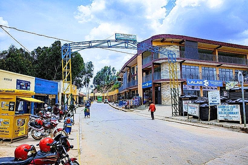
Nyamagabe Market – 4.8km East
Murambi Genocide Memorial – 6.5km Southeast
Mushishito Marshland – 1.5km Northwest
RN6 Highway – 0.4km South