Landmark: Lagoa do Fogo
City: Azores
Country: Portugal
Continent: Europe
Lagoa do Fogo, Azores, Portugal, Europe
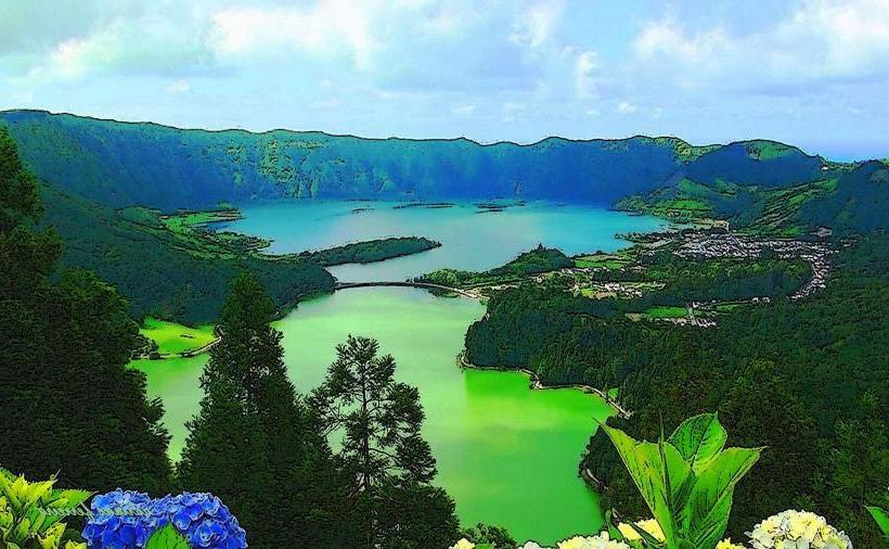
Lagoa do Fogo is a crater lake situated within the Água de Pau Massif in the center of São Miguel Island, Azores. It occupies the caldera of an active volcano and is the highest lake on the island, sitting at an elevation of approximately $575$ meters above sea level.
Visual Characteristics
The lake is surrounded by steep, verdant interior walls that rise up to $300$ meters above the water surface. The water is characterized by high clarity and deep blue tones, bordered by white sand beaches and endemic vegetation including Azorean heather and juniper. The surrounding peaks, such as Pico da Barrosa, reach elevations of $947$ meters, often interacting with low-level cloud formations.
Location & Access Logistics
The site is located 20 kilometers east of Ponta Delgada and is accessed via the EN5-2A mountain road. Several designated viewpoints, including the Miradouro da Lagoa do Fogo and Miradouro do Pico da Barrosa, provide paved parking areas. During peak summer months (June to September), private vehicle access to the main road is restricted, and a mandatory shuttle bus service operates from the Caldeira Velha and Remédios transit hubs.
Historical & Ecological Origin
The caldera was formed approximately 15,000 years ago, with its current morphology significantly shaped by the explosive eruption of 1563. It is a designated Nature Reserve and part of the Natura 2000 network. The ecosystem is a vital nesting ground for seagulls and terns and remains one of the least disturbed natural sites in the Azores due to its status as a protected catchment area for the regional water supply.
Key Highlights & Activities
A steep hiking trail (PRC2SMI) allows visitors to descend from the viewpoint to the lakeside beach, taking approximately 30 minutes. Birdwatching is a primary activity, particularly for observing the Azores common tern. The area is also used for technical hiking along the caldera rim, though paths can be narrow and slippery. Swimming is strictly prohibited to preserve the water quality of the reservoir.
Infrastructure & Amenities
There are no buildings, restrooms, or food vendors within the nature reserve or at the lakeside. Infrastructure is limited to stone-paved viewpoints and dirt hiking paths. 4G and 5G cellular signals are generally available at the higher viewpoints but become unreliable or non-existent at the lake level. Shade is non-existent along the rim and the descent path.
Best Time to Visit
The best time for clear views is between 11:00 and 15:00, as the caldera is frequently shrouded in fog during the early morning and late evening. The most stable weather conditions occur from July to September. Photographers should monitor the SpotAzores webcam (Pico da Barrosa station) in real-time to confirm visibility before beginning the ascent.
Facts & Legends
Local legends suggest the lake is bottomless, though its maximum depth is officially recorded at approximately $30$ meters. A verified historical fact is that the area was used as a source of pumice and other volcanic materials during the early settlement of the island. The name "Lagoa do Fogo" (Lake of Fire) originates from the intense volcanic activity observed by early settlers during the 16th-century eruptions.
Nearby Landmarks
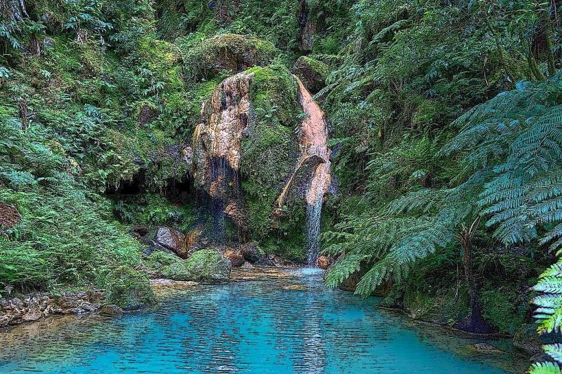
Caldeira Velha Environmental Interpretation Centre: 3.2km North
Salto do Cabrito Waterfall: 4.1km North
Miradouro do Pico da Barrosa: 0.8km West
Janela do Inferno Trail: 4.5km South
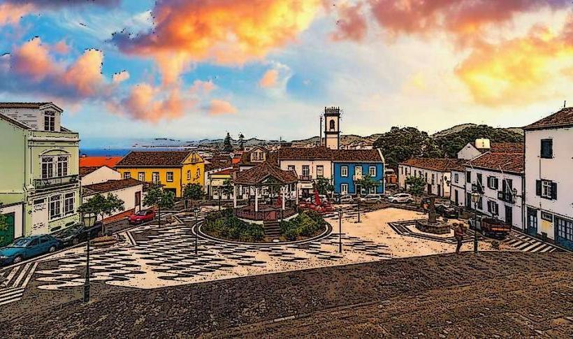
Ribeira Grande City Center: 4.9km North