Information
Landmark: Little Talbot Island State ParkCity: Jacksonville
Country: USA Florida
Continent: North America
Little Talbot Island State Park, Jacksonville, USA Florida, North America
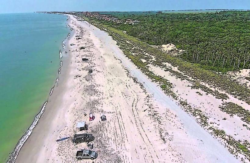
Little Talbot Island State Park is a protected natural area located on a barrier island east of Jacksonville, Florida.
It preserves a significant portion of the remaining undeveloped barrier island ecosystem in Northeast Florida.
Visual Characteristics
The park features a coastline characterized by wide, sandy beaches with a coarse grain. Dune systems, stabilized by sea oats and other native vegetation, rise behind the beach. Inland, maritime hammocks consist of live oaks, sabal palms, and red cedars. Salt marshes are present along the western edge of the island, bordering the Intracoastal Waterway.
Location & Access Logistics
The park is situated at 12157 Heckscher Drive, Jacksonville, FL 32226. It is approximately 20 miles east of downtown Jacksonville. Access is via Heckscher Drive (State Road 101). Ample parking is available at designated lots throughout the park, including near the main beach access and the Fort George River boat ramp. No public transport directly serves the park.
Historical & Ecological Origin
Little Talbot Island is a natural barrier island formed by Holocene sediment deposition. Its ecological significance lies in its relatively intact dune and maritime forest ecosystems, which are increasingly rare along the Atlantic coast. The island has a history of limited human settlement, with evidence of Timucua occupation and later colonial-era activity, particularly around Fort George Island to the west.
Key Highlights & Activities
Activities include beachcombing, birdwatching, fishing from the shore or the Fort George River boat ramp, kayaking and canoeing in the salt marshes, and hiking the Dune Ridge Trail (3 miles) and the Fort George River Trail (3 miles). Swimming is permitted in the Atlantic Ocean. Primitive camping is available for registered groups.
Infrastructure & Amenities
Restrooms are available at the main park entrance and near the beach access points. Picnic tables and shelters are provided. Shade is available under the maritime hammocks and at designated picnic areas. Cell phone signal (4G/5G) is generally available but can be intermittent in more remote areas of the park.
Best Time to Visit
For photography, early morning and late afternoon offer optimal lighting conditions on the beach and dunes. The best months for weather are typically March through May and September through November, with lower humidity and milder temperatures. High tide is suitable for observing the full extent of the beach, while low tide exposes more of the sandbar and potential tide pools.
Facts & Legends
The park is known for "Boneyard Beach," where the bleached, skeletal remains of salt-pruned cedars and oaks stand along the shoreline, a result of coastal erosion and changing dune lines. A local legend speaks of shipwrecks along the coast, though specific documented accounts are scarce.
Nearby Landmarks
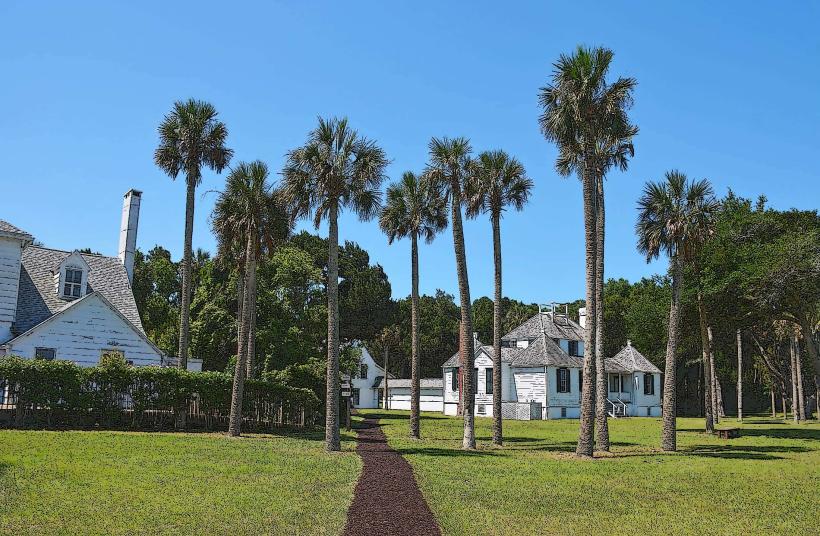
- Fort George Island Cultural State Park (0.5km West)
- Timucuan Ecological and Historic Preserve (1km West)
- Jacksonville Zoo and Gardens (15km Southwest)
- Kathryn Abbey Hanna Park (18km Southwest)
- St. Johns River Ferry (2km West)