Landmark: Mackerel Cove Beach
City: Jamestown
Country: USA Rhode Island
Continent: North America
Mackerel Cove Beach, Jamestown, USA Rhode Island, North America
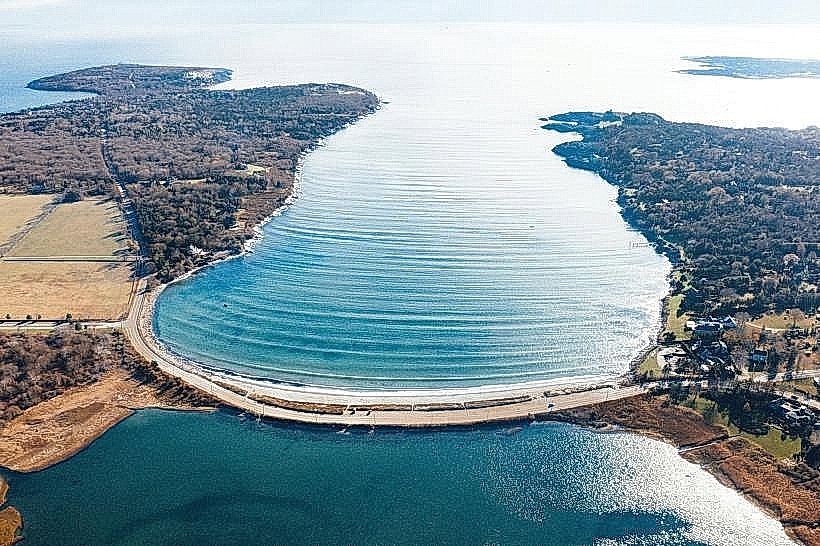
Mackerel Cove Beach is a public access shoreline located in Jamestown, Rhode Island.
This coastal area provides a sandy beach environment adjacent to a small harbor.
Visual Characteristics
The beach consists of fine, light-colored sand. The water in the cove is typically calm and shallow, with a greenish hue. Rocky outcrops are present at the northern and southern extremities of the beach. Vegetation is sparse, primarily consisting of dune grasses.
Location & Access Logistics
Mackerel Cove Beach is situated on the west side of Conanicut Island, accessible via Beavertail Road. It is approximately 3.2 kilometers (2 miles) south of the Jamestown Bridge and 4.8 kilometers (3 miles) south of the Jamestown Village center. Parking is available in a designated lot adjacent to the beach, with capacity for approximately 50 vehicles. There are no direct public bus routes to the beach; access typically requires private transportation.
Historical & Ecological Origin
Mackerel Cove is a natural indentation in the coastline, formed by glacial activity and subsequent erosion. The area has historically served as a sheltered anchorage for small fishing vessels. The ecological classification is a temperate coastal beach and shallow bay environment.
Key Highlights & Activities
Swimming is permitted in the cove. Kayaking and paddleboarding are possible, particularly during calm conditions. Beachcombing for shells and observing local birdlife are common activities. Fishing from the rocky points is also undertaken.
Infrastructure & Amenities
Restrooms are available at the beach access point. Limited shade is provided by natural vegetation at the edges of the beach. Cell phone signal (4G/5G) is generally reliable. No food vendors are permanently located at the beach; visitors typically bring their own provisions.
Best Time to Visit
For swimming and water activities, the months of July and August offer the warmest water temperatures. Mid-morning to late afternoon provides optimal sunlight for beach use. High tide is generally preferred for swimming due to deeper water, though the cove remains shallow.
Facts & Legends
The cove's name is derived from historical fishing practices where mackerel were abundant. A local anecdote suggests that during certain periods, the water would appear silver due to large schools of fish near the surface.
Nearby Landmarks
- Beavertail State Park (1.5km South)
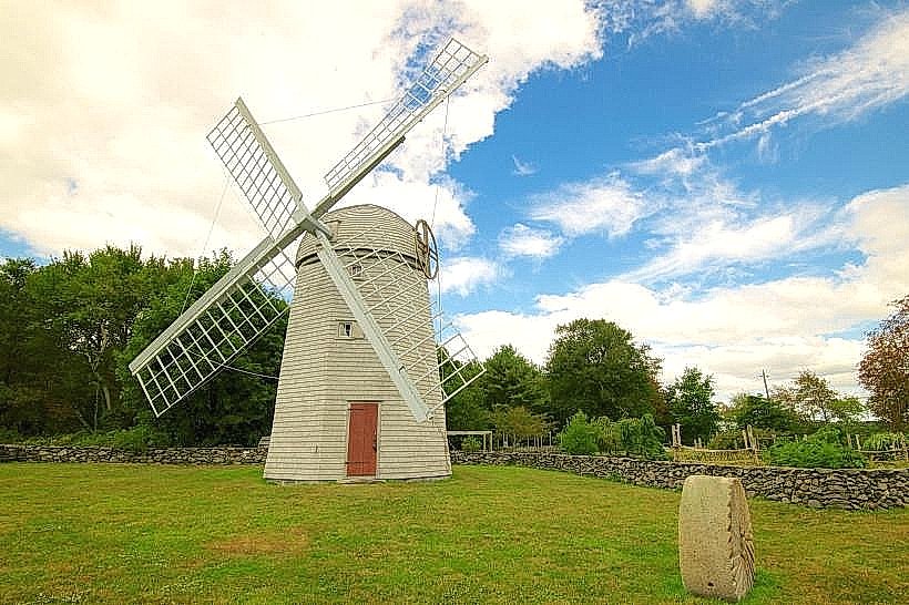
- Jamestown Windmill (3.0km North)
- Fort Adams State Park (4.0km East, across the East Passage)
- The Jamestown Bridge (3.2km North)