Landmark: Maxwell Hill (Bukit Larut)
City: Taiping
Country: Malaysia
Continent: Asia
Maxwell Hill (Bukit Larut), Taiping, Malaysia, Asia
Maxwell Hill, known locally as Bukit Larut, is a mountain located near Taiping, Malaysia.
It is the highest point in the state of Perak.
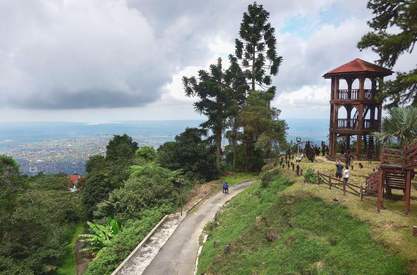
Visual Characteristics
Maxwell Hill is characterized by its steep slopes covered in dense tropical rainforest. The primary access road is paved and winds upwards. At higher elevations, the vegetation thins slightly, revealing exposed rock faces in some areas. The summit area features a small plateau with several buildings, including a meteorological station and bungalows.
Location & Access Logistics
Maxwell Hill is situated approximately 10 kilometers east of Taiping's city center. Access is via Jalan Maxwell. Private vehicles are generally not permitted to drive to the summit; visitors must park at the base station. From the base station, a 4WD taxi service operates on a scheduled basis to transport visitors to the summit. The journey takes approximately 30-45 minutes. There are no direct public bus routes to the summit.
Historical & Ecological Origin
Bukit Larut was established as a hill station during the British colonial era, with development beginning in the late 19th century. Its original purpose was to provide a cooler climate for British administrators. Ecologically, it is part of the Main Range of Peninsular Malaysia, characterized by montane rainforest ecosystems.
Key Highlights & Activities
Hiking is a primary activity, with several trails of varying difficulty. The main road itself serves as a popular route for walkers and cyclists. Birdwatching is common due to the diverse avian population. Visitors can also observe the cooler climate compared to the lowlands. The summit offers viewpoints, though visibility can be affected by cloud cover.
Infrastructure & Amenities
Restrooms are available at the base station and at designated points along the access road. Limited shaded rest stops are present. Cell phone signal (4G) is generally available at the base station and intermittently along the road, but can be weak at the summit. There are no food vendors on the hill; visitors are advised to bring their own provisions. Basic accommodation is available in the form of government bungalows, which require advance booking.
Best Time to Visit
The best time of day for photography is generally in the early morning before the clouds typically form, or late afternoon. The months of March to September offer drier weather, though rain can occur year-round. High tide is not a relevant factor for this inland location. The summit is often cooler and more pleasant in the morning hours.
Facts & Legends
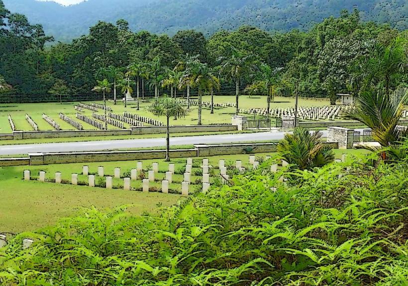
A specific historical oddity is the presence of a colonial-era cemetery located partway up the hill, containing graves of early British residents. The hill is known for its significant temperature drop compared to the surrounding plains, often reaching below 20 degrees Celsius.
Nearby Landmarks
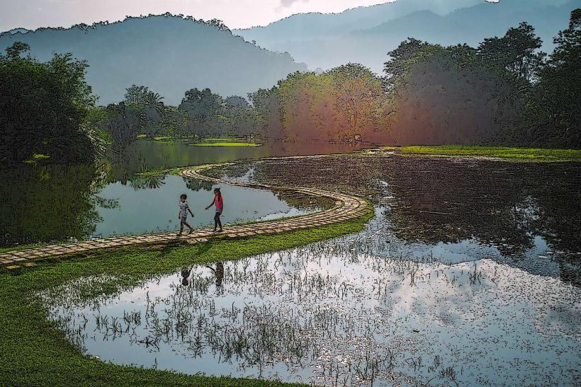
- Taiping Lake Gardens (5km West)
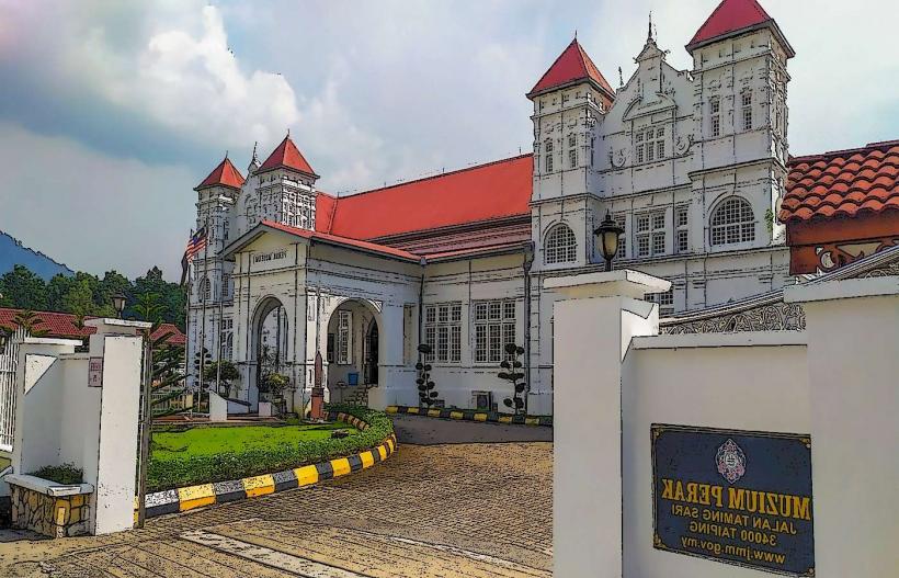
- Perak Museum (7km West)
- Kuala Gula Bird Sanctuary (35km Northwest)
- Matang Mangrove Forest Reserve (25km Southwest)
- Maxwell Hill Forest Reserve (surrounds the landmark)