Information
Landmark: Misima IslandCity: Provice Area
Country: Papua New Guinea
Continent: Australia
Misima Island, Provice Area, Papua New Guinea, Australia
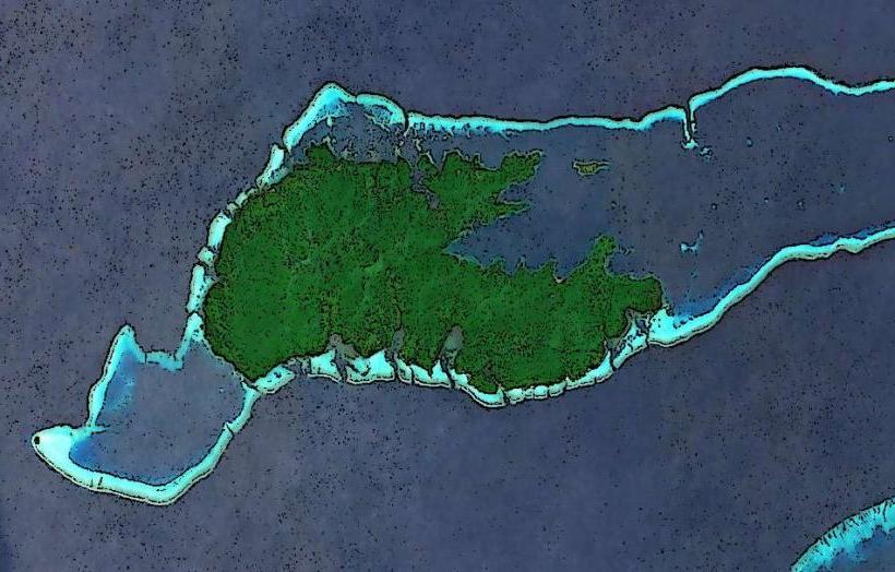
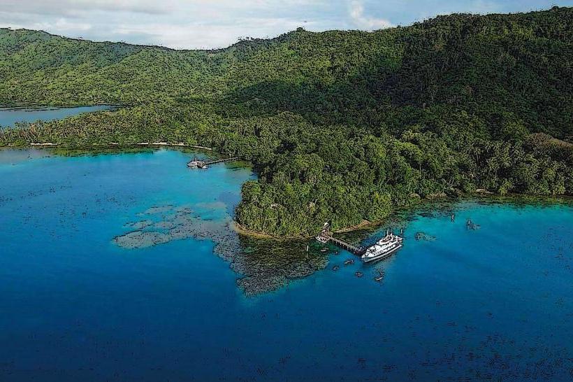
Misima Island is a landmass located in the Milne Bay Province of Papua New Guinea. It is part of the Louisiade Archipelago.
Visual Characteristics
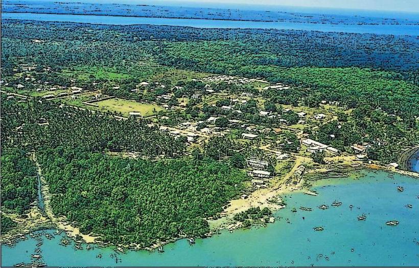
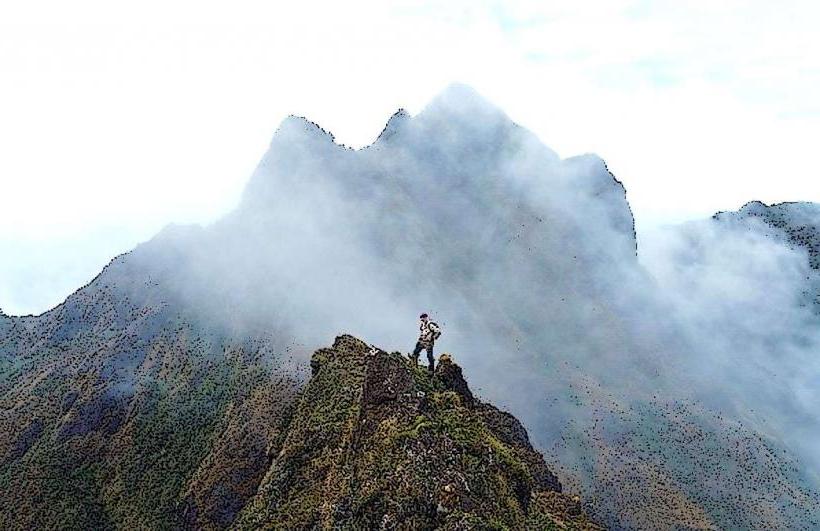
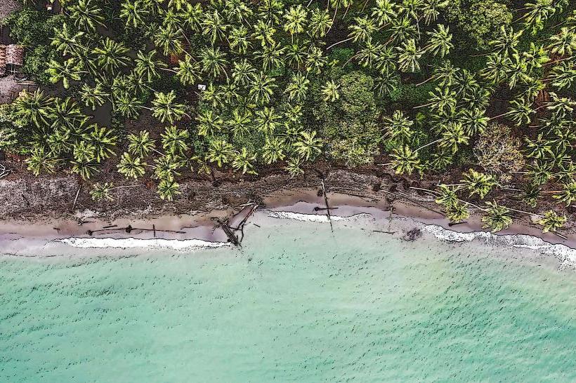
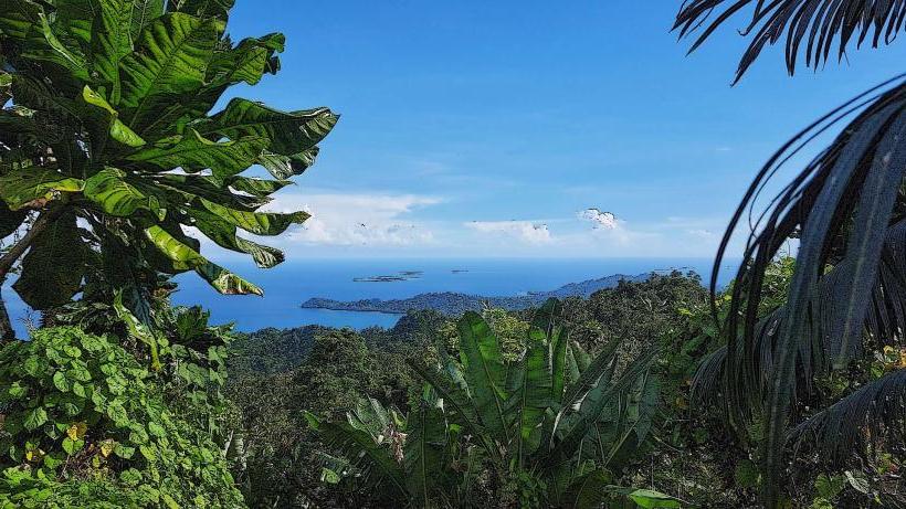
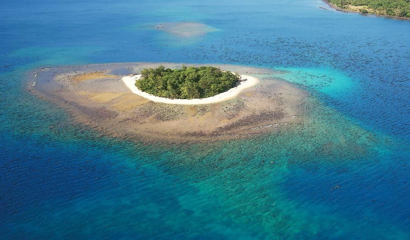
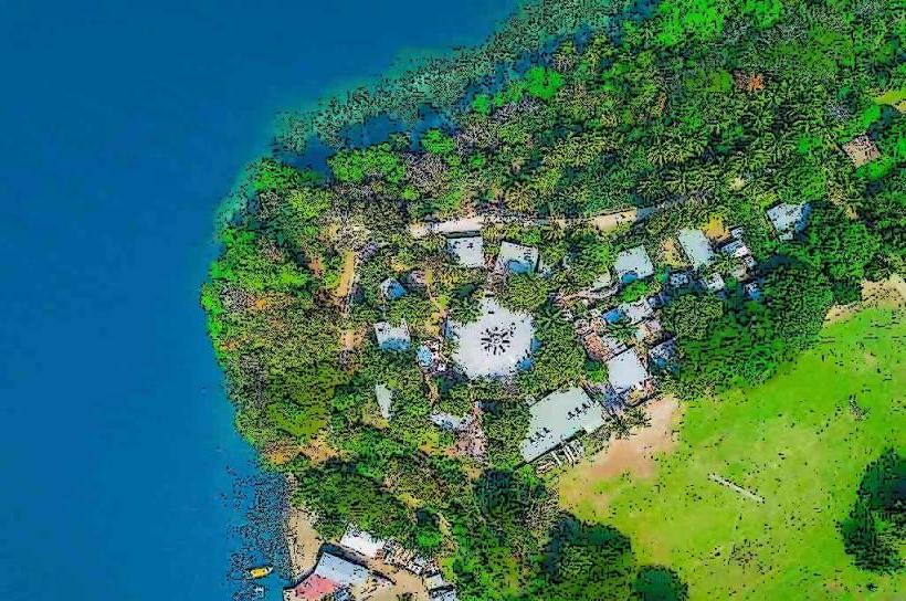
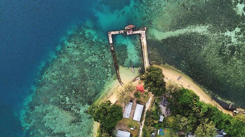
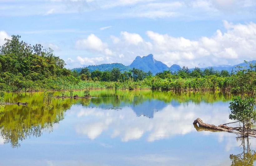
The island is characterized by a central volcanic ridge reaching approximately 600 meters in elevation. The coastline features sandy beaches interspersed with rocky outcrops. Vegetation is dense tropical rainforest, with coconut palms prevalent along the shorelines. The surrounding waters are clear, with visible coral reefs.
Location & Access Logistics
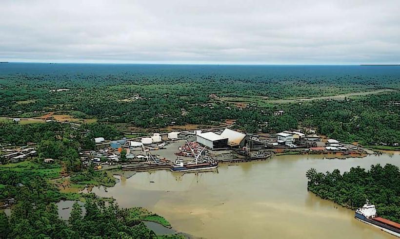
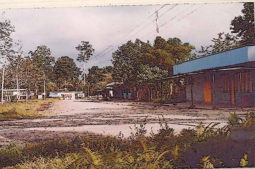
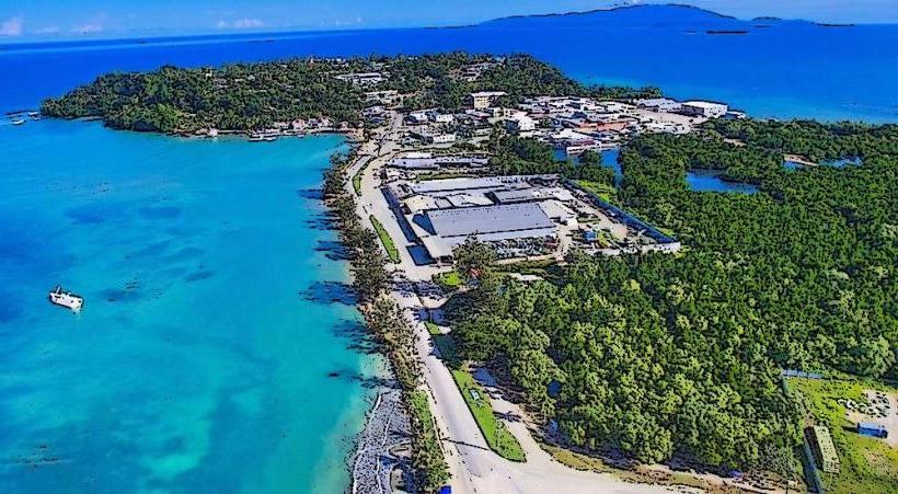
Misima Island is situated approximately 200 kilometers east of the provincial capital, Alotau. Access is primarily via air to Misima Airport (MIS), which receives infrequent charter flights. Sea access is possible via cargo vessels or private boats, with limited docking facilities at Bwagaoia, the main settlement. There are no public transport services on the island; local transport relies on walking or hired utility vehicles.
Historical & Ecological Origin
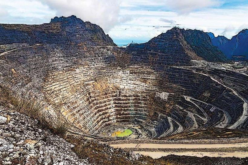
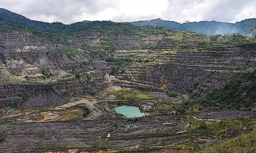
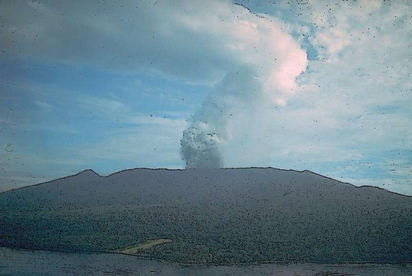
Geologically, Misima Island is a volcanic island formed by uplift and erosion over millions of years. Historically, it was inhabited by indigenous Papuan peoples for centuries. In the late 19th and early 20th centuries, it became a site for gold mining operations, which significantly impacted the island's landscape and economy.
Key Highlights & Activities
Activities include exploring the remnants of the historical gold mine, hiking to the island's highest points for panoramic views, and snorkeling or diving in the surrounding coral reefs. Fishing is also a common activity for local residents and visitors.
Infrastructure & Amenities
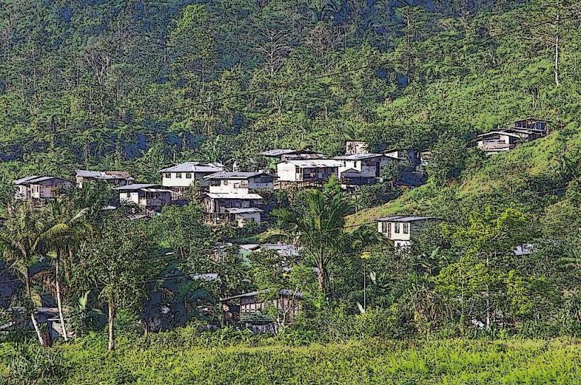
Basic amenities are available in Bwagaoia, including a small market and limited guesthouses. Restrooms are generally available at these establishments. Cell phone signal is intermittent and unreliable. Shade is provided by natural tree cover and structures in the settlement areas. Food vendors are present in Bwagaoia, offering local produce and prepared meals.
Best Time to Visit
The dry season, from June to September, offers the most favorable weather conditions with reduced rainfall. The best time of day for photography is generally in the morning or late afternoon when the sun angle is lower, providing softer light. Tidal conditions are not a significant factor for most activities, though they can influence reef access for snorkeling.
Facts & Legends
A notable historical fact is the significant gold production from the Misima mine, which operated for several decades. Local legends speak of ancient spirits residing in the island's volcanic peaks, influencing weather patterns and the success of fishing expeditions.
Nearby Landmarks
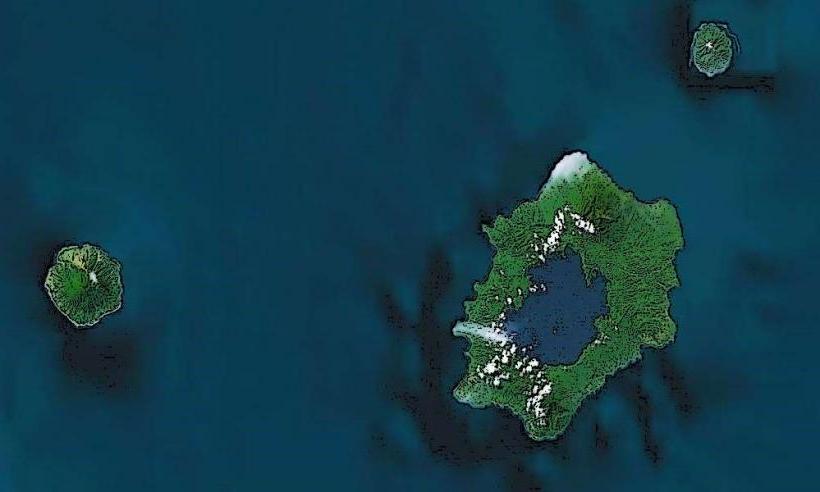
- Rossel Island (approx. 50km Southeast)
- Sudest Island (approx. 100km West)
- Woodlark Island (approx. 150km Northwest)
- Calvados Chain Islands (approx. 70km Southwest)