Information
Landmark: Montagu Road LookoutCity: Lae
Country: Papua New Guinea
Continent: Australia
Montagu Road Lookout, Lae, Papua New Guinea, Australia
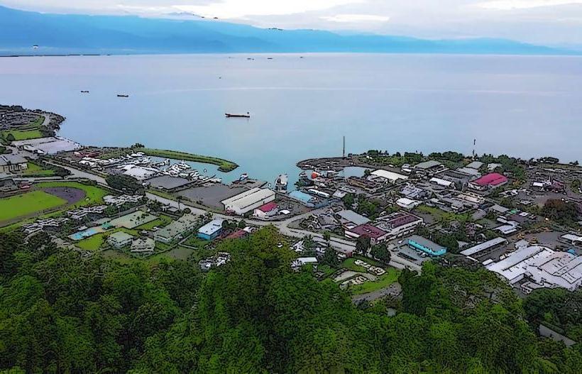
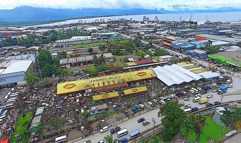
The Montagu Road Lookout is a designated viewpoint situated on the outskirts of Lae, Papua New Guinea.
This site offers a panoramic perspective of the surrounding coastal landscape and the Huon Gulf.
Visual Characteristics
The lookout platform is constructed from reinforced concrete. It features a low, weathered concrete barrier along its perimeter. The ground surface is primarily gravel and compacted earth. Vegetation surrounding the lookout consists of low-lying scrub and scattered tropical trees, typical of coastal New Guinea.
Location & Access Logistics
The Montagu Road Lookout is located approximately 8 kilometers west of Lae's city center. Access is via Montagu Road, a paved public thoroughfare. The turn-off to the lookout is clearly marked with a brown sign. Parking is available on a gravel area adjacent to the lookout, accommodating approximately 10-15 vehicles. No public transport services directly serve the lookout; private vehicles or taxis are the primary means of access.
Historical & Ecological Origin
The Montagu Road Lookout was established in the late 1970s by the Lae City Council as a public amenity to showcase the coastal geography. Ecologically, the site sits on a raised coral terrace, indicative of the region's geological history.
Key Highlights & Activities
Observation of the Huon Gulf coastline. Identification of shipping traffic entering and leaving the Port of Lae. Photography of the coastal panorama. Birdwatching for local avian species.
Infrastructure & Amenities
The lookout has a concrete viewing platform. There are no permanent restroom facilities or food vendors at the immediate site. Shade is limited to the natural cover provided by surrounding trees. Cell phone signal (4G) is generally available.
Best Time to Visit
For optimal lighting conditions for photography, the late afternoon (approximately 16:00 to 17:30) provides favorable angles. The dry season, from June to September, generally offers clearer skies and less rainfall, improving visibility.
Facts & Legends
Local lore suggests that during World War II, this elevated position was used by reconnaissance units for observing enemy movements. A specific tip for visitors is to look for the distinctive shape of the islands in the distance, often referred to by locals as the "Three Sisters."
Nearby Landmarks
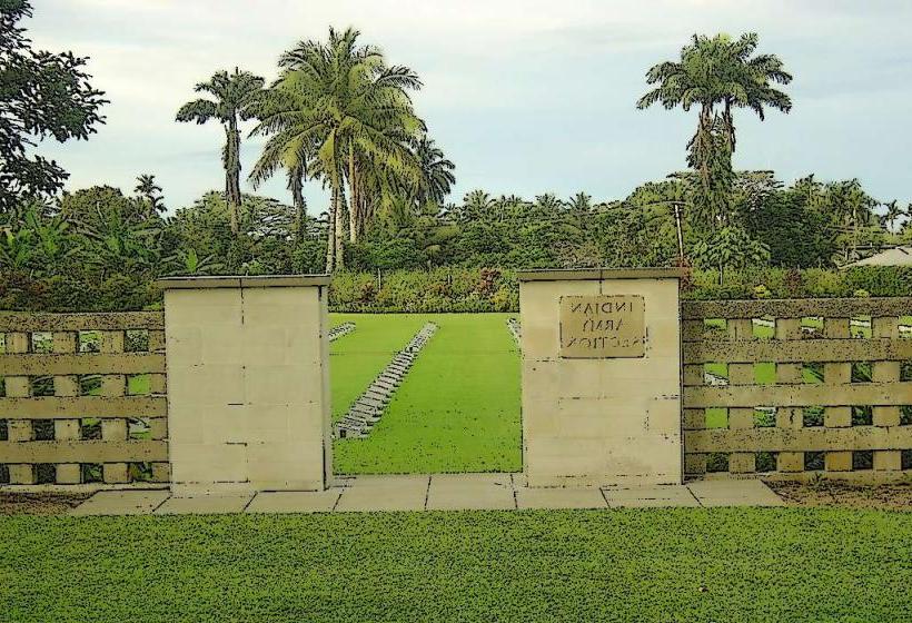
- Lae War Cemetery (1.5km East)
- Lae Botanic Gardens (3.0km Northeast)
- Malahang Mission (4.0km Northwest)
- Lae Golf Club (4.5km North)