Landmark: Mucuchies
City: Trujillo State
Country: Venezuela
Continent: South America
Mucuchies, Trujillo State, Venezuela, South America
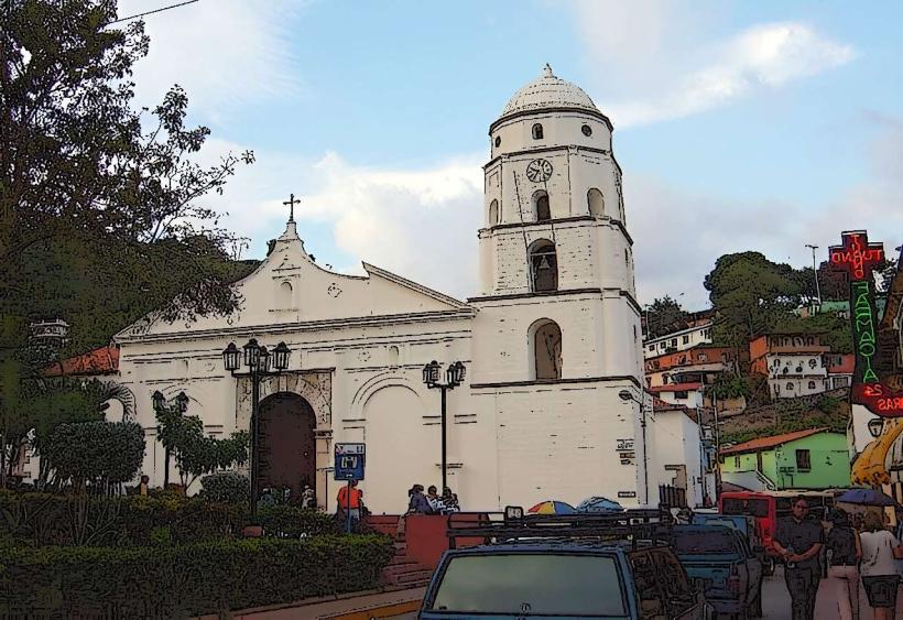
Mucuchies is a town located in the state of Mérida, Venezuela. It is situated within the Venezuelan Andes mountain range.
Visual Characteristics
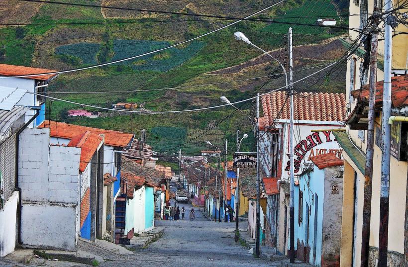
Mucuchies is characterized by its high-altitude Andean landscape. The town itself features a collection of low-rise buildings constructed primarily from stone and adobe, with red-tiled roofs. The surrounding terrain is mountainous, with steep slopes covered in dense paramo vegetation, including frailejones (Espeletia species). The climate is cool to cold year-round.
Location & Access Logistics
Mucuchies is located on the Trans-Andean Highway (Carretera Transandina), approximately 60 kilometers west of Mérida city. Travel time from Mérida is about 1.5 hours by car. Public transport is available via inter-city buses that run regularly between Mérida and Mucuchies. Parking is generally available along the main road or in designated small lots within the town. The altitude is approximately 3,100 meters above sea level.
Historical & Ecological Origin
Mucuchies originated as a settlement for indigenous peoples of the Mucuchíes ethnic group. It developed as a stopover point along ancient trade routes in the Andes. Ecologically, the area is part of the Venezuelan Andes paramo, a high-altitude grassland ecosystem characterized by unique flora adapted to cold, windy, and high-UV conditions.
Key Highlights & Activities
Visitors can explore the town's central plaza and church. Hiking trails in the surrounding paramo offer opportunities for observing local flora and fauna. The nearby Laguna de Mucubají, a glacial lake, is a primary destination for scenic walks and photography. Horseback riding tours are also offered in the vicinity.
Infrastructure & Amenities
Basic amenities are available in Mucuchies, including small restaurants (posadas) serving local food. Restrooms are typically found at these establishments. Cell phone signal (GSM/3G) is generally available within the town, though it can be intermittent in more remote paramo areas. There are no large commercial centers or extensive shade structures outside of the town's buildings.
Best Time to Visit
The best time for clear photographic conditions is generally during the dry season, from December to March. Mornings often offer the clearest light before potential cloud cover develops. The weather is consistently cool, with daytime temperatures averaging 10-15°C and dropping significantly at night. No specific tide requirements apply.
Facts & Legends
Mucuchies is famously known as the "Land of the Dogs" due to the historical presence and breeding of the Mucuchies dog, a large, robust breed developed for herding and guarding in the Andean climate. A local legend states that the dogs were once guardians of ancient gold mines hidden in the mountains.
Nearby Landmarks
- Laguna de Mucubají (2km East)
- Parque Nacional Sierra de La Culata (Access points within 5km North)
- Pico El Águila (15km West)
- Teleférico Mukumbarí (Mérida Cable Car System) (Approx. 40km East)