Landmark: O Le Pupu-Pu'e National Park
City: Siumu
Country: Samoa
Continent: Australia
O Le Pupu-Pu'e National Park, Siumu, Samoa, Australia
O Le Pupu-Pu'e National Park is Samoa’s first national park, established in 1978. It encompasses a massive corridor of land on the south-central coast of Upolu, extending from the island's highest peaks down to the rugged volcanic coastline.
Visual Characteristics
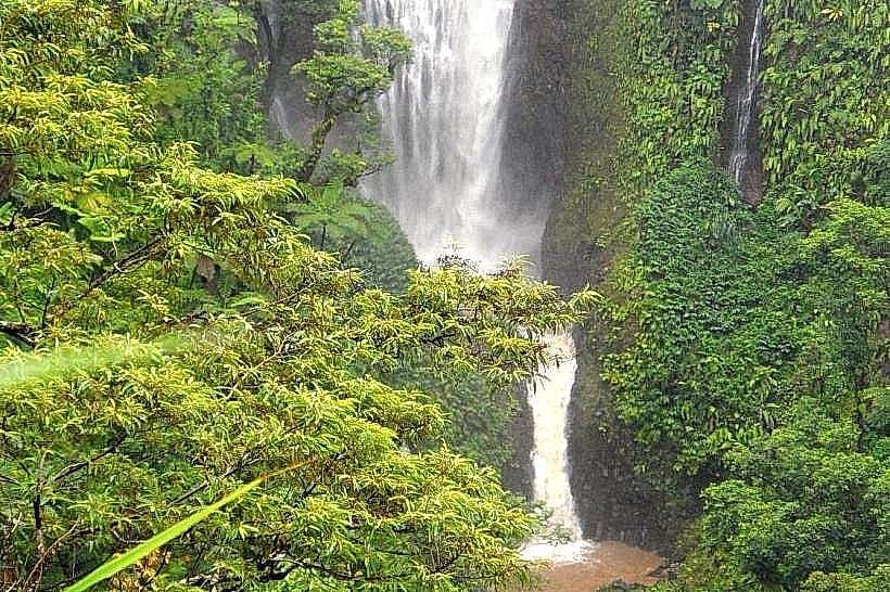
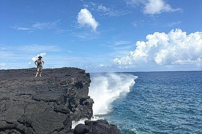
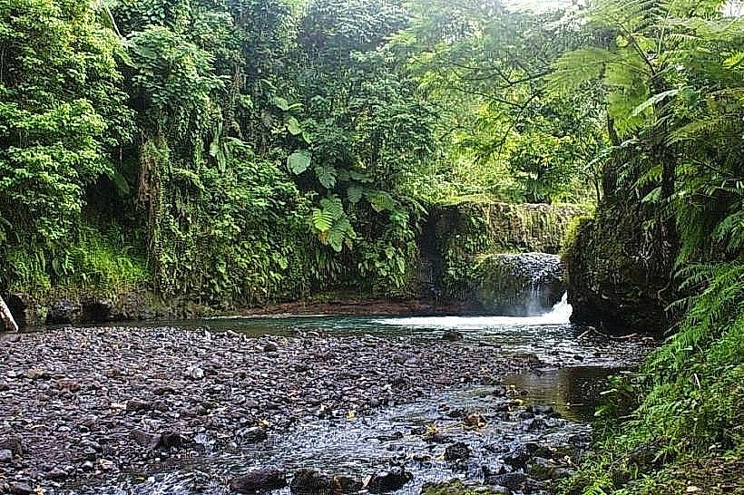
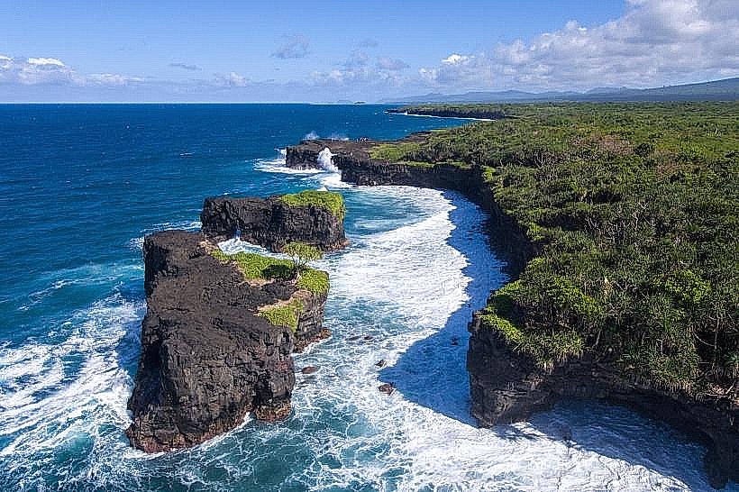
The park features diverse terrain, ranging from montane rainforest and cloud forest in the interior to dramatic basaltic sea cliffs along the coast. The "Pupu" coastline is characterized by jagged, black lava formations where the southern swells crash against vertical rock faces. Inland, the park is dominated by dense, multi-layered tropical forest with massive Banyan trees, ferns, and lianas.
Location & Access Logistics
The park is located approximately 25km south of Apia. The main entrance and visitor area are situated off the South Coast Road, near the village of Togitogiga. Access to the coastal sections and the Togitogiga Waterfall is via well-marked turn-offs. While the coastal areas are accessible by 2WD, exploring the deeper inland trails requires a 4WD and, in some cases, a local guide. Public buses traveling the South Coast route stop near the park entrances.
Historical & Ecological Origin
The park covers approximately 2,850 hectares and was created to protect the watershed of the central highlands and the biodiversity of the lowland rainforest. Geologically, the coastal "Pupu" (meaning "cliff") section was formed by prehistoric lava flows that reached the ocean. It is a critical conservation area, home to nearly all of Samoa’s native bird species, including the endangered tooth-billed pigeon (Manumea).
Key Highlights & Activities
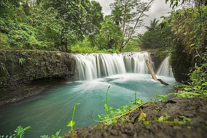
Togitogiga Waterfall: A series of swimming holes and cascades located within the park boundaries.
Coastal Trail: A rugged hiking path along the basalt cliffs offering views of sea arches and blowholes.
Pe'ape'a Cave: A large lava tube (separate from the Savai'i site) inhabited by swiftlets.
Mount Pu'e: A volcanic cone providing panoramic views for those attempting the challenging inland hike.
Infrastructure & Amenities
The Togitogiga area features the most developed infrastructure, including picnic fales, changing rooms, and public restrooms. The coastal sections have marked trails but limited facilities. 4G cell phone signal is generally available near the main road but drops off significantly in the deep forest and along the remote cliff paths. There are no food vendors inside the park; visitors must bring their own supplies.
Best Time to Visit
The dry season (May to October) is the most reliable time for hiking the inland trails and visiting the coastal cliffs. Early morning (7:00 AM to 10:00 AM) is optimal for birdwatching. The Togitogiga waterfalls are best visited following moderate rain, though they can become brown and turbulent during heavy storms.
Facts & Legends
A unique ecological fact is that the park protects a complete "top-to-bottom" ecosystem, allowing for the natural migration of species between different altitudes. A safety tip for the coastal section: the basalt cliffs are extremely sharp and the southern swells are unpredictable; visitors should stay strictly on the marked paths and avoid the cliff edges during high surf.
Nearby Landmarks
Togitogiga Waterfall – 0.5km (Within Park)
Siumu Village – 5.5km West
Papapapaitai Falls – 6.0km Northwest
Ma Tree Walk – 2.0km East