Landmark: Outer-Islet Beach Strips
City: Mili Atoll
Country: Marshall Islands
Continent: Australia
Outer-Islet Beach Strips, Mili Atoll, Marshall Islands, Australia
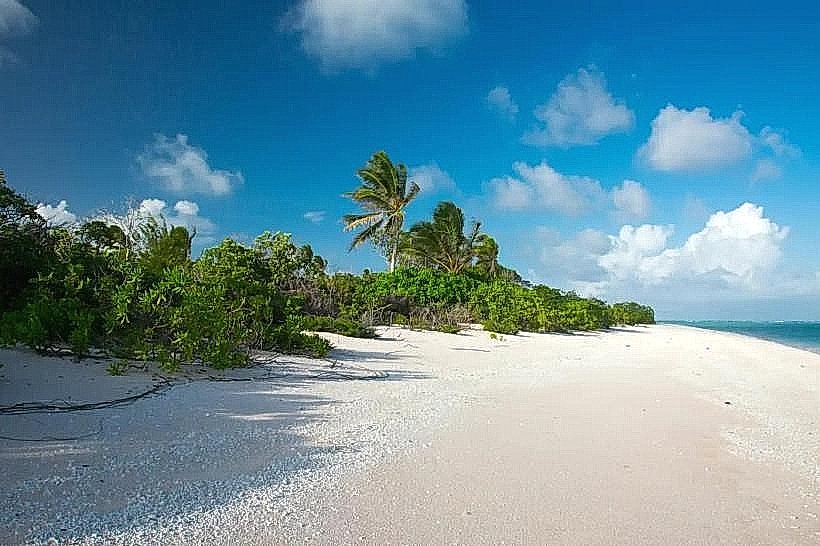
Outer-Islet Beach Strips are a series of small, sandy landmasses located within the Mili Atoll in the Marshall Islands.
These islets are characterized by fine, white coral sand and sparse vegetation, primarily coconut palms and low-lying shrubs.
Visual Characteristics
The islets consist of narrow strips of sand, typically less than 50 meters wide, with a maximum elevation of approximately 3 meters above sea level. The sand is composed of crushed coral, giving it a pale white appearance. The surrounding water is a clear turquoise, transitioning to deeper blue further from the shore. Vegetation is limited to scattered coconut palms and salt-tolerant grasses.
Location & Access Logistics
Outer-Islet Beach Strips are situated within the Mili Atoll, approximately 80 kilometers east of the main island of Majuro. Access is exclusively by boat. Private boat charters or local fishing vessels can be arranged from Majuro, with a transit time of approximately 2-3 hours depending on sea conditions. There are no designated landing facilities; boats anchor offshore, and visitors are transported to the islets via dinghy. No public transport is available.
Historical & Ecological Origin
These islets are natural formations, part of the coral reef system that constitutes the Mili Atoll. They are geologically classified as coral cays, formed by the accumulation of coral debris and sand over millennia. Ecologically, they represent a typical low-lying atoll environment, supporting a limited range of flora and fauna adapted to saline conditions and sandy substrates.
Key Highlights & Activities
Activities include sunbathing on the sand, swimming in the shallow lagoon waters, and observing marine life in the reef areas. Snorkeling is possible in calm conditions. Limited exploration of the islet interiors is feasible due to their small size and vegetation density.
Infrastructure & Amenities
There are no permanent structures or amenities on the Outer-Islet Beach Strips. Visitors should bring all necessary supplies, including water, food, and sun protection. Restrooms and shade are not available. Cell phone signal is generally unreliable.
Best Time to Visit
The best time for visiting is during the dry season, from January to April, when rainfall is minimal and winds are typically calmer. Mid-morning offers good lighting for photography before the sun reaches its zenith. High tide is generally preferred for easier boat access and more expansive beach areas.
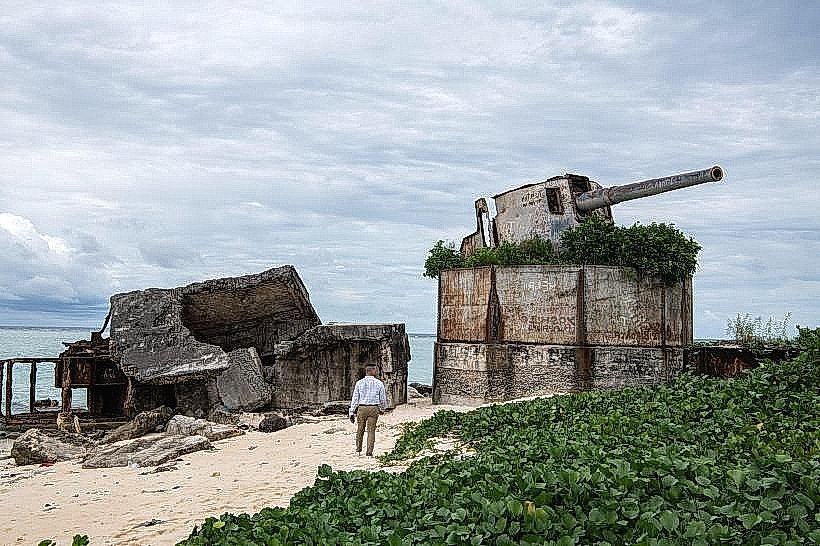
Facts & Legends
During World War II, the Mili Atoll was a Japanese military base. Remnants of this period, including concrete structures and scattered debris, can sometimes be found on the larger islets within the atoll, though not specifically on these smaller beach strips.
Nearby Landmarks
- Enen-kio Island (0.8km Southwest)
- Eneje Island (1.2km West)
- Nallu Island (1.5km Northeast)
- Arrak Island (2.1km South)
- Namorik Atoll (4.5km Northwest)