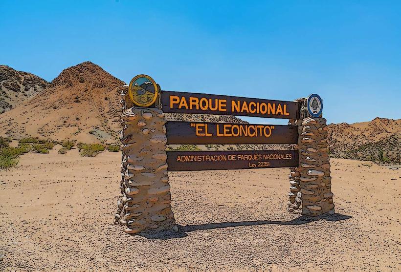
Landmark: Pampa del Leoncito
City: San Juan
Country: Argentina
Continent: South America
Pampa del Leoncito, San Juan, Argentina, South America
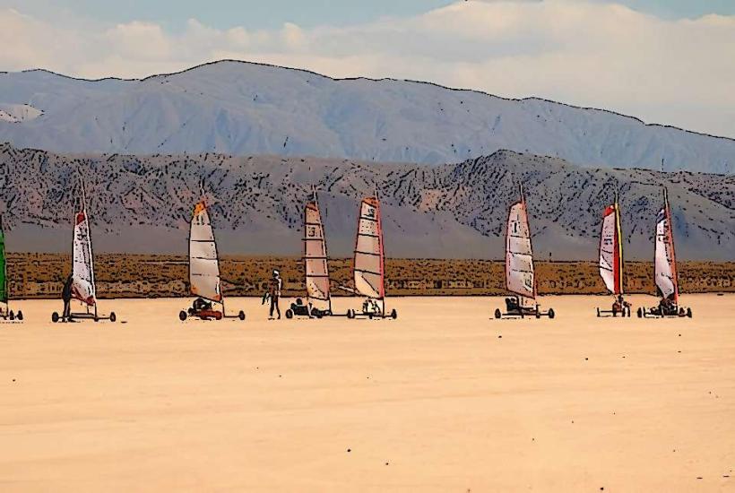
Pampa del Leoncito is a large, flat alluvial plain located in the San Juan Province of Argentina. It is a significant geological formation known for its unique surface characteristics.
Visual Characteristics
The surface of Pampa del Leoncito consists of fine, compacted sediment, primarily silt and clay, forming a hard, dry crust. The plain is predominantly flat with minimal topographical variation. Its color ranges from light brown to pale gray, depending on moisture content and light conditions. Vegetation is sparse, consisting of drought-resistant grasses and shrubs scattered across the landscape.
Location & Access Logistics
Pampa del Leoncito is situated approximately 150 kilometers northwest of the city of San Juan. Access is via National Route 40, then turning onto Provincial Route 196 towards Uspallata. The final section leading to the pampa is an unpaved but generally well-maintained dirt road. Parking is available at designated informal areas along the access road. Public transport is not available directly to the site; private vehicle or organized tour is required.
Historical & Ecological Origin
This area is an alluvial fan, formed by the deposition of sediments carried by watercourses originating in the Andes Mountains over millennia. Its formation is a result of arid climate conditions and fluvial processes characteristic of the Cuyo region.
Key Highlights & Activities
The primary activity is land sailing (carrovelismo) due to the flat, hard surface. Visitors can observe or participate in this activity. Photography of the expansive, flat landscape is also a common pursuit. Hiking is possible but limited due to the lack of defined trails and sparse vegetation.
Infrastructure & Amenities
There are no permanent infrastructure or amenities directly on Pampa del Leoncito. Basic services such as restrooms and food vendors are not present. Cell phone signal is unreliable to non-existent. Visitors should bring their own water and supplies.
Best Time to Visit
The best time of day for photography is during the early morning or late afternoon when the low sun angle creates shadows that define the terrain. The dry season, from April to October, offers the most favorable weather conditions with minimal rainfall and cooler temperatures. High winds are common year-round, which is beneficial for land sailing.
Facts & Legends
Pampa del Leoncito is one of the largest and most suitable natural land sailing tracks in the world. Its hard, flat surface, often compared to a dry lakebed, allows for high speeds. Local folklore does not contain specific legends tied to this particular geological feature, but the vastness of the landscape inspires a sense of isolation.
Nearby Landmarks
- Parque Provincial Ischigualasto (Valle de la Luna) - 70km Northeast
- Cerro Mercedario Base Camp - 40km West
- Embalse Ullum - 100km Southeast
- San Agustín del Valle Fértil - 85km Northeast