Information
Landmark: Parque Natural de PilanconesCity: Gran Canaria
Country: Canary Islands
Continent: Europe
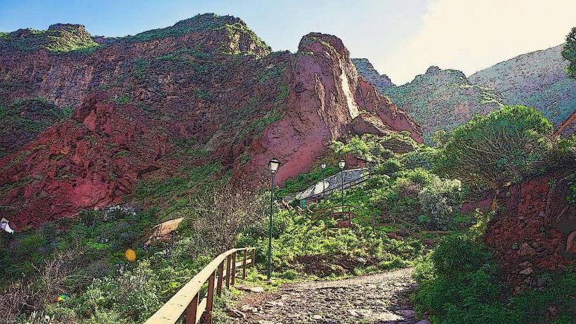
Parque Natural de Pilancones, Gran Canaria, Canary Islands, Europe
Parque Natural de Pilancones is a protected natural park situated in the south-central region of Gran Canaria, Canary Islands. It covers an extensive area characterized by pine forests, deep ravines, and volcanic rock formations.
Visual Characteristics
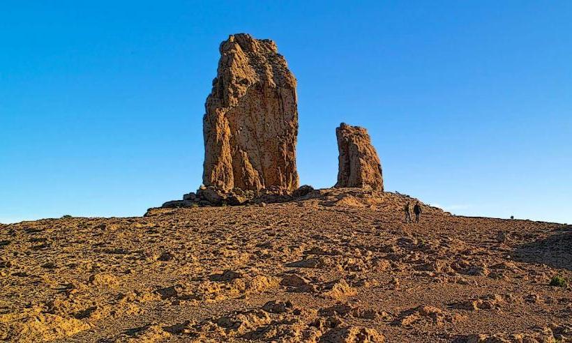
The park's landscape is dominated by dense stands of Canary Island pine (Pinus canariensis), which exhibit a dark green hue. The terrain features numerous deep ravines and barrancos, carved into reddish-brown volcanic rock. Prominent geological features include isolated rock formations known as "roques," which are remnants of ancient volcanic activity. The overall appearance is rugged and mountainous, with significant elevation changes.
Location & Access Logistics
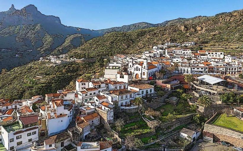
Parque Natural de Pilancones is located approximately 20 kilometers north of Maspalomas. Access is primarily via the GC-60 road, which traverses parts of the park, or the GC-604. From Maspalomas, take the GC-60 north towards Fataga. Parking is available in designated, often unpaved, areas along the main roads or at trailheads; spaces can be limited. Public transport options are scarce directly within the park; local bus lines (e.g., Global Bus lines serving Fataga or San Bartolomé de Tirajana) can bring visitors to nearby villages, requiring further travel by foot or taxi into the park's interior.
Historical & Ecological Origin
The park's geological origin is volcanic, with its landscape shaped by successive eruptions and subsequent erosion over millions of years, creating the characteristic ravines and roques. Ecologically, it is classified as a significant example of the Canary Island pine forest ecosystem. This forest type is adapted to the island's climate, with the pines playing a crucial role in water capture through fog condensation. The park was designated a Natural Park in 1987 to protect its unique biodiversity and geological features.
Key Highlights & Activities
Hiking is the primary activity, with numerous marked and unmarked trails traversing the park. Specific routes include the path to Roque Nublo (partially within or adjacent to the park's northern reaches) and trails leading through the Barranco de Fataga. Bird watching is possible, with opportunities to observe endemic species such as the Gran Canaria blue chaffinch. Nature observation focuses on the unique flora and fauna adapted to the pine forest environment.
Infrastructure & Amenities
Infrastructure within the park is minimal. Restrooms are generally not available, except possibly at specific picnic areas or in nearby villages. Shade is abundant due to the dense pine canopy. Cell phone signal (4G/5G) can be intermittent and unreliable, particularly within deep ravines. Food vendors are not present inside the park; visitors should carry their own provisions. Water sources are limited to natural springs, which may not be potable.
Best Time to Visit
The best time to visit for hiking is during the cooler months, from October to May, when temperatures are more moderate. Summer months (June to September) can be hot, especially at lower elevations. For photography, early morning or late afternoon light provides optimal conditions, highlighting the textures of the pine trees and volcanic rock formations. No specific high/low tide requirements apply to this inland park.
Facts & Legends
The Canary Island pine is remarkably fire-resistant; its thick bark and ability to resprout from the trunk and branches allow it to survive and regenerate after forest fires, a common natural disturbance in the region. A local tip for visitors is to carry sufficient water and sun protection, as services are scarce and trails can be demanding.
Nearby Landmarks
- Roque Nublo: 8km North
- Fataga: 5km East
- Presa de Chira: 7km West
- Mirador de la Degollada de la Yegua: 10km South