Landmark: Peregrine Bluff Scenic Viewpoint
City: Williston
Country: USA North Dakota
Continent: North America
Peregrine Bluff Scenic Viewpoint, Williston, USA North Dakota, North America
Peregrine Bluff Scenic Viewpoint is a geological formation located near Williston, North Dakota.
This site offers elevated perspectives of the surrounding Missouri River basin.
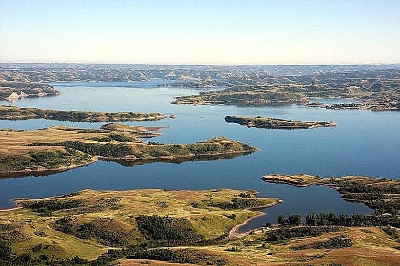
Visual Characteristics
The bluff is composed of sedimentary rock, primarily sandstone and shale, exhibiting layered strata in shades of tan, brown, and grey. The elevation provides a panoramic view of the Missouri River and the adjacent plains. Vegetation consists of sparse prairie grasses and scattered hardy shrubs adapted to arid conditions.
Location & Access Logistics
The viewpoint is situated approximately 15 kilometers southwest of Williston, North Dakota. Access is via County Road 101, which transitions to an unpaved, gravel surface for the final 3 kilometers. A designated gravel parking area is available at the bluff's base. No public transport services reach this location.
Historical & Ecological Origin
Peregrine Bluff is a product of geological erosion, formed over millennia by the action of wind and water on ancient sedimentary deposits. The area is part of the Great Plains physiographic region, characterized by its vast, relatively flat terrain shaped by glacial activity and fluvial processes.
Key Highlights & Activities
Observation of the river valley from the bluff's edge. Photography of the landscape. Birdwatching, particularly for raptors that may utilize the bluff for nesting or hunting.
Infrastructure & Amenities
The viewpoint has no developed infrastructure. There are no restrooms, designated seating, or shade structures. Cell phone signal is intermittent and generally unreliable. No food vendors are present at the site.
Best Time to Visit
For optimal lighting conditions for photography, early morning or late afternoon is recommended due to the angle of the sun. The months of May through October offer the most stable weather patterns, with minimal snow cover. The site is accessible year-round, weather permitting.
Facts & Legends
Local accounts suggest the bluff was historically used as a vantage point by indigenous peoples for observing game and potential threats. The name "Peregrine" is attributed to the occasional sightings of peregrine falcons in the vicinity, though nesting has not been consistently documented.
Nearby Landmarks
- Lake Sakakawea State Park (12km Southeast)
- Fort Union Trading Post National Historic Site (45km West)
- Missouri River (Adjacent)
- Williston Basin (Regional)