Landmark: Playa Covarrubias
City: Las Tunas
Country: Cuba
Continent: North America
Playa Covarrubias, Las Tunas, Cuba, North America
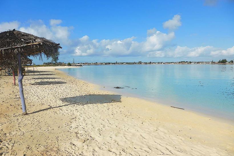
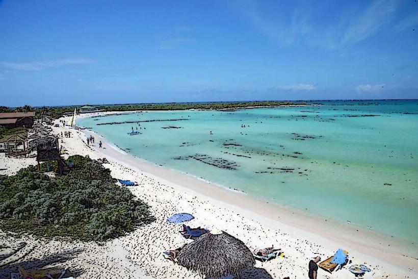
Playa Covarrubias is a coastal area situated in the municipality of Amancio, Las Tunas Province, Cuba.
It is characterized by its extensive sandy shoreline and shallow, clear waters.
Visual Characteristics
The beach consists of fine, light-colored sand. The water exhibits a pale turquoise hue, transitioning to a deeper blue further offshore. The shoreline is approximately 2 kilometers in length. Vegetation along the immediate coast includes palm trees and low-lying shrubs.
Location & Access Logistics
Playa Covarrubias is located 65 kilometers east of the provincial capital, Las Tunas. Access is primarily via Carretera Central (Cuba's main highway) and then turning south onto Carretera a Covarrubias. The final approach is a paved road leading directly to the beach area. Parking is available in designated lots adjacent to the main resort facilities. Public transport options are limited; shared taxis (taxis colectivos) can be arranged from Las Tunas, or local buses may service the general area, requiring a short walk to the beach itself.
Historical & Ecological Origin
The area's development as a tourist destination began in the late 20th century, with the construction of resort facilities. Ecologically, it is part of the northern Cuban shelf, characterized by shallow marine environments and coral formations offshore, contributing to the clarity of the water.
Key Highlights & Activities
Swimming is possible in the calm, shallow waters. Snorkeling and diving are available, with access to coral reefs approximately 500 meters offshore. Boat excursions for fishing and sightseeing depart from the marina. Beach volleyball courts are present. Walking the length of the beach is a common activity.
Infrastructure & Amenities
Restrooms are located within the resort complex. Shade is provided by natural palm trees and some man-made structures. Cell phone signal (primarily 3G) is generally available. Food and beverage services are concentrated at the resort's restaurants and bars.
Best Time to Visit
For photography, early morning (07:00-09:00) and late afternoon (16:00-18:00) offer optimal lighting conditions. The dry season, from November to April, provides the most favorable weather with lower humidity and less rainfall. High tide is generally preferred for swimming and water activities due to increased water depth along the shore.
Facts & Legends
A local anecdote suggests the beach was named after a Spanish explorer, though historical records are inconclusive. The shallow depth of the water extends a considerable distance from the shore, making it a safe area for non-swimmers.
Nearby Landmarks
- Resort facilities (0.1km West)
- Marina Covarrubias (0.3km West)
- Laguna de la Juba (3.5km North)
- Cayo Sabinal (15km Northwest, accessible by boat)