Landmark: Playa La Boca
City: Las Tunas
Country: Cuba
Continent: North America
Playa La Boca, Las Tunas, Cuba, North America
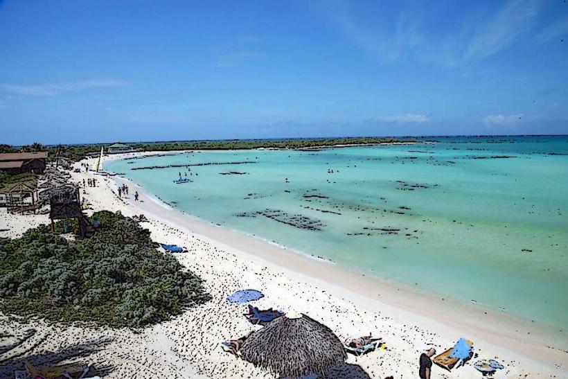
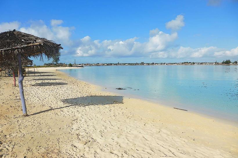
Playa La Boca is a coastal area situated near the city of Las Tunas in Cuba.
It is characterized by its shoreline and proximity to the Caribbean Sea.
Visual Characteristics
The beach consists of light brown sand with a moderate grain size. The water exhibits a clear, turquoise hue, transitioning to a deeper blue further from shore. The coastline is generally flat, with sparse vegetation comprising low-lying shrubs and palm trees along the immediate hinterland. The area is approximately 1.5 kilometers in length.
Location & Access Logistics
Playa La Boca is located 18 kilometers west of the city center of Las Tunas. Access is via Carretera Central (Cuba's main highway) heading west, then turning south onto a paved local road marked for La Boca. The final 3 kilometers are unpaved but generally passable for standard vehicles. Parking is available along the roadside adjacent to the beach, with no designated lots. Public transport options are limited; local taxis from Las Tunas are the primary means of access. Bus service does not directly serve the beach.
Historical & Ecological Origin
Playa La Boca is a natural coastal formation, part of the southern coastline of Cuba. Its geological origin is sedimentary, formed by the deposition of marine and terrestrial materials over millennia. Ecologically, it functions as a shallow marine environment with a sandy substrate, supporting typical Caribbean coastal flora and fauna.
Key Highlights & Activities
Swimming is possible in the calm waters. Beachcombing along the shoreline is an available activity. Observation of local birdlife is possible in the vegetated areas. Fishing from the shore is practiced by local residents.
Infrastructure & Amenities
There are no public restrooms or designated shade structures. Cell phone signal (primarily 2G/3G) is intermittent. No food vendors or established facilities are present directly at the beach; visitors should bring supplies. Limited shade is provided by natural vegetation.
Best Time to Visit
For photography, early morning (07:00-09:00) and late afternoon (16:00-18:00) offer optimal lighting conditions. The driest months are typically November through April, with average temperatures ranging from 25°C to 30°C. Humidity is higher from May to October. Tidal variations are minimal and do not significantly impact access or activities.
Facts & Legends
Local fishermen report occasional sightings of manatees in the waters offshore during the early morning hours. The name "La Boca" translates to "The Mouth," likely referring to the area's position where a small, seasonal stream meets the sea.
Nearby Landmarks
- Las Tunas City Center (18km East)
- Balneario Las Caletas (25km West)
- Parque Natural Monte Cabaniguán (40km Southwest)