Landmark: Playa de la Boca
City: Matanzas
Country: Cuba
Continent: North America
Playa de la Boca, Matanzas, Cuba, North America
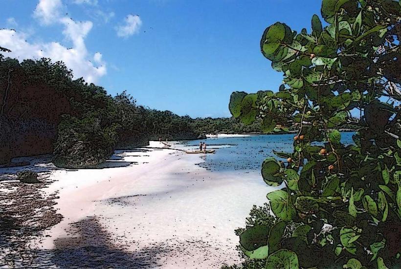
Playa de la Boca is a coastal area situated south of the city of Matanzas, Cuba.
It is characterized by its shallow, calm waters and a shoreline composed of fine, light-colored sand.
Visual Characteristics
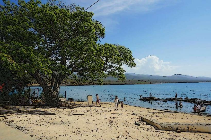
The beach features a wide expanse of pale sand. The water is consistently shallow and exhibits a light turquoise hue, particularly noticeable during daylight hours. The shoreline is bordered by low-lying vegetation, primarily scrub and grasses, with scattered palm trees providing limited shade.
Location & Access Logistics
Playa de la Boca is located approximately 10 kilometers south of the Matanzas city center. Access is via Carretera de la Boca (also known as Circuito Sur). The road is paved and in fair condition. Parking is available along the roadside, with informal spaces often utilized by visitors. Public transport options are limited; local buses serving routes to the south of Matanzas may pass near the area, but direct service to the beach is not guaranteed. The nearest major transport hub is the bus terminal in Matanzas city.
Historical & Ecological Origin
Playa de la Boca is a natural coastal formation, part of the extensive coastline of the Zapata Peninsula. Its shallow nature is attributed to the gradual slope of the seabed and the deposition of fine sediment. Ecologically, it is a sandy beach environment supporting halophytic vegetation adapted to saline conditions.
Key Highlights & Activities
Swimming is possible due to the calm and shallow water. Wading and shallow water exploration are primary activities. Birdwatching can be undertaken in the adjacent scrubland. Fishing from the shore is also practiced by local residents.
Infrastructure & Amenities
There are no formal public restrooms or dedicated shade structures at Playa de la Boca. Informal vendors may occasionally be present selling drinks or snacks, but this is not a consistent service. Cell phone signal (3G/4G) is generally available in the area.
Best Time to Visit
For photography, the period between 9:00 AM and 11:00 AM offers direct sunlight on the water. The dry season, from November to April, provides the most favorable weather conditions with lower humidity and less rainfall. The water temperature is consistently warm year-round.
Facts & Legends
Local fishermen report that the shallow, calm waters of Playa de la Boca are a natural nursery for various small fish species, contributing to the local marine ecosystem's health.
Nearby Landmarks
- Parque Natural Montemar (15km Southwest)
- Ciénaga de Zapata National Park (20km Southwest)
- Museo Histórico Provincial de Matanzas (10km North)
- Castillo de San Severino (12km North)
- Laguna de la Jovera (8km Southwest)