Landmark: Playa de Varadero
City: Matanzas
Country: Cuba
Continent: North America
Playa de Varadero, Matanzas, Cuba, North America
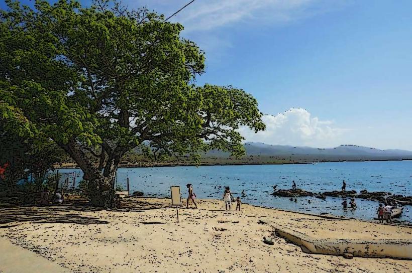
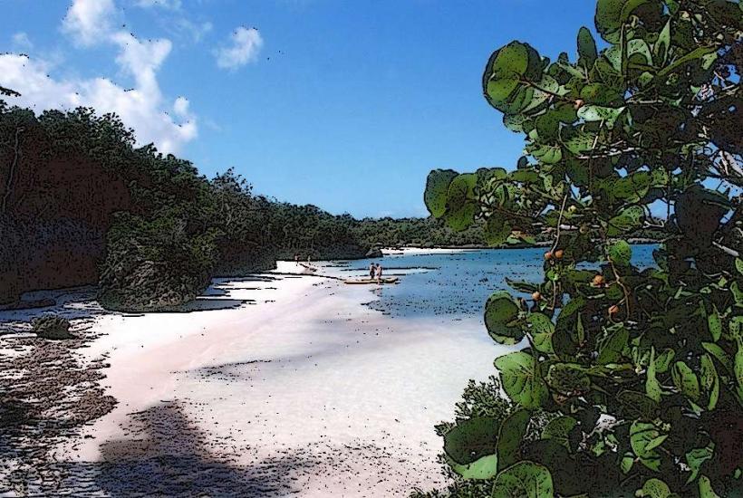
Playa de Varadero is a 20-kilometer-long beach located on the Hicacos Peninsula in Matanzas Province, Cuba.
It is characterized by its fine, white sand and clear, shallow waters.
Visual Characteristics
The beach consists of a strip of fine, white carbonate sand extending approximately 20 kilometers. The water exhibits a gradient from pale turquoise near the shore to a deeper blue further offshore. The shoreline is generally flat with a gentle slope into the sea. Vegetation, primarily palm trees and low-lying shrubs, lines the landward side of the beach.
Location & Access Logistics
Playa de Varadero is situated on the Hicacos Peninsula, approximately 140 kilometers east of Havana. Access is primarily via the Carretera de Varadero (Cuba's National Highway 1). The peninsula is connected to the mainland by a causeway. Numerous parking areas are available along the length of the beach, particularly adjacent to hotels and public access points. Public transport includes local buses that traverse the main avenue (Avenida 1ra) and intercity buses from Havana and other Cuban cities. Taxi services are also readily available.
Historical & Ecological Origin
The Hicacos Peninsula, upon which Playa de Varadero is located, is a karst formation. The beach itself is a result of natural coastal processes, with the sand composed of eroded coral and shell fragments. Historically, the area was sparsely populated and used for cattle ranching and salt production before its development as a tourist destination began in the early 20th century.
Key Highlights & Activities
Swimming is a primary activity. Water sports such as snorkeling, diving, and jet skiing are available. Boat tours, including catamaran excursions and fishing trips, depart from various points along the coast. Walking the length of the beach is possible. Sunbathing is a common activity.
Infrastructure & Amenities
Restrooms are available at public access points and within hotel facilities. Shade is provided by natural vegetation and constructed palapas. Cell phone signal (3G/4G) is generally available. Food vendors and restaurants are located along Avenida 1ra and within resort areas.
Best Time to Visit
The best time for weather is generally from November to April, with average temperatures ranging from 25°C to 30°C. The dry season runs from November to April. For photography, early morning and late afternoon offer softer light. High tide is suitable for swimming; low tide exposes a wider sand area.
Facts & Legends
A notable historical oddity is the presence of the Ambrosio Cave, a pre-Columbian cave dwelling located near the eastern end of the peninsula, which contains ancient pictographs. Local lore sometimes refers to the beach as a former pirate haven, though concrete evidence is scarce.
Nearby Landmarks
- Josone Park (0.8km West)
- Ambrosio Cave (15km East)
- Varadero Municipal Museum (2km West)
- Marina Gaviota Varadero (18km East)
- Delfinario (10km East)