Landmark: Rawa Pening Lake
City: Semarang
Country: Indonesia
Continent: Asia
Rawa Pening Lake, Semarang, Indonesia, Asia
Rawa Pening Lake is a natural lake located in the Ambarawa district, south of Semarang, Indonesia.
This freshwater lake covers an area of approximately 2,670 hectares and is situated at an elevation of 500 meters above sea level.
Visual Characteristics
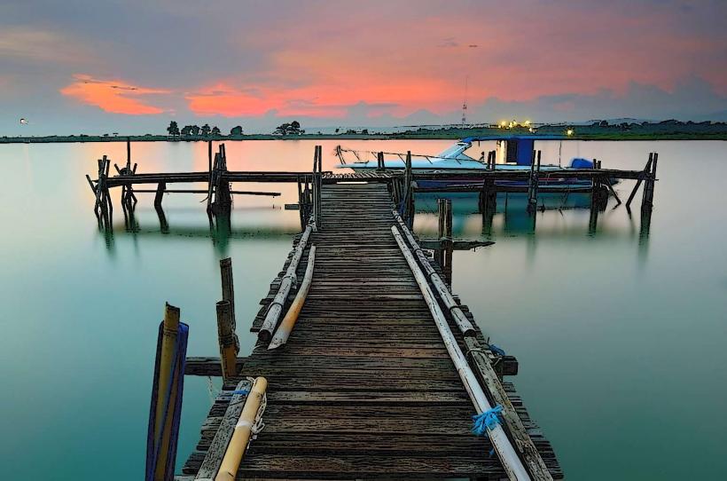
The lake's surface is predominantly covered by water hyacinths, giving it a green hue. The surrounding landscape consists of rolling hills and agricultural land, with Mount Merbabu and Mount Telomoyo visible in the distance on clear days. The water itself is generally calm, with occasional ripples from wind or boat activity.
Location & Access Logistics
Rawa Pening Lake is accessible via the Trans-Java Toll Road, exiting at the Bawen toll gate. From Bawen, follow Jalan Raya Semarang-Solo towards Ambarawa for approximately 10 kilometers. The lake is situated directly off this main road. Parking is available at designated points near the lake's edge, primarily in the villages of Bejalen and Rowoboni. Public transport options include local buses traveling between Semarang and Ambarawa, which stop near the lake. Boat services are also available for hire at various points along the shore.
Historical & Ecological Origin
Rawa Pening is a natural lake formed by volcanic activity and tectonic shifts over millennia. Its ecological classification is that of a shallow, eutrophic freshwater lake. The lake's current state, with significant water hyacinth coverage, is a result of natural processes and nutrient enrichment from surrounding agricultural runoff.
Key Highlights & Activities
Boat tours are available, offering exploration of the lake and its water hyacinth fields. Fishing is a common activity for local residents and visitors. Birdwatching is possible, particularly during migratory seasons. Visitors can also walk along the lake shore or visit nearby villages.
Infrastructure & Amenities
Basic restroom facilities are available at some access points. Shade is limited, primarily provided by natural vegetation or small shelters. Cell phone signal (4G) is generally available in the vicinity. Food vendors are present at popular access points, offering local snacks and simple meals.
Best Time to Visit
The best time of day for photography is typically in the early morning or late afternoon when the light is softer and the surrounding hills are illuminated. The dry season, from June to September, offers more stable weather conditions. High tide is not a significant factor for lake access.
Facts & Legends
A local legend attributes the formation of Rawa Pening to the tears of a mother searching for her son, Jaka Kembang Kuncup. The "secret" tip for visitors is to hire a local fisherman for a more authentic and informative boat tour, as they possess detailed knowledge of the lake's ecosystem and local lore.
Nearby Landmarks
- Ambarawa Railway Museum (2.5km Northwest)
- Gedong Songo Temple (8km Southwest)
- Candi Banon (4km West)
- Taman Rekreasi Umbul Sidomukti (7km Southwest)