Landmark: Ribeira da Barca
City: Calheta de Sao Miguel
Country: Cabo Verde
Continent: Africa
Ribeira da Barca, Calheta de Sao Miguel, Cabo Verde, Africa
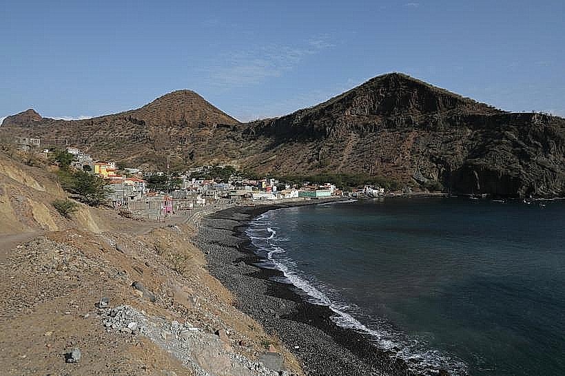
Ribeira da Barca is a coastal village situated on the northwestern tip of Santiago Island in Cabo Verde.
It is a fishing community known for its natural harbor and proximity to the Atlantic Ocean.
Visual Characteristics
The village consists of low-lying structures, primarily constructed from concrete and painted in muted earth tones. The coastline is characterized by dark volcanic rock formations interspersed with small, dark sand beaches. The harbor area features moored fishing boats. Vegetation is sparse, consisting of drought-resistant shrubs and grasses.
Location & Access Logistics
Ribeira da Barca is located approximately 45 kilometers northwest of Praia, the capital city. Access is via the EN1-SD01 regional road, which connects to the larger island highway network. The final approach involves a paved road leading directly into the village. Parking is available along the main village road, with capacity for approximately 30 vehicles. Public transport options include local minibuses (aluguers) that run from Praia to Ribeira da Barca, typically departing when full.
Historical & Ecological Origin
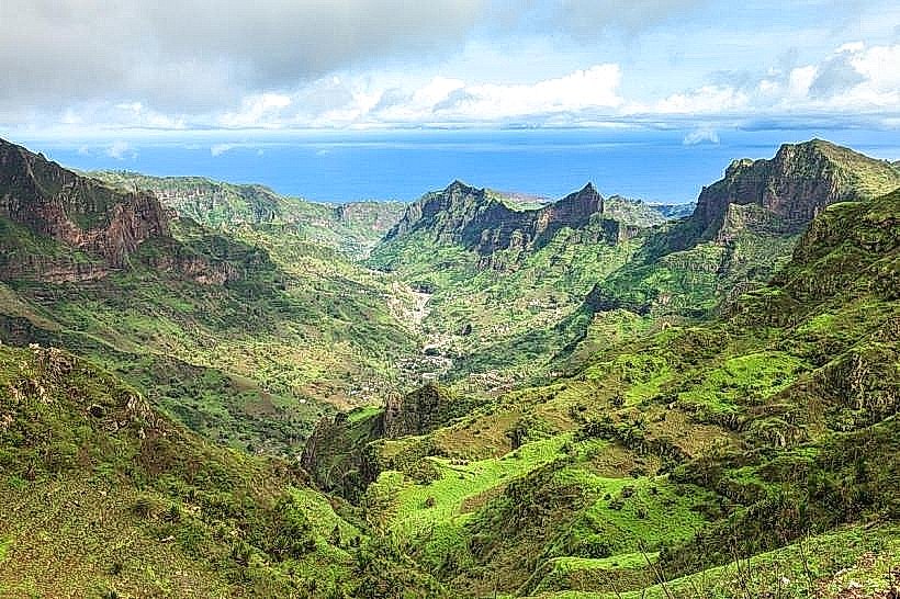
Ribeira da Barca's origin is tied to its natural harbor, which has been utilized by local fishermen for centuries. The settlement developed organically around this resource. Ecologically, the area is part of the arid coastal zone of Santiago Island, characterized by volcanic geology and limited freshwater sources.
Key Highlights & Activities
Observe local fishing activities in the harbor. Walk along the rocky coastline. Swimming is possible in sheltered areas during calm sea conditions. Boat trips for fishing or coastal exploration can be arranged with local operators.
Infrastructure & Amenities
Basic amenities include a small number of local eateries and shops. Restrooms are available at some establishments. Shade is limited, primarily provided by structures within the village. Cell phone signal (4G) is generally available.
Best Time to Visit
The best time for photography is in the late afternoon when the sun is lower, casting longer shadows on the volcanic rock. The dry season, from November to June, offers the most stable weather conditions. High tide can make access to certain coastal areas more challenging.
Facts & Legends
Local lore suggests that the harbor was historically a favored stopping point for ships due to its sheltered nature, though formal records are scarce. A specific tip for visitors is to inquire locally about the daily catch; fresh fish can often be purchased directly from returning fishermen.
Nearby Landmarks
- Pico de Antónia (10km Northeast)
- Tarrafal Beach (12km Northwest)
- Cidade Velha (25km Southeast)
- São Francisco Church Ruins (26km Southeast)