Information
Landmark: Riverwalk TrailCity: Danville
Country: USA Virginia
Continent: North America
Riverwalk Trail, Danville, USA Virginia, North America
The Riverwalk Trail is a paved urban pathway situated along the Dan River in Danville, Virginia, USA.
It provides pedestrian and cyclist access to the riverfront and adjacent park areas.
Visual Characteristics
The trail is constructed of asphalt, measuring approximately 3 meters in width. It is bordered by a combination of manicured grass, mature deciduous trees, and concrete retaining walls in certain sections. The Dan River's water color varies from brown to grey depending on recent rainfall and sediment load. Small concrete bridges span smaller tributaries feeding into the main river.
Location & Access Logistics
The Riverwalk Trail is accessible from multiple points within Danville. The primary access point is located at the intersection of Main Street and Craghead Street, approximately 0.5km South of the Danville Central Business District. Ample street parking is available along Main Street and adjacent side streets. Public transport route 3 (Danville Transit) stops within 0.2km of the Main Street access point.
Historical & Ecological Origin
The Riverwalk Trail was developed as part of a city revitalization project, with initial construction commencing in 2005 and phased completion through 2015. The trail follows the historical path of the Dan River, which has been a significant waterway for transportation and industry since the 18th century. The surrounding vegetation is characteristic of a temperate deciduous forest ecosystem.
Key Highlights & Activities
Activities include walking, jogging, and cycling. Birdwatching is possible along the riverbanks. Fishing is permitted from designated access points. Interpretive signage detailing local history and ecology is placed at intervals.
Infrastructure & Amenities
Restrooms are available at the Main Street access point and at the Riverfront Park pavilion. Benches are situated at regular intervals along the trail, providing seating. Shade is provided by the tree canopy in many sections. Cell phone signal (4G/5G) is generally consistent along the trail. No food vendors are permanently located on the trail itself, but several restaurants are within a 0.5km radius of the Main Street access.
Best Time to Visit
For photography, early morning (7:00 AM - 9:00 AM) offers favorable lighting conditions with fewer pedestrians. The months of April through October provide the most pleasant weather for outdoor activity. No specific tide requirements apply.
Facts & Legends
During the late 19th century, the Dan River was a crucial artery for transporting tobacco and textiles. A local anecdote suggests that during periods of heavy flooding, remnants of old riverboats would occasionally surface, though this is unverified.
Nearby Landmarks
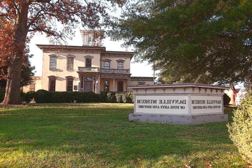
- Danville Museum of Fine Arts & History (0.3km West)
- Ballou Park (1.2km North)
- Danville Science Center (0.6km Southwest)
- Piedmont Arts (0.4km West)