Landmark: Santa Margherita Lines
City: Cospicua
Country: Malta
Continent: Europe
Santa Margherita Lines, Cospicua, Malta, Europe
The Santa Margherita Lines are a series of 17th-century defensive fortifications located on the landward side of Cospicua, Malta, designed to protect the Three Cities and the Grand Harbour from land-based attacks.
Visual Characteristics
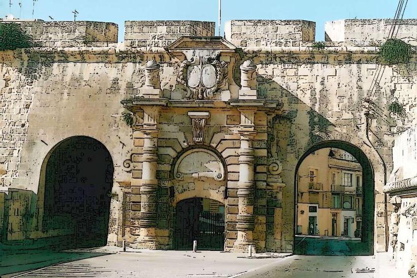
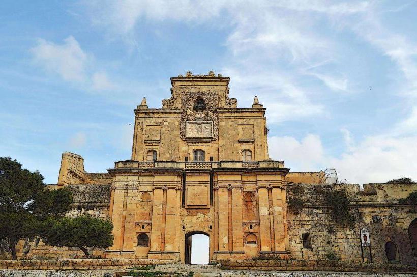
The fortifications consist of high, thick curtain walls and bastions constructed primarily from local globigerina limestone, exhibiting a pale yellow to honey-colored hue. The walls rise significantly from the surrounding terrain, featuring a robust, military Baroque architectural style. Key elements include the St. Helen Bastion and the St. John Bastion, characterized by their angular projections and embrasures. The overall structure presents a formidable, imposing barrier.
Location & Access Logistics
The Santa Margherita Lines traverse the Cospicua peninsula, separating the urban area from the mainland. Access is possible from various points within Cospicua. From Valletta, the lines are approximately 6 kilometers southeast, reachable via Triq il-Barrakki or Triq Santu Rokku. Public transport includes several bus routes, such as the 1, 2, and 3, which serve Cospicua and have stops near the fortifications. Limited street parking is available in the residential areas adjacent to the lines.
Historical & Ecological Origin
Construction of the Santa Margherita Lines commenced in 1638 under the Order of St. John, with initial designs by Vincenzo Maculani and later refined by Francesco Buonamici. Their original purpose was to create a secondary line of defense behind the older Birgu and Senglea fortifications, protecting the Grand Harbour's inner reaches. The lines were never fully completed to their intended design, with work ceasing in 1645, leaving them with lower profiles than initially planned.
Key Highlights & Activities
Visitors can walk along sections of the ramparts, particularly near the St. Helen Gate, offering elevated views of Cospicua and the surrounding landscape. Exploring the bastions provides insight into 17th-century military engineering. The ditch areas, though not always accessible, reveal the scale of the defensive works. Photography of the limestone structures and their strategic placement is a common activity.
Infrastructure & Amenities
Directly on the Santa Margherita Lines, infrastructure is minimal. There are no dedicated public restrooms or shade structures. Cell phone signal (4G/5G) is generally reliable across the area. Food vendors and cafes are available within the residential areas of Cospicua, a short walk from the fortifications.
Best Time to Visit
The optimal time to visit is during the cooler months, from October to May, to avoid the intense summer heat. Early morning or late afternoon provides softer light for photography, highlighting the texture and color of the limestone. There are no tide requirements for visiting these land-based fortifications.
Facts & Legends
A notable historical oddity is that despite their strategic importance, the Santa Margherita Lines were never fully completed according to their original ambitious plans. This led to the subsequent construction of the more extensive Cottonera Lines in the 1670s, which enveloped and superseded the Santa Margherita Lines as the primary landward defense for the Three Cities.
Nearby Landmarks
- Inquisitor's Palace (Vittoriosa) - 0.8km East
- Fort St. Angelo (Vittoriosa) - 1.2km East
- Gardjola Gardens (Senglea) - 1.0km Northeast
- Malta Maritime Museum (Vittoriosa) - 0.9km East
- Valletta City Gate (Valletta) - 2.5km Northwest