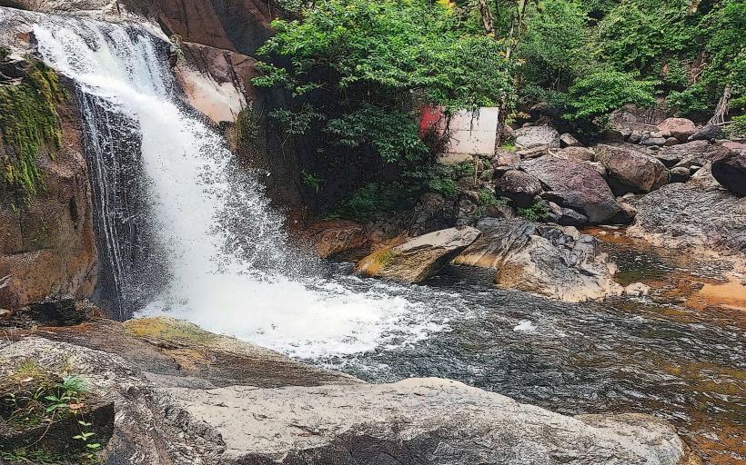
Landmark: Sekayu Waterfall
City: Terengganu
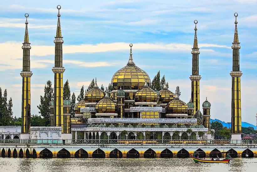
Country: Malaysia
Continent: Asia
Sekayu Waterfall, Terengganu, Malaysia, Asia
Sekayu Waterfall is a multi-tiered cascade located within the Sekayu Recreational Forest in Terengganu, Malaysia.
This natural site features a series of seven distinct waterfalls, each with varying heights and flow rates, set within a tropical rainforest environment.
Visual Characteristics
The waterfalls descend over smooth, dark grey rock formations. The water is typically clear and cool, with surrounding vegetation consisting of dense tropical trees, ferns, and mosses. The primary waterfall has an estimated drop of 10 meters.
Location & Access Logistics
Sekayu Waterfall is situated approximately 40 kilometers northwest of Kuala Terengganu. Access is via Jalan Ajil-Kuala Berang (Federal Route 106), then turning onto Jalan Sekayu. The final 5 kilometers to the waterfall entrance are on a paved road. Parking is available at the designated area near the entrance. Public transport options are limited; bus services typically run to Ajil or Kuala Berang, requiring onward taxi or private transport.
Historical & Ecological Origin
The Sekayu Recreational Forest is a protected area managed by the Terengganu Forestry Department. The waterfalls are a result of natural erosion and geological processes over millennia, carving channels through the sedimentary rock of the region. The area is classified as lowland dipterocarp forest.
Key Highlights & Activities
Activities include swimming in the natural pools at the base of the falls, hiking along designated trails that connect the different tiers of the waterfall, and picnicking in designated areas. Observation platforms are present at several levels.
Infrastructure & Amenities
Facilities include public restrooms, changing rooms, and several covered picnic shelters. Food stalls are often present near the main entrance, particularly on weekends and public holidays. Cell phone signal (4G) is generally available within the recreational forest area.
Best Time to Visit
The best time for photography is generally in the morning when sunlight filters through the canopy, illuminating the water. The dry season, from March to September, offers the most stable weather conditions. Water levels are highest during the monsoon season (November to February), which can impact accessibility to certain trails and pools.
Facts & Legends
Local folklore suggests that the water from the main waterfall possesses healing properties. A specific tip for visitors is to wear non-slip footwear, as the rocks around the falls can become very slippery, especially after rainfall.
Nearby Landmarks
- Kuala Berang Town (15km Southwest)
- Tasik Kenyir (45km East)
- Terengganu State Museum (40km Southeast)
- Sultan Mahmud Power Station (42km East)