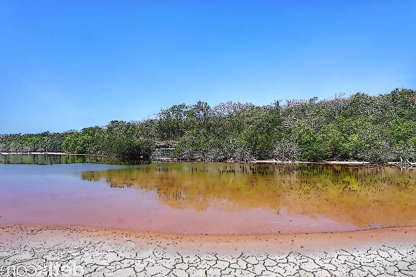
Landmark: Sempaja Lake
City: Samarinda
Country: Indonesia
Continent: Asia
Sempaja Lake, Samarinda, Indonesia, Asia
Sempaja Lake is a man-made reservoir located in the city of Samarinda, East Kalimantan, Indonesia.
It serves as a water source for the surrounding urban area.
Visual Characteristics
The lake's surface is generally calm, reflecting the sky and surrounding vegetation. The water color varies from murky brown to greenish depending on rainfall and sediment levels. The banks are a mix of earth and concrete structures, with some areas featuring dense tropical foliage.
Location & Access Logistics
Sempaja Lake is situated approximately 10 kilometers north of Samarinda's city center. Access is via Jalan Pahlawan and then Jalan Sempaja. Road conditions are paved. Parking is available at designated points around the lake, though capacity can be limited during peak hours. Public transport options include local angkot (minibus) routes that pass near the lake, specifically routes serving the Sempaja district.
Historical & Ecological Origin
The lake was constructed in the late 1980s as part of a regional development project to secure a consistent water supply for Samarinda. It is an artificial reservoir created by damming a local river system.
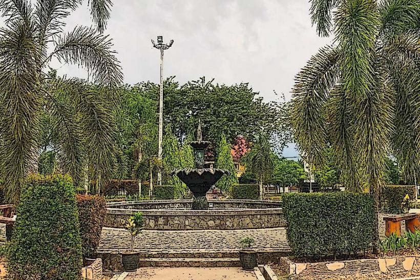
Key Highlights & Activities
Visitors can walk along the perimeter paths. Fishing is permitted in designated areas. Observation points offer views of the reservoir and the city skyline in the distance. Local vendors sometimes sell snacks and drinks near the main access points.
Infrastructure & Amenities
Basic restroom facilities are available at the main entrance. Some shaded areas are provided by trees and small shelters. Cell phone signal (4G) is generally consistent around the lake. Food vendors are present on weekends and public holidays.
Best Time to Visit
The best time of day for photography is in the early morning or late afternoon when the sun's angle provides softer light. The dry season, typically from June to September, offers more stable weather conditions. There are no tide-dependent activities.
Facts & Legends
A local belief suggests that the lake's depth is considerable, with some stories attributing its creation to a mythical giant. Officially, the lake's depth varies but does not exceed 15 meters in its deepest sections.
Nearby Landmarks
- Samarinda Square (Mall) - 3.5km Southwest
- East Kalimantan Regional Museum - 4.0km Southwest
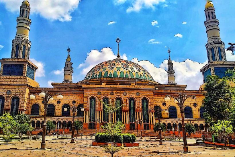
- Islamic Center Samarinda - 4.5km Southwest
- Tenggarong City (requires longer travel) - 30km Southeast