Landmark: Tanjung Bira Beach
City: Makassar
Country: Indonesia
Continent: Asia
Tanjung Bira Beach, Makassar, Indonesia, Asia
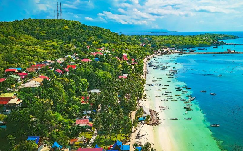
Tanjung Bira Beach is a coastal area located on the southeastern tip of the South Sulawesi peninsula, approximately 200 kilometers east of Makassar, Indonesia.
Visual Characteristics
The beach features fine, white sand with a grain size of approximately 0.5 mm. The water exhibits a clear turquoise hue, transitioning to deeper blue further offshore. The coastline is characterized by a gentle slope and is fringed by coconut palm trees. Offshore, limestone formations are visible.
Location & Access Logistics
Access from Makassar requires a drive of approximately 4-5 hours via National Route 19. The road surface is primarily asphalt. Parking is available at designated lots near the beach entrance, with a fee. Public transport options are limited; shared minivans (pete-pete) operate from Makassar to Bulukumba, requiring a subsequent local taxi or motorcycle taxi to reach Tanjung Bira.
Historical & Ecological Origin
Tanjung Bira is a natural coastal formation. The white sand is derived from the erosion of coral reefs and limestone bedrock over geological time. The area is part of a marine ecosystem supporting diverse coral and fish populations.
Key Highlights & Activities
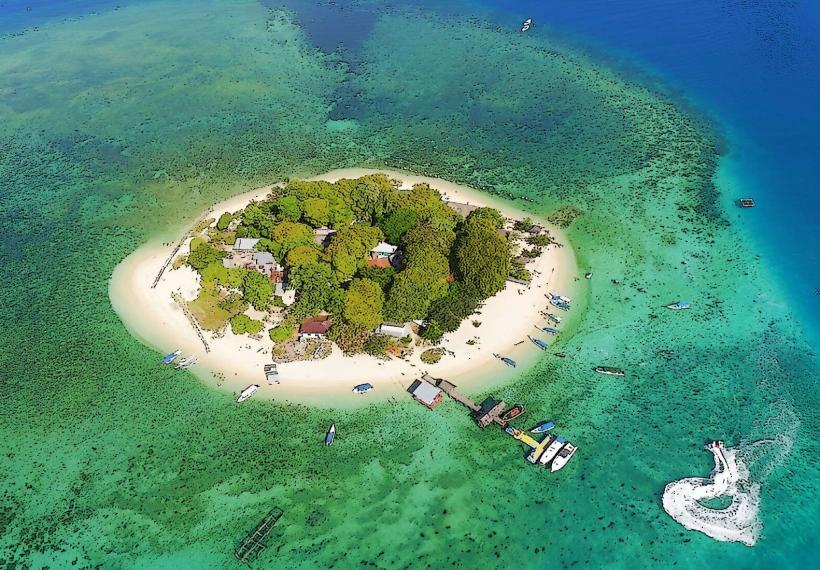
Swimming and sunbathing are primary activities. Snorkeling and diving are possible, particularly around the offshore coral reefs. Boat trips to nearby islands like Liukang Loe are available. Visitors can observe local boat building activities in the nearby village.
Infrastructure & Amenities
Restrooms and basic shower facilities are present. Shade is provided by natural tree cover and some constructed shelters. Cell phone signal (2G/3G) is generally available. Small food stalls (warungs) selling local dishes and drinks are located along the beach access road.
Best Time to Visit
The dry season, from April to October, offers the most favorable weather conditions with reduced rainfall. The best time of day for photography is generally between 9:00 AM and 11:00 AM, and again from 3:00 PM to 5:00 PM, due to optimal sunlight angles. Tidal variations have minimal impact on beach access.
Facts & Legends
Local folklore tells of a mythical dragon that created the white sand by shedding its scales. A practical tip for visitors is to bring insect repellent, especially for use during dawn and dusk.
Nearby Landmarks
- Batu Putih Beach (0.8km West)
- Tanjung Biru Lighthouse (1.2km Southwest)
- Pua Janggo Village (2.5km North)
- Bira Port (3.0km West)
- Kajang Traditional Village (15km Northwest)