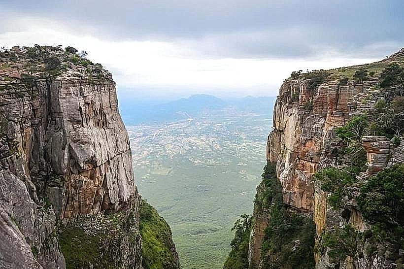
Landmark: Tundavala Fissure
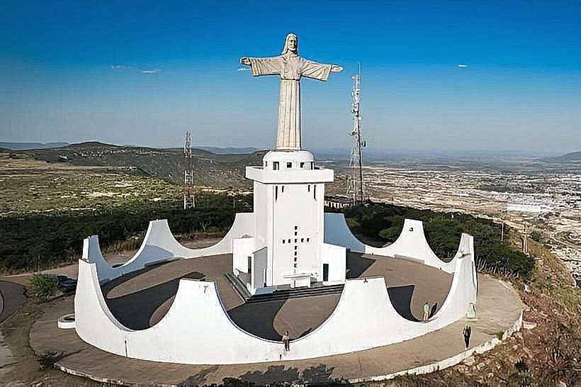
City: Lubango
Country: Angola
Continent: Africa
Tundavala Fissure, Lubango, Angola, Africa
The Tundavala Fissure is a geological formation located in the Serra da Leba mountain range, near Lubango, Angola.
It is a significant geological fault line characterized by a dramatic drop in elevation.
Visual Characteristics
The fissure presents as a deep, elongated chasm with sheer rock faces. The rock strata are visible, displaying various geological layers. The elevation change is approximately 1,000 meters (3,280 feet) from the plateau to the valley floor. Vegetation on the plateau consists of dry savanna grasses and scattered shrubs, while the valley floor supports more diverse plant life.
Location & Access Logistics
The Tundavala Fissure is situated approximately 18 kilometers (11 miles) southwest of Lubango. Access is via the National Road EN100 (Estrada Nacional 100) towards Humpata. A well-maintained dirt track branches off the EN100, leading directly to the viewpoint. Parking is available at the designated viewpoint area. Public transport directly to the fissure is limited; taxis or private vehicles are the primary means of access from Lubango.
Historical & Ecological Origin
The Tundavala Fissure is a result of tectonic activity and erosion over millions of years, forming a significant escarpment. It is part of the Great Escarpment of Africa. Ecologically, it represents a transition zone between the high-altitude plateau and the lower coastal plains, supporting distinct flora and fauna adapted to these environments.
Key Highlights & Activities
Observation of the geological scale of the fissure from the designated viewpoint. Photography of the landscape. Birdwatching, particularly of raptors that utilize the updrafts. Hiking is possible on trails leading away from the immediate viewpoint, but caution is advised due to steep drops.
Infrastructure & Amenities
A basic viewpoint structure with a railing is present. Restrooms are typically available at the viewpoint. Shade is limited to the structure itself. Cell phone signal (4G/5G) is generally weak or absent at the fissure itself, though it may be present on the approach roads.
Best Time to Visit
The best time of day for photography is late afternoon, when the sun's angle casts shadows that emphasize the depth and contours of the fissure. The dry season, from May to September, offers clearer skies and more stable weather conditions. Avoid visiting during the rainy season (October to April) due to potential fog and reduced visibility.
Facts & Legends
Local folklore suggests the fissure was created by a giant serpent or a divine intervention. Geologically, it is a prime example of an escarpment formed by faulting and subsequent erosion, offering a window into Angola's geological history.
Nearby Landmarks
- Serra da Leba Pass (2km Northwest)
- Humpata Village (8km Southwest)
- Lubango City Center (18km Northeast)
- Fortress of São Francisco do Pocolo (20km East)