Landmark: Wotje Lagoon Shore
City: Wotje Atoll
Country: Marshall Islands
Continent: Australia
Wotje Lagoon Shore, Wotje Atoll, Marshall Islands, Australia
Wotje Lagoon Shore is a coastal area located on Wotje Atoll in the Marshall Islands.
This location encompasses the shoreline and immediate waters of the Wotje Atoll's lagoon.
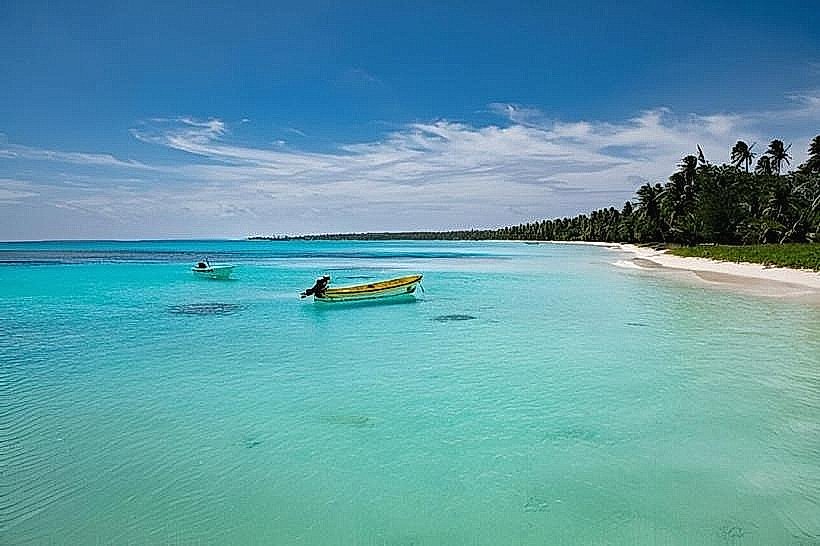
Visual Characteristics
The shoreline consists of coral sand, varying in color from pale white to light grey. The lagoon water exhibits a gradient of blues, from pale turquoise near the shore to deeper sapphire further out. Scattered coral bommies are visible in shallower sections. Vegetation is sparse, primarily consisting of low-lying coastal shrubs and coconut palms lining the landward side of the shore.
Location & Access Logistics
Wotje Lagoon Shore is situated on the eastern side of Wotje Atoll. Access is primarily via boat from the main settlement on Wotje Island, approximately 2 kilometers West. There is no direct road access to most of the lagoon shore. Limited small boat docking facilities are available at the settlement. No public transport operates directly to the shore. Visitors typically arrive via inter-island flights to Wotje Airport (WTE), followed by local arrangements for boat transport.
Historical & Ecological Origin
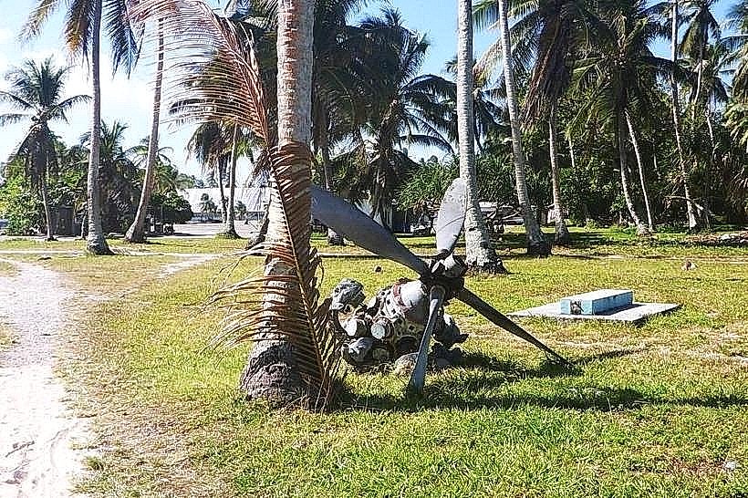
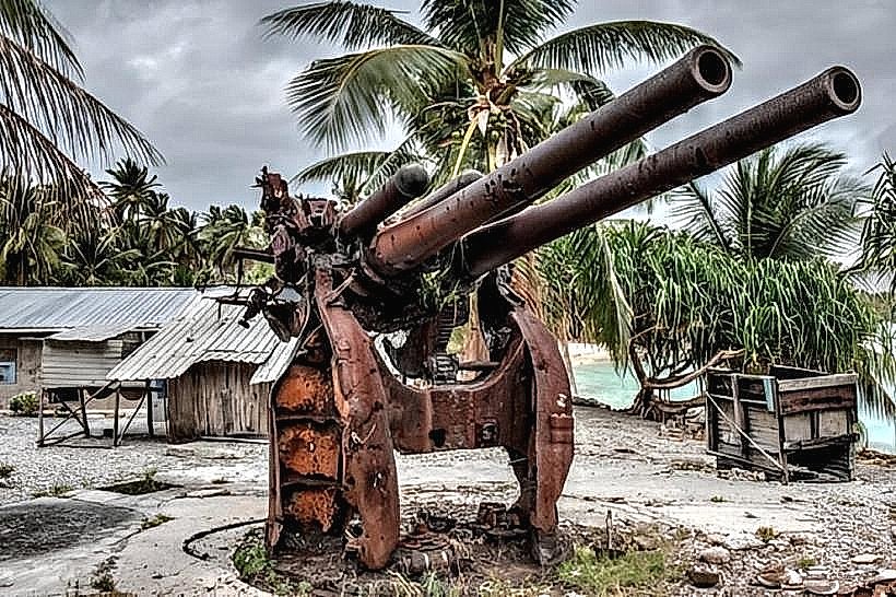
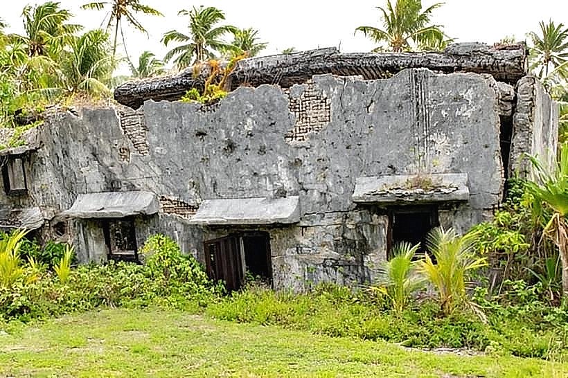
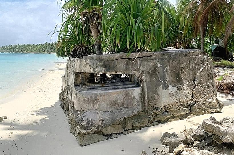
Wotje Atoll is a coral atoll, formed by the accumulation of coral polyps on submerged volcanic seamounts. The lagoon was formed as the seamount subsided and a reef rim developed. Historically, Wotje was a significant site during World War II, with Japanese fortifications present. The lagoon itself is an integral part of the Marshall Islands' marine ecosystem, supporting diverse coral and fish populations.
Key Highlights & Activities
Snorkeling is possible in the shallow lagoon waters, particularly around visible coral formations. Kayaking and paddleboarding are suitable activities within the protected lagoon. Beachcombing along the sandy shores is also an option. Limited fishing can be undertaken by local residents.
Infrastructure & Amenities
Basic amenities are concentrated in the nearby settlement of Wotje. These include a small store and a local guesthouse. Restrooms are not directly available at the lagoon shore itself. Shade is minimal, provided only by scattered coconut trees. Cell phone signal (2G/3G) is generally available in the settlement area but can be intermittent at the shore.
Best Time to Visit
The best time for clear water visibility for snorkeling is during the dry season, from January to April. Mid-morning offers good sunlight for underwater observation. High tide is generally preferable for accessing more of the lagoon area for water activities.
Facts & Legends
During World War II, Wotje Atoll was a Japanese airbase and naval anchorage. Remnants of this period, including concrete structures and aircraft wreckage, can still be found on the island and in the surrounding waters. Local lore speaks of the lagoon being a place where ancient navigators would observe star patterns reflected on the calm water surface.
Nearby Landmarks
- Wotje Airport (WTE) - 2.5km West
- Wotje Settlement - 2.0km West
- Japanese WWII Bunker Remnants - 1.8km West
- Enewetak Atoll (requires significant travel) - 250km West
- Bikini Atoll (requires significant travel) - 300km Northwest