Information
City: BanosCountry: Ecuador
Continent: South America
Banos, Ecuador, South America
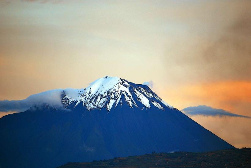
Baños de Agua Santa, commonly referred to as Baños, is the "Adventure Capital of Ecuador." It is situated at an elevation of 1,820m in a subtropical valley at the foot of the active Tungurahua Volcano.
Historical Timeline
Baños has served as a center for pilgrimage and thermal healing for centuries. Its modern history is defined by its resilience against the Tungurahua Volcano, which underwent a major eruptive cycle starting in 1999 that forced a temporary total evacuation of the town. Since then, the community has developed a sophisticated monitoring and evacuation system, allowing it to grow into one of South America's premier hubs for ecotourism and extreme sports.
Demographics & Population
The estimated 2026 permanent population is 16,000, though the transient tourist population significantly inflates this number daily. Approximately 70% of visitors are domestic, with 30% being international travelers. The median age is roughly 30 years, influenced by a large community of adventure operators and hospitality staff.
Urban Layout & Key Districts
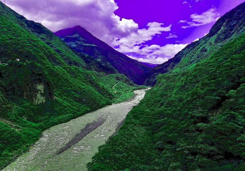
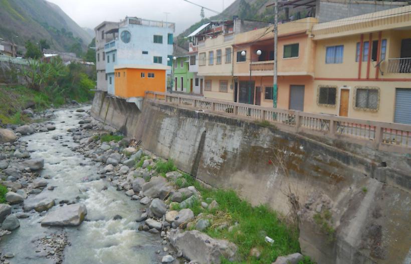
The town is compact and centered around a main plaza, with most development hugging the Pastaza River gorge.
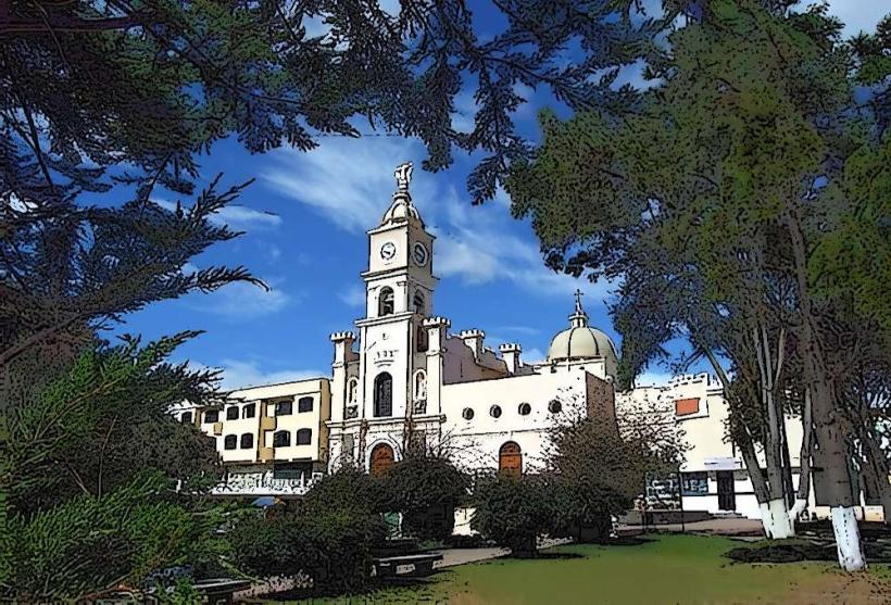
The Center: Focused on the Basílica de Nuestra Señora del Agua Santa, it contains the highest concentration of tour agencies and thermal baths.
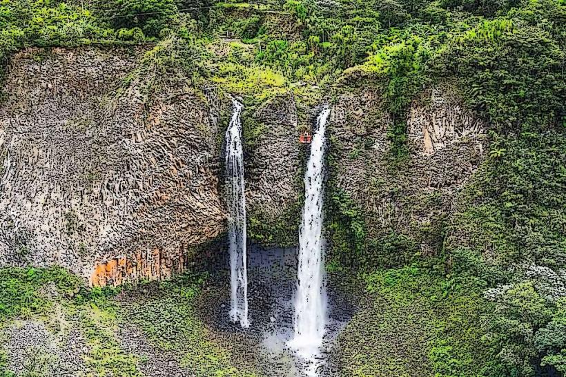
Ruta de las Cascadas: An eastern corridor extending 20 km toward Puyo, housing dozens of waterfalls and adventure parks.
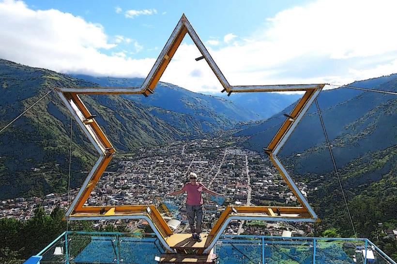
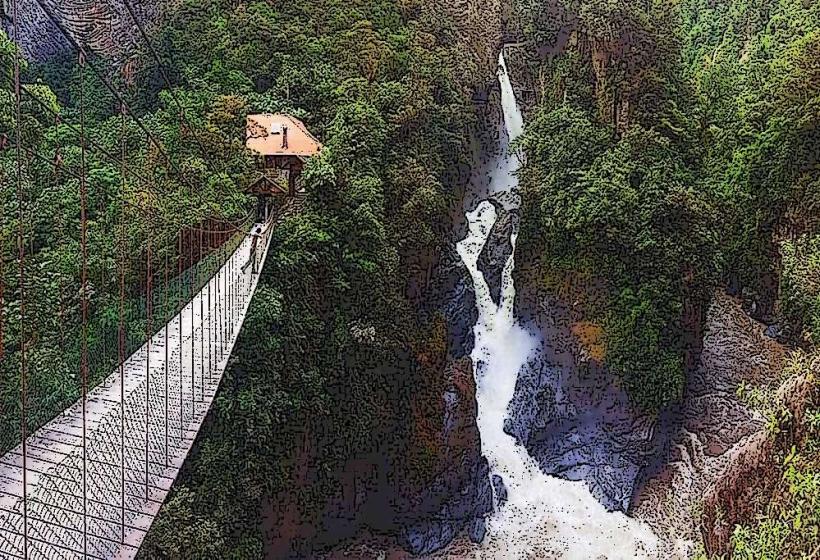
Runtún: A high-altitude residential and tourist area on the mountain slopes above the town, home to the famous Treehouse.
Top City Landmarks
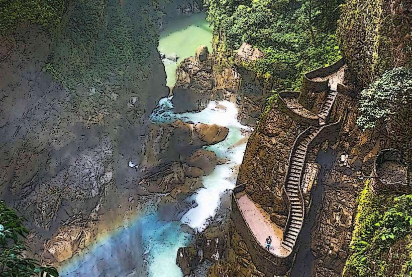
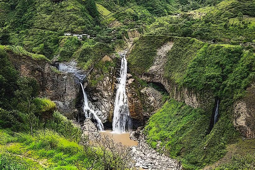
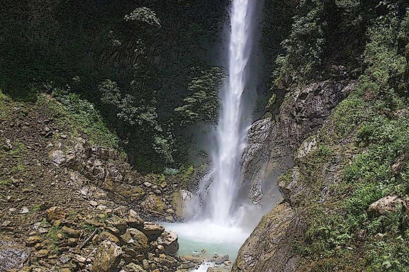
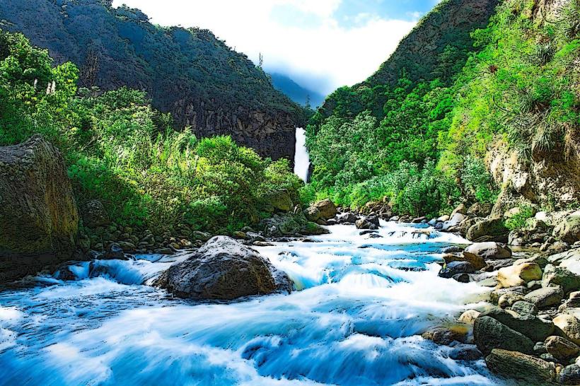
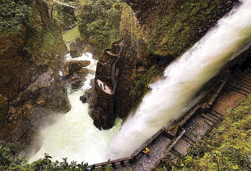
Pailón del Diablo (Devil’s Cauldron): A massive 80m waterfall featuring a "stairway to heaven" carved into the rock.
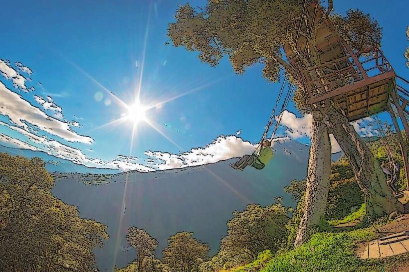
Casa del Árbol: Home to the "Swing at the End of the World," providing unobstructed views of the volcano.
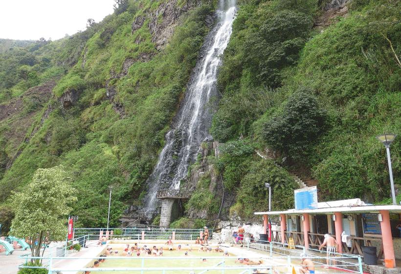
Termas de la Virgen: Hot springs located directly at the base of a towering waterfall in the city center.
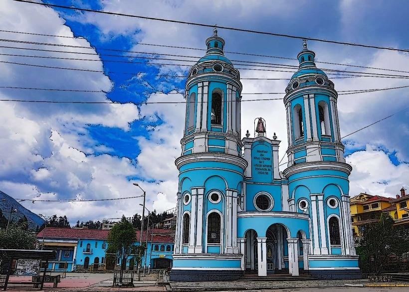
The Basílica: A volcanic stone church dedicated to the Virgin of the Holy Water, featuring murals of local miracles.
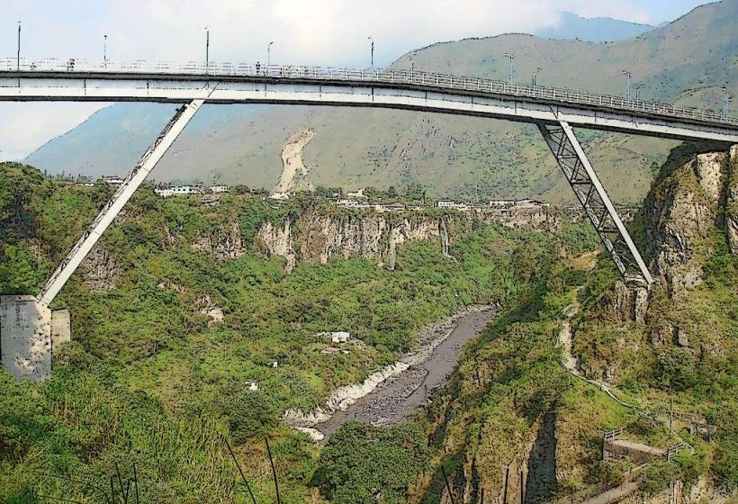
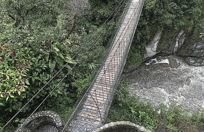
San Francisco Bridge: A primary site for bungee jumping ("puenting") over the Pastaza River.
Transportation Network
Bus: Most travelers arrive via the Terminal Terrestre, with frequent connections to Quito (3.5h) and Ambato (45m).
Local Mobility: The town is walkable. For regional tours, Chivas (open-air colorful buses) and Tarabitas (cable cars) are the standard modes of transport.
Biking: Renting mountain bikes to ride the downhill route to Puyo is a signature tourist activity.
Safety & Environmental Risk
As of January 2026, Baños remains a safe destination within the Ecuadorian tourist circuit.
Volcanic Alert: Tungurahua is monitored 24/7. Current alert levels are typically "Green" or "Yellow" (Normal/Low Unrest). Visitors should heed local sirens and evacuation route signs.
General Security: Petty theft is rare but can occur at the busy hot springs and bus terminal.
Adventure Safety: Use only registered agencies for high-risk activities like canyoning or rafting to ensure equipment meets 2026 safety standards.
Digital & Financial Infrastructure
Average fixed internet speed is 135 Mbps, with 5G coverage available in the town center via Claro and Movistar. The official currency is the US Dollar ($). While cards are widely accepted in hotels and major restaurants, the "Chivas," markets, and entry fees for waterfalls ($1.50–$5.00) are strictly cash-only.
Climate & Social Norms
The climate is subtropical highland with frequent mist and rain. Average January temperatures are around 17°C–19°C.
Tipping: 10% is expected in tourist restaurants.
Dress: "Quick-dry" clothing and waterproof gear are essential for the humidity and spray from waterfalls.
Siesta: Unlike the coast, many shops stay open throughout the day to cater to tourists.
Local Cost Index
1 Standard Lunch: $3.50–$6.00 USD
1 Canyoning Tour: $30–$48 USD
1 Zipline Entry: $26–$30 USD
1 Bus to Treehouse: $1.00 USD
Nearby Day Trips
Puyo (Amazon Gateway): 60 km (Jungle tours and indigenous community visits).
Chimborazo: 80 km (High-altitude trekking on Ecuador's highest peak).
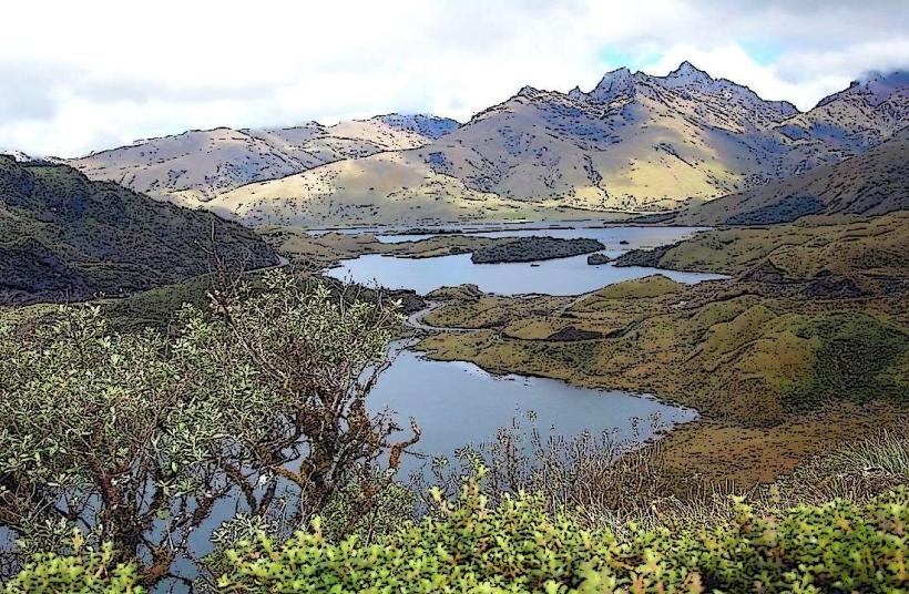
Quilotoa Crater: 100 km (A 3-hour drive to the emerald volcanic lake).
Facts & Legends
A local historical curiosity is that the town's name literally translates to "Baths of Sacred Water," referring to the healing properties attributed to the volcanic minerals. A popular legend says the Virgin of the Holy Water has twice physically blocked lava flows from entering the town with her mantle, a belief reflected in the prominent religious artwork inside the central Basílica.