Information
Landmark: Baños de Agua SantaCity: Banos
Country: Ecuador
Continent: South America
Baños de Agua Santa, Banos, Ecuador, South America
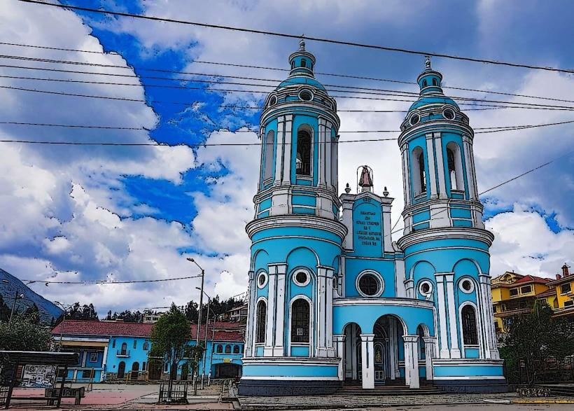
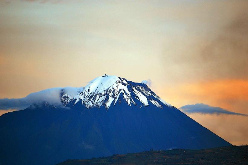
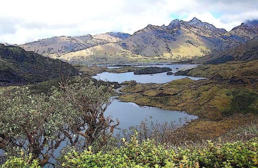
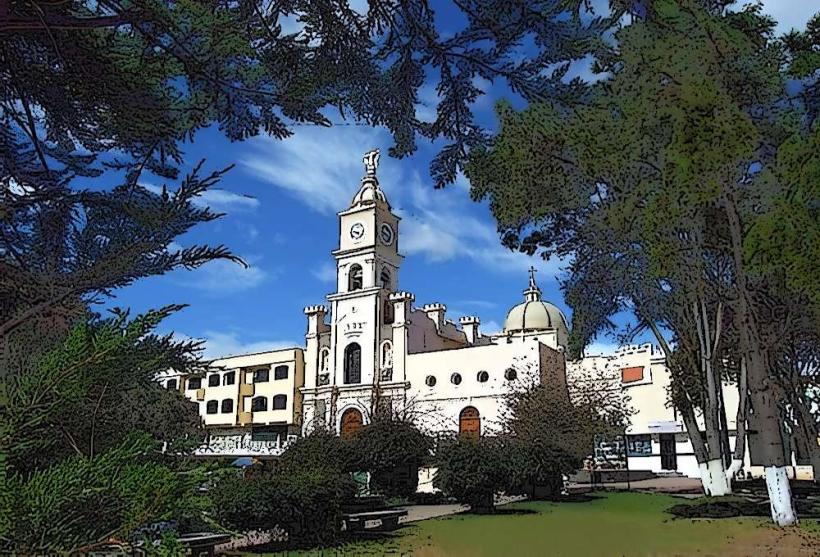
Baños de Agua Santa is a town situated in the Tungurahua Province of Ecuador, at the base of the active Tungurahua Volcano.
Visual Characteristics
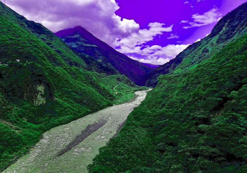
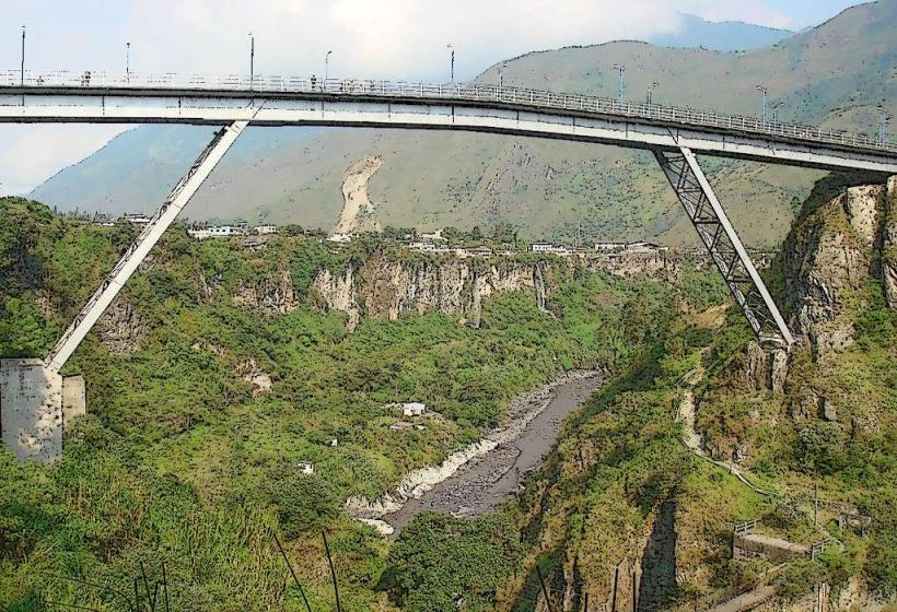
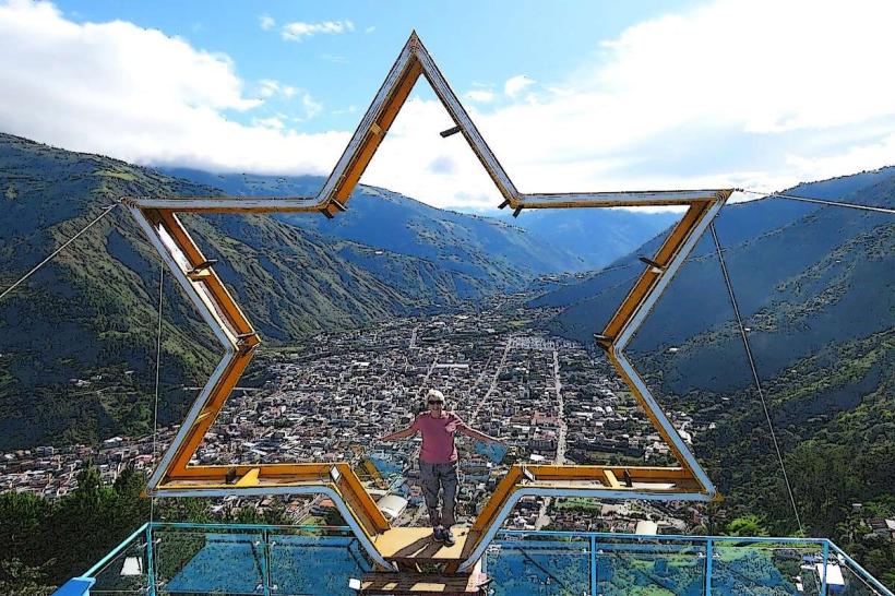
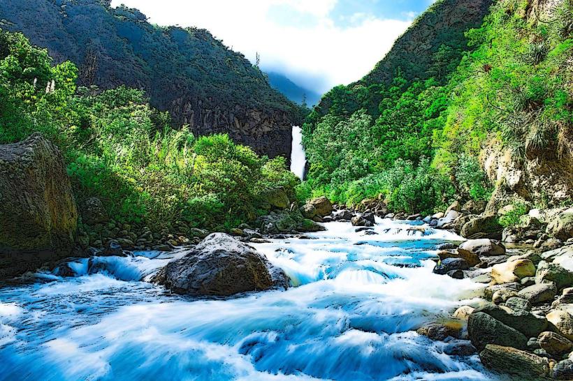
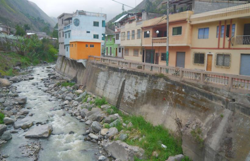
The town is characterized by its proximity to steep, verdant mountain slopes. Buildings are predominantly constructed from concrete and brick, with terracotta or metal roofing. The Tungurahua volcano, often visible, presents a conical shape with a summit that can be obscured by clouds. The Pastaza River flows through the valley, a significant watercourse with a moderate flow rate.
Location & Access Logistics
Baños is located approximately 180 kilometers south of Quito. Access from Quito is primarily via the E30 highway (Avenida de los Libertadores). The journey typically takes 3 to 4 hours by car or bus. Several bus companies operate frequent services from Quito's Quitumbe Terminal. Parking is available in designated public lots within the town, though it can be limited during peak seasons. Local taxis and mototaxis are readily available for intra-town transport.
Historical & Ecological Origin
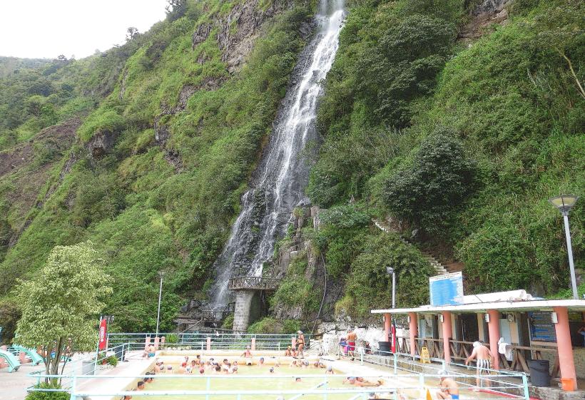
The town's origin is linked to the thermal hot springs found in the area, which were recognized for their therapeutic properties by early settlers. The Tungurahua volcano is a stratovolcano, part of the Andean Volcanic Belt, with its last significant eruption occurring in 2010. The surrounding region is classified as a cloud forest ecosystem, supporting high biodiversity.
Key Highlights & Activities
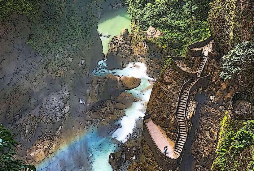
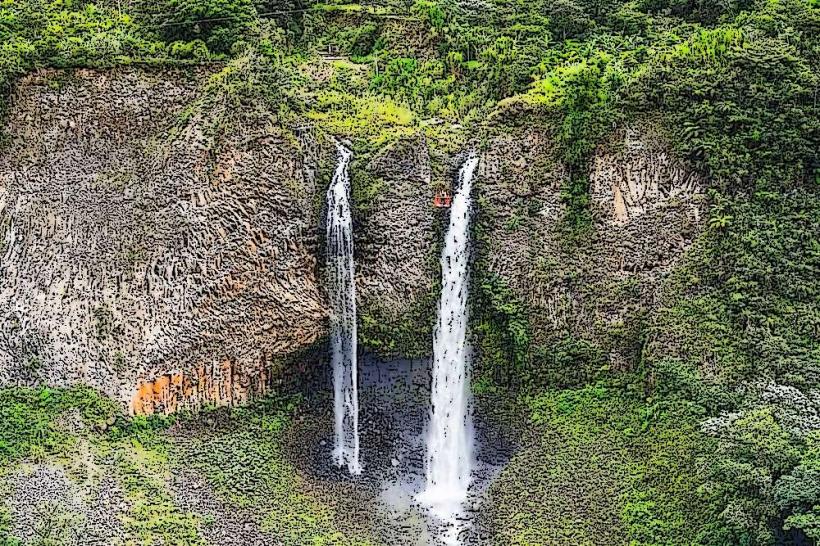
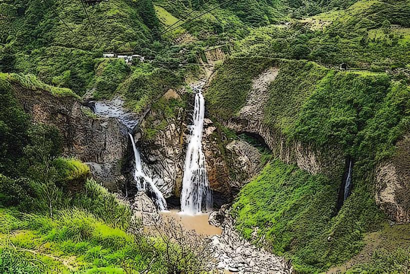
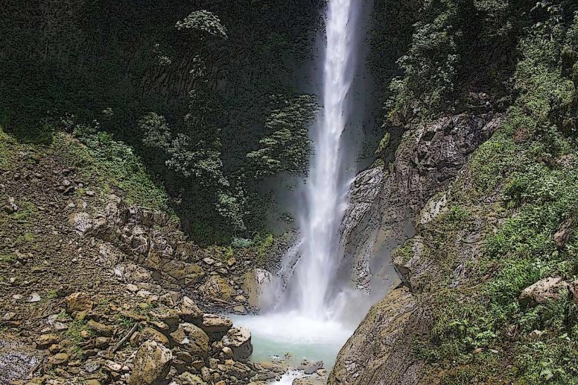
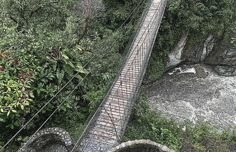
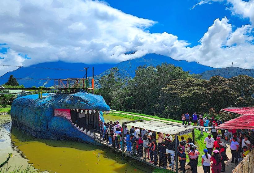
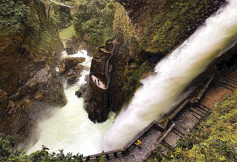
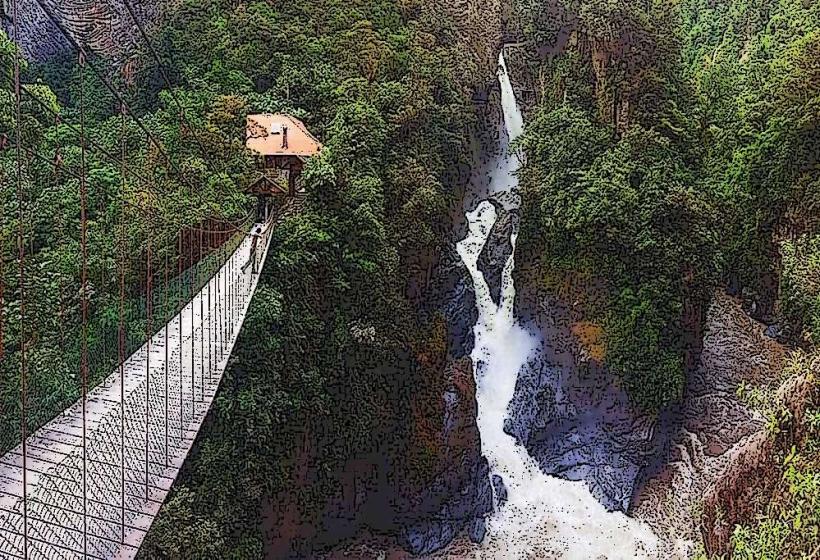
Activities include bathing in the thermal hot springs (e.g., Termas de la Virgen, Termas El Salado). Hiking trails lead to waterfalls such as Pailón del Diablo and Manto de la Novia. Ziplining and canopy tours are offered across the Pastaza River gorge. Cycling the "Ruta de las Cascadas" (Route of the Waterfalls) is a common activity.
Infrastructure & Amenities
Restrooms are available at most tourist attractions and public facilities. Shade is provided by natural tree cover in surrounding areas and by awnings at commercial establishments. Cell phone signal (4G) is generally consistent within the town. Numerous restaurants and small food vendors are located along the main streets.
Best Time to Visit
The best months for weather are typically June through September, which represent the drier season. However, rain can occur year-round. The best time of day for photography of the volcano is often early morning, before cloud cover typically forms. High tide is not a relevant factor for visiting this inland location.
Facts & Legends
Local legend attributes healing powers to the waters of the hot springs, with stories of miraculous recoveries. A specific tip for visitors is to book popular activities like the canopy tours in advance, especially during weekends or holidays, to secure preferred time slots.
Nearby Landmarks
- 0.5km West: Tungurahua Volcano
- 2km East: Pailón del Diablo Waterfall
- 3km Northeast: Manto de la Novia Waterfall
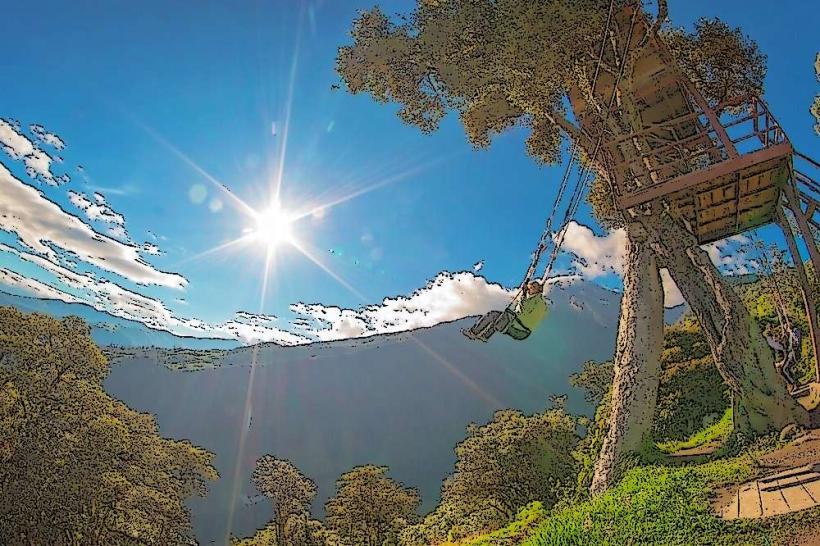
- 4km South: Casa del Arbol (Swing at the End of the World)