Information
City: GarissaCountry: Kenya
Continent: Africa
Garissa, Kenya, Africa
Garissa is the administrative capital of Garissa County and the primary economic hub of North Eastern Kenya. It is situated at an elevation of 140 meters on the Tana River, serving as a critical bridge between the arid northern regions and the central highlands.
Historical Timeline
Garissa was established as a colonial administrative outpost to manage the North Eastern Province. The primary event shaping its current urban form was the post-independence expansion of the livestock trade and its strategic role as a regional military and logistical center. The 2015 tragedy at Garissa University led to a massive overhaul of security infrastructure and a subsequent surge in development and government investment aimed at regional stabilization.
Demographics & Population
The estimated metropolitan population for 2026 is 190,000. The demographics are predominantly Somali, with a significant population of civil servants and traders from other parts of Kenya. The culture is deeply Islamic. The median age is approximately 18.4 years.
Urban Layout & Key Districts
The city is organized along the Tana River and the main A3 highway (Nairobi-Liboi road).
The CBD: A bustling commercial center focused on the main livestock and textile markets.
Bula Punda & Bula Mzuri: High-density residential zones.
The Government Quarter: Housing the County Headquarters and regional administrative offices.
Riverfront: Area along the Tana River utilized for small-scale irrigation and leisure.
Top City Landmarks
Tana River: The longest river in Kenya, which provides a green belt through the arid landscape.
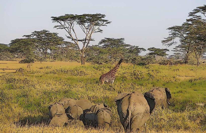
Bour-Algi Giraffe Sanctuary: Located south of the town, protecting the reticulated giraffe.
Garissa University: A symbol of resilience and the primary higher education center in the region.
Garissa Livestock Market: One of the largest and most active camel and cattle markets in East Africa.
The Silverstar Terrace: A notable local social landmark.
Transportation Network
Intra-city transit is dominated by Tuk-tuks and Boda Bodas. Garissa is a major transit node for travelers moving toward the Dadaab refugee complex and the Somali border. The Nairobi-Garissa Highway is the primary artery for goods. There is no rail service. Garissa Airport serves military and chartered humanitarian flights. Traffic is moderate but peaks during market days.
Safety & "Red Zones"
The general safety level is moderate and highly regulated. There is a heavy presence of security forces (KDF and Police). Travelers should observe the local curfew if one is in effect and avoid traveling near the border regions without security clearance. Specific "red zones" include the areas heading toward the Boni Forest. Vigilance is required in crowded public spaces.
Digital & Financial Infrastructure
Internet speeds average 20–35 Mbps. Main carriers are Safaricom and Airtel. M-Pesa is the ubiquitous payment method. ATMs are concentrated in the CBD along the main road. Credit card acceptance is very low, limited to a few major hotels.
Climate & Air Quality
Temperatures range from 22°C to 38°C. The climate is arid and hot throughout the year. Air quality is generally high, though dust levels are extreme during the dry season. Significant weather risks include severe droughts and flash flooding of the Tana River during the rainy seasons in the highlands.
Culture & Social Norms
English, Swahili, and Somali are the primary languages. The culture is conservative and Islamic; modest dress is mandatory (shoulders and legs covered). Public consumption of alcohol is restricted and largely unavailable. Shaking hands is the standard greeting among the same gender.
Accommodation Zones
Town Center: Recommended for business transit and security.
Riverfront Area: Recommended for quieter hotel stays with better views.
Local Cost Index
1 Espresso (Coffee): 200 KES ($1.30 USD)
1 Standard Lunch (Camel Meat/Rice): 600 KES ($3.90 USD)
1 Short Tuk-tuk Trip: 100 KES ($0.65 USD)
Nearby Day Trips
Arawale National Reserve: 70 km (Home to the rare Hirola antelope).
Rahole National Reserve: 45 km (Arid landscape wildlife).
Facts & Legends
Garissa is known as the "Gateway to the North." A local legend suggests that the Tana River is guarded by ancient spirits that determine the success of the annual harvest. A verified historical oddity is that the Garissa Livestock Market operates as a highly sophisticated informal exchange where millions of shillings change hands daily based solely on oral contracts and traditional trust systems.