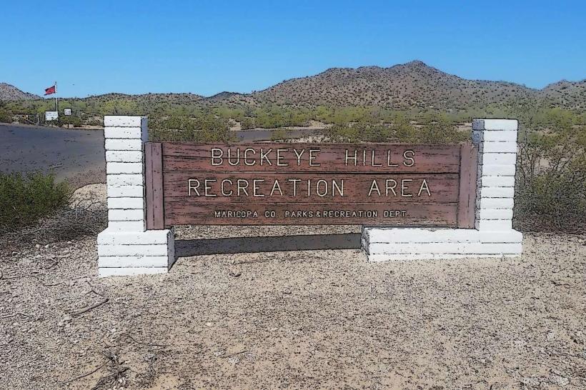
Landmark: Buckeye Hills Recreation Area
City: Buckeye
Country: USA Arizona
Continent: North America
Buckeye Hills Recreation Area, Buckeye, USA Arizona, North America
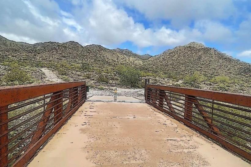
Buckeye Hills Recreation Area is a designated public land parcel situated within the city limits of Buckeye, Arizona. It encompasses a significant portion of desert terrain managed for recreational use.
Visual Characteristics
The landscape is characterized by arid desert scrub, including creosote bush, palo verde, and saguaro cacti. The terrain features rolling hills and washes, with exposed rock formations of reddish-brown sandstone. Elevation ranges from approximately 1,000 to 1,500 feet above sea level.
Location & Access Logistics
The primary access point is via Old US 80, which runs along the northern boundary of the recreation area. The main entrance is located approximately 5 miles west of the Buckeye city center. Unpaved, graded roads provide internal access for vehicles. Parking is available at designated pull-offs and trailheads; no formal parking lots are present. Public transport does not directly serve the recreation area.
Historical & Ecological Origin
Buckeye Hills Recreation Area is part of the Sonoran Desert ecosystem, characterized by its unique flora and fauna adapted to arid conditions. The geological formations are primarily sedimentary rock, shaped by millions of years of erosion. The land was designated for public recreation to preserve its natural state and provide outdoor opportunities.
Key Highlights & Activities
Activities include hiking on marked and unmarked trails, off-highway vehicle (OHV) use on designated routes, and wildlife observation. Rock climbing is possible on certain sandstone formations. Camping is permitted in undeveloped areas.
Infrastructure & Amenities
No developed infrastructure or amenities are present within the recreation area. Visitors should be self-sufficient. Cell phone signal is intermittent and generally unreliable. No restrooms, shade structures, or food vendors are available on-site.
Best Time to Visit
The optimal time for visiting is during the cooler months, from October through April. Mid-morning (9:00 AM - 11:00 AM) and late afternoon (3:00 PM - 5:00 PM) offer the most favorable lighting conditions for photography and reduce exposure to peak daytime temperatures.
Facts & Legends
The area is known for its significant population of desert tortoises. A specific geological feature, a large, solitary rock formation known locally as "The Sentinel," is a common reference point for hikers.
Nearby Landmarks
- White Tank Mountain Regional Park (2.5km Northwest)
- Buckeye Municipal Airport (4.0km East)
- Harquahala Valley (5.0km West)