Information
Landmark: Buckeye Hills TrailheadCity: Buckeye
Country: USA Arizona
Continent: North America
Buckeye Hills Trailhead, Buckeye, USA Arizona, North America
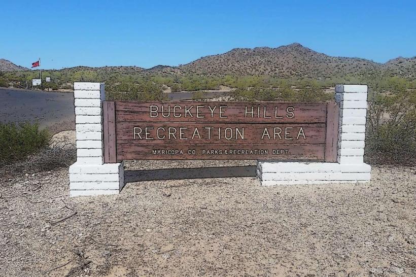
The Buckeye Hills Trailhead is a point of access for hiking trails located in Buckeye, Arizona, USA.
Visual Characteristics
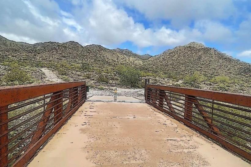
The trailhead area is characterized by desert scrub vegetation, including creosote bush and palo verde trees. The terrain consists of compacted dirt and gravel, with rocky outcrops and sandy washes. The surrounding hills are composed of sedimentary rock formations, exhibiting shades of tan, brown, and red.
Location & Access Logistics
The trailhead is situated approximately 5 miles southwest of downtown Buckeye. Access is via Olde Town Road, which transitions into a dirt road for the final 1.5 miles. A designated gravel parking lot is available, accommodating approximately 20 vehicles. No public transport services reach this specific location.
Historical & Ecological Origin
The Buckeye Hills are geologically classified as Basin and Range Province topography, formed by faulting and erosion over millions of years. The area supports Sonoran Desert flora and fauna adapted to arid conditions.
Key Highlights & Activities
Hiking is the primary activity. The main trail, the Buckeye Hills Loop, is a 4.5-mile moderate difficulty circuit. Shorter spur trails branch off to various viewpoints. Birdwatching is possible due to the native vegetation.
Infrastructure & Amenities
A single information kiosk with trail maps is present. No restrooms, shade structures, or food vendors are located at the trailhead. Cell phone signal (4G/5G) is intermittent to non-existent.
Best Time to Visit
The optimal time for hiking is during the cooler months, from October through April. Early morning or late afternoon provides the best lighting for photography and avoids the most intense daytime heat. Midday temperatures can exceed 100°F (38°C) from May to September.
Facts & Legends
Local lore suggests that prospectors in the late 19th century found small gold deposits in the washes of these hills, though large-scale mining never materialized.
Nearby Landmarks
- Buckeye Aqueduct (1.8km Northeast)
- Skyline Drive Trailhead (3.2km North)
- Verrado Heritage Golf Club (4.5km North)
- White Tank Mountain Regional Park (7.1km Northwest)