Landmark: Burlingame State Park
City: Charlestown RI
Country: USA Rhode Island
Continent: North America
Burlingame State Park, Charlestown RI, USA Rhode Island, North America
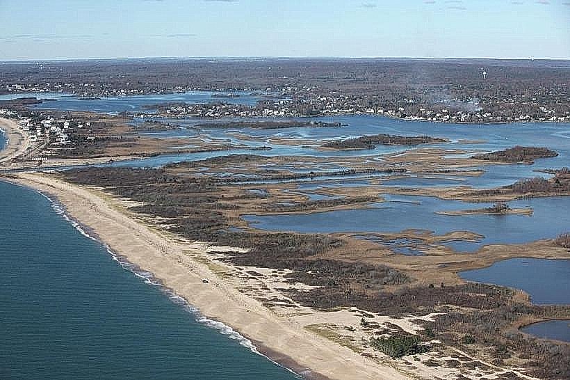
Burlingame State Park is a protected natural area located in Charlestown, Rhode Island, USA. It encompasses a significant portion of woodland and freshwater pond environments.
Visual Characteristics
The park features mixed deciduous and coniferous forests with a dense understory of shrubs. Quonochontaug Pond, a large brackish pond, forms a central feature, with its water color varying from greenish to brownish depending on sediment and algae levels. Shorelines are a mix of sandy areas and marshy vegetation. Several smaller freshwater ponds are also present within the park's boundaries.
Location & Access Logistics
Burlingame State Park is situated approximately 5 miles west of Charlestown's village center. Access is primarily via Route 1, with a turn onto Burlingame State Park Road. Parking is available at designated lots throughout the park, including near the campground and main recreational areas. Public transport options are limited; the nearest bus routes operate along Route 1, requiring a significant walk or taxi to reach the park entrance.
Historical & Ecological Origin
The land was acquired by the state of Rhode Island in the mid-20th century for conservation and recreation. Ecologically, the park protects a significant coastal plain pond system and surrounding woodland habitats, supporting diverse flora and fauna characteristic of the region.
Key Highlights & Activities
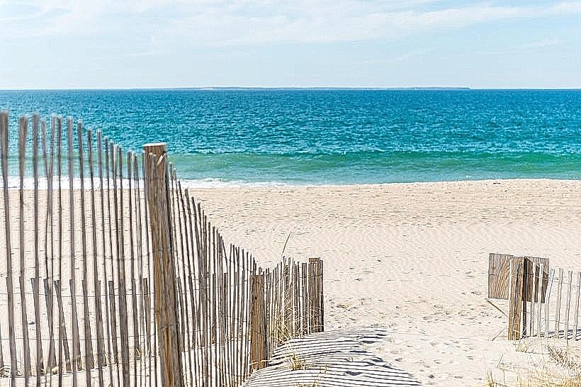
Activities include hiking on marked trails, fishing in Quonochontaug Pond and freshwater ponds (license required), boating (non-motorized permitted on freshwater ponds), and camping at the state-run campground. Birdwatching is also a common activity due to the varied habitats.
Infrastructure & Amenities
Restrooms are available at the campground and main day-use areas. Picnic tables and grills are provided in designated picnic spots. Shade is abundant within the forested areas. Cell phone signal strength varies significantly throughout the park, with stronger reception closer to park entrances and roads.
Best Time to Visit
For hiking and general recreation, late spring (May-June) and early autumn (September-October) offer moderate temperatures and fewer insects. Summer months (July-August) are suitable for water-based activities but can be hot. Quonochontaug Pond is tidal; checking tide charts is advisable for specific water access points. Early morning and late afternoon provide optimal lighting for photography.
Facts & Legends
Quonochontaug Pond is one of the largest coastal salt ponds in Rhode Island, historically supporting significant shellfishing industries. A local anecdote suggests that during certain fog conditions, the pond can create disorienting sound echoes.
Nearby Landmarks
- Charlestown Breachway State Beach (1.5km Southeast)
- East Beach State Management Area (3.0km South)
- Ninigret National Wildlife Refuge (4.0km West)
- Frosty Drew Observatory (4.5km Northwest)