Landmark: Ninigret National Wildlife Refuge
City: Charlestown RI
Country: USA Rhode Island
Continent: North America
Ninigret National Wildlife Refuge, Charlestown RI, USA Rhode Island, North America
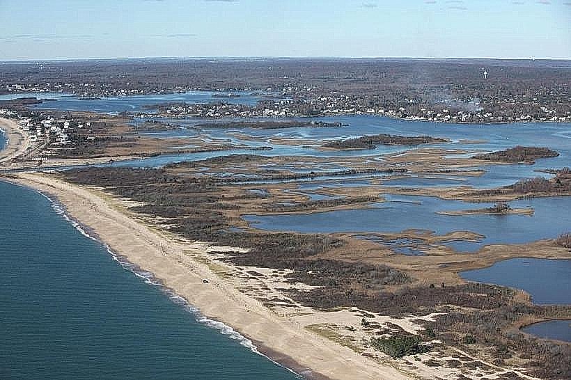
Ninigret National Wildlife Refuge is a protected area located in Charlestown, Rhode Island, USA. It encompasses coastal salt ponds, barrier beaches, and upland forests.
Visual Characteristics
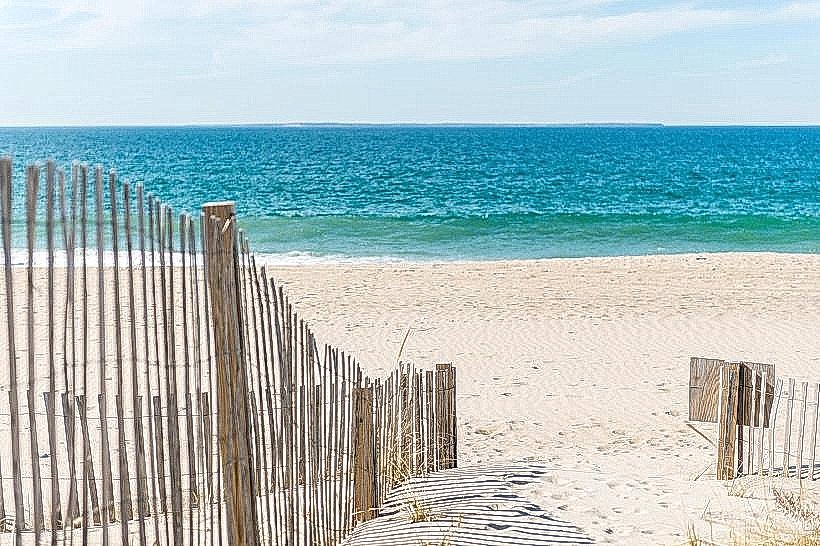
The refuge features extensive salt marsh ecosystems characterized by Spartina grasses. The Ninigret Pond is a large, shallow coastal lagoon with varying water clarity depending on tidal flow and sediment. Barrier beaches are composed of sand and gravel. Upland areas consist of mixed deciduous and coniferous forests with undergrowth.
Location & Access Logistics
Ninigret National Wildlife Refuge is situated approximately 5 kilometers west of Charlestown's village center. Access is primarily via US Route 1, turning south onto Charlestown Beach Road. Parking is available at designated lots along Charlestown Beach Road and at the Breachway area. Public transportation options are limited; the nearest bus route stops several kilometers from the refuge entrance.
Historical & Ecological Origin
The refuge was established in 1970 to protect migratory bird habitat and coastal ecosystems. Ecologically, it represents a significant estuarine system, with Ninigret Pond being one of the largest salt ponds in Rhode Island. The barrier beaches are dynamic geological features shaped by wave action and longshore drift.
Key Highlights & Activities
Birdwatching is a primary activity, with opportunities to observe waterfowl, shorebirds, and wading birds. Kayaking and canoeing are permitted on Ninigret Pond. Hiking trails are available in the upland forest sections. Fishing is allowed in designated areas during specific seasons.
Infrastructure & Amenities
Restrooms are available at the main parking areas. Limited shade is provided by trees in upland sections. Cell phone signal (4G/5G) is generally available but can be intermittent in more remote areas. No food vendors are located within the refuge; nearest services are in Charlestown village.
Best Time to Visit
For birdwatching, spring (April-May) and fall (September-November) offer peak migratory activity. Early morning and late afternoon provide optimal lighting for photography. Tidal conditions affect access to certain areas; consult local tide charts for Ninigret Pond.
Facts & Legends
Ninigret Pond was historically used for aquaculture, particularly oyster farming. A specific tip for visitors is to check the refuge's website for scheduled controlled burns, which are part of the habitat management plan and can temporarily restrict access to certain areas.
Nearby Landmarks
- Charlestown Breachway (0.8km West)
- East Beach State Beach (1.5km Southwest)
- Burlingame State Park (4.0km North)
- Block Island National Wildlife Refuge (Ferry access from Point Judith, 15km East)