Landmark: Charlestown Breachway State Beach
City: Charlestown RI
Country: USA Rhode Island
Continent: North America
Charlestown Breachway State Beach, Charlestown RI, USA Rhode Island, North America
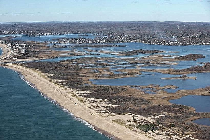
Charlestown Breachway State Beach is a coastal access point located in Charlestown, Rhode Island, USA.
This location provides access to the Atlantic Ocean and Charlestown Pond.
Visual Characteristics
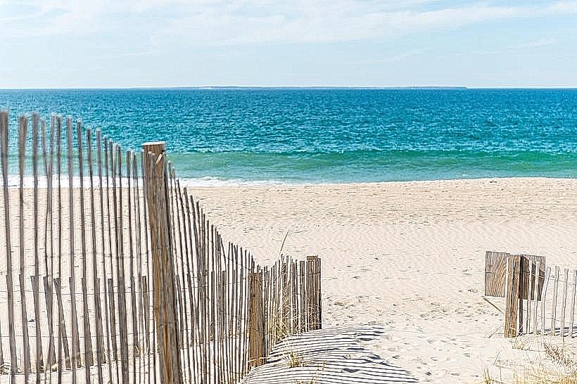
The beach consists of a sand barrier separating Charlestown Pond from the Atlantic Ocean. The ocean side features coarse sand and wave action. The pond side is calmer with finer sediment. Vegetation on the dunes is primarily sea grass and low-lying coastal shrubs.
Location & Access Logistics
Charlestown Breachway State Beach is situated approximately 3.2 kilometers (2 miles) south of U.S. Route 1 in Charlestown. Access is via Charlestown Breachway Road, a paved public road. Parking is available in a designated lot, with fees typically collected during peak season. No public transport directly serves the beach; automobile access is required.
Historical & Ecological Origin
The breachway is a natural geological feature, a barrier beach formed by the deposition of sand and sediment over time. It serves as a dynamic interface between freshwater pond ecosystems and the marine environment of the Atlantic Ocean. The current configuration is subject to natural erosion and accretion processes.
Key Highlights & Activities
Activities include surf fishing, kayaking on Charlestown Pond, and beachcombing. Swimming is permitted in the ocean, with caution advised due to currents. Access to the breachway for boat launching is available.
Infrastructure & Amenities
Restrooms are available seasonally. Limited shade is provided by natural dune vegetation. Cell phone signal (4G/5G) is generally available. No food vendors are present directly at the beach; visitors should bring supplies.
Best Time to Visit
For photography, early morning and late afternoon offer optimal lighting conditions. The months of June through September provide the warmest weather for beach activities. Tidal conditions can affect access and fishing opportunities; consult local tide charts.
Facts & Legends
The breachway has historically been a site for both recreational and commercial fishing. Local lore sometimes refers to the shifting nature of the breachway's opening to the sea as being influenced by strong storms.
Nearby Landmarks
- Charlestown Pond (0.1km West)
- East Beach State Management Area (1.5km East)
- Fort Neck (2.0km Northwest)
- Ninigret Pond (3.0km West)
- Blue Shutters Beach (4.0km Southeast)