Landmark: Cerro de la Virgen
City: Maldonado
Country: Uruguay
Continent: South America
Cerro de la Virgen, Maldonado, Uruguay, South America
Cerro de la Virgen is a prominent hill located in the city of Maldonado, Uruguay. It serves as a significant natural and historical point of interest within the region.
Visual Characteristics
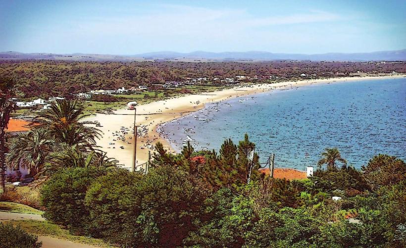
The hill's surface is primarily composed of exposed granite rock formations, with sparse vegetation consisting of low-lying shrubs and grasses. The summit offers a panoramic view of the surrounding urban landscape and the Atlantic coastline. The elevation reaches approximately 50 meters above sea level.
Location & Access Logistics
Cerro de la Virgen is situated approximately 2 kilometers west of Maldonado's city center. Access is via Avenida Francisco Piria, turning onto Calle de la Virgen. A paved road leads to a small parking area at the base of the hill. Public transport options include the local bus line 7, which stops at the intersection of Avenida Francisco Piria and Calle de la Virgen, a 5-minute walk from the trailhead.
Historical & Ecological Origin
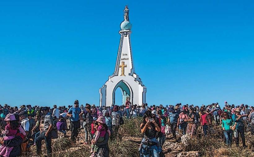
Geologically, Cerro de la Virgen is an outcropping of Precambrian granite, part of the Crystalline Basement of the Río de la Plata. Historically, the site features a small chapel constructed in the mid-20th century, dedicated to the Virgin Mary, which gives the hill its name. It has been a site of local pilgrimage and observation for centuries.
Key Highlights & Activities
Visitors can ascend to the summit via a marked walking path. The path is approximately 500 meters long and moderately steep. Observation points along the ascent provide views of Maldonado Bay and the city. The chapel at the summit is accessible for viewing.
Infrastructure & Amenities
A small, unpaved parking area is available at the base. There are no restroom facilities or designated shade structures on the hill itself. Cell phone signal (4G) is generally available at the summit. No food vendors are present at the site; amenities are located in the nearby city center.
Best Time to Visit
For optimal lighting conditions for photography, the late afternoon (approximately 16:00 to 18:00) provides favorable angles and softer light. The months of October through April offer the most stable weather patterns with lower rainfall. There are no tidal considerations for access.
Facts & Legends
Local folklore suggests that the hill was a lookout point for indigenous peoples prior to European settlement. A specific historical detail is the presence of a small, weathered stone marker near the chapel, believed to be a boundary stone from the early colonial period, though its exact origin is unverified.
Nearby Landmarks
- Plaza de los Treinta y Tres (1.5km East)
- Museo de Arte Contemporáneo (2km East)
- Faro de Punta del Este (10km Southeast)
- Avenida Gorlero (10km Southeast)
- La Mano de Punta del Este (11km Southeast)