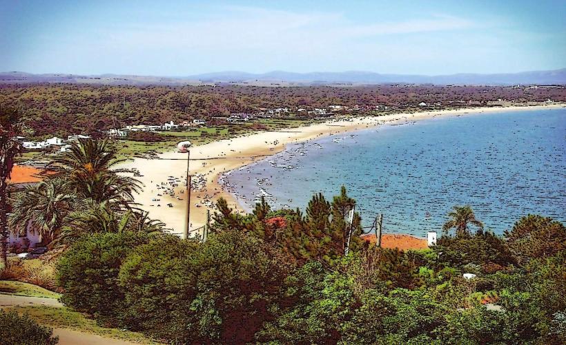
Landmark: Playa Punta Ballena
City: Maldonado
Country: Uruguay
Continent: South America
Playa Punta Ballena, Maldonado, Uruguay, South America
Playa Punta Ballena is a coastal area located in Maldonado, Uruguay. It is characterized by its distinctive rock formations and marine life observation opportunities.
Visual Characteristics
The beach features a shoreline composed of coarse sand and numerous granite rock formations, some of which extend into the water. The water color varies from clear to a light turquoise depending on light conditions. Vegetation is sparse, consisting primarily of low-lying coastal shrubs and grasses on the higher ground surrounding the beach.
Location & Access Logistics
Playa Punta Ballena is situated approximately 15 kilometers west of the city center of Maldonado. Access is via Route Interbalnearia, turning south onto Calle de los Pescadores. Parking is available along the unpaved access road adjacent to the beach, with capacity for approximately 30 vehicles. Public transport options are limited; Bus line 7 from Maldonado stops at the intersection of Route Interbalnearia and Calle de los Pescadores, requiring a 1.5km walk to the beach.
Historical & Ecological Origin
The rock formations at Punta Ballena are primarily composed of Precambrian granite, shaped by millennia of erosion from wind and sea. The area is ecologically significant as a migratory route and breeding ground for various marine species, including Southern Right Whales during their migration season (June to October).
Key Highlights & Activities
Whale watching is a primary activity during the migration season. Rock pooling among the granite formations is possible at low tide. Observation of marine birds is also common. No organized tours are available on-site.
Infrastructure & Amenities
There are no permanent restroom facilities or food vendors directly at Playa Punta Ballena. Limited shade is provided by natural rock overhangs. Cell phone signal (4G) is generally available.
Best Time to Visit
For whale watching, the optimal period is from July to September, with early mornings and late afternoons offering the best light for observation. The beach is accessible year-round, but low tide is recommended for exploring the rock formations. Weather is most favorable between December and March.
Facts & Legends
The name "Punta Ballena" (Whale Point) originates from the historical presence of Southern Right Whales in the area, which were frequently sighted by early settlers. A local anecdote suggests that the specific shape of certain rock formations resembles a resting whale, though this is subjective.
Nearby Landmarks
- Casapueblo (2km West)
- Museo de Arte Contemporáneo Atchugarry (3.5km North)
- Reserva Natural de Laguna del Sauce (4km Northeast)
- Playa Chihuahua (5km West)