Information
Landmark: Curtain BluffCity: Southwest Antigua
Country: Antigua and Barbuda
Continent: North America
Curtain Bluff, Southwest Antigua, Antigua and Barbuda, North America
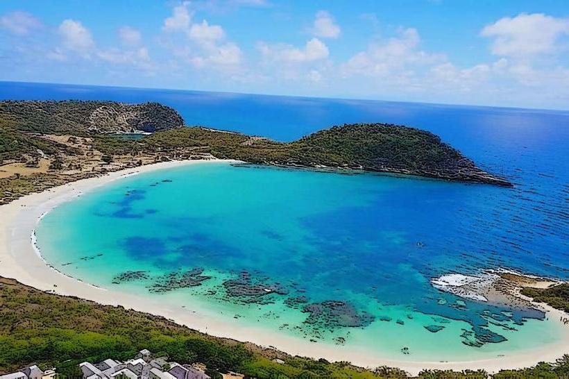
Curtain Bluff is a prominent headland located on the southwestern coast of Antigua, Antigua and Barbuda. It is a significant geological feature characterized by its dramatic cliff face.
Visual Characteristics
The headland features a sheer cliff face composed of limestone, rising approximately 60 feet above sea level. The rock exhibits stratification and is weathered by wave action. The vegetation on the bluff is sparse, consisting primarily of drought-resistant shrubs and grasses. The waters surrounding the bluff are typically clear, with varying shades of blue and turquoise depending on depth and sunlight.
Location & Access Logistics
Curtain Bluff is situated at the southern end of Morris Bay on the southwestern coast of Antigua. Access is via the main coastal road, Sir Rupert John Highway. From St. John's, travel south on Sir Rupert John Highway for approximately 25 kilometers. Turn west onto the unpaved access road marked for Curtain Bluff. Parking is available at the base of the bluff, with capacity for approximately 20 vehicles. Public transport options are limited; the nearest bus stop is approximately 2 kilometers east on Sir Rupert John Highway, requiring a walk or taxi service.
Historical & Ecological Origin
Curtain Bluff is a natural geological formation. Its current form is the result of coastal erosion and the geological uplift of limestone deposits over millennia. The limestone itself is composed of fossilized marine organisms, indicating a past marine environment. The area is part of the island's coastal ecosystem, subject to tidal influences and marine weathering.
Key Highlights & Activities
Observation of the cliff face and surrounding coastline. Birdwatching, particularly seabirds that nest on the cliffs. Photography of the geological formations and coastal scenery. Access to the waters below for swimming and snorkeling is possible during calm sea conditions, but caution is advised due to submerged rocks and currents.
Infrastructure & Amenities
There are no permanent infrastructure or amenities directly at Curtain Bluff. Restrooms, food vendors, and shaded areas are not available on-site. Cell phone signal (4G/5G) is generally available but can be intermittent due to the exposed coastal location.
Best Time to Visit
For photography, early morning or late afternoon provides optimal lighting conditions for the cliff face. The best months for visiting are generally from December to May, during the dry season, when rainfall is minimal and sea conditions are typically calmer. High tide can obscure some of the base rock formations.
Facts & Legends
Local lore suggests that the bluff was a strategic lookout point during periods of historical conflict, though verifiable records are scarce. The name "Curtain Bluff" is thought to derive from the way the waves crash and recede, creating a visual effect resembling a curtain.
Nearby Landmarks
- Morris Bay Beach (0.2km West)
- Old Road Town (3.5km East)
- Dow's Hill Interpretation Centre (4.0km Northeast)
- Shirley Heights (4.5km Northeast)
- Nelson's Dockyard (4.8km Northeast)