Landmark: Enewetak WWII Ruins
City: Enewetak Atoll
Country: Marshall Islands
Continent: Australia
Enewetak WWII Ruins, Enewetak Atoll, Marshall Islands, Australia
The Enewetak WWII Ruins are remnants of military installations located on Enewetak Atoll in the Marshall Islands.
These structures represent a significant historical site from the Pacific theater of World War II.
Visual Characteristics
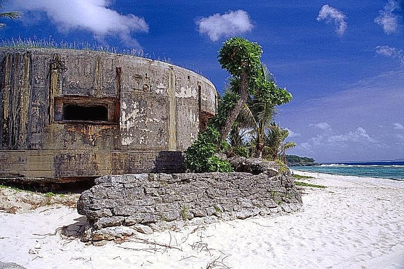
The ruins consist primarily of concrete foundations, blast walls, and scattered debris. Materials are predominantly reinforced concrete, showing signs of weathering and erosion from exposure to the marine environment. Some structures exhibit rebar exposure. Vegetation, including coconut palms and low-lying shrubs, has encroached upon many of the sites, partially obscuring them.
Location & Access Logistics
Enewetak Atoll is located in the Ralik Chain of the Marshall Islands. Access is primarily via chartered boat or small aircraft to Enewetak Island. There are no public transport options. Visitors typically arrange transport through local authorities or specialized tour operators. Landing sites are generally on the main islands where the ruins are concentrated.
Historical & Ecological Origin
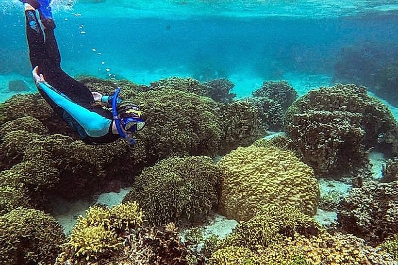
These ruins are the remnants of Japanese and later American military fortifications and infrastructure constructed during and immediately after World War II. The atoll was the site of significant battles and subsequent nuclear testing by the United States. The geological origin of Enewetak Atoll is a coral reef system built upon a submerged volcanic seamount.
Key Highlights & Activities
Exploration of concrete bunkers and command posts. Observation of overgrown military emplacements. Photography of historical decay. Site visits require prior arrangement and adherence to local regulations.
Infrastructure & Amenities
Limited infrastructure exists. Basic shelter may be found in some larger concrete structures, but no formal amenities like restrooms or designated shade areas are available. Cell phone signal is generally absent. Food vendors are not present on the atoll; visitors must bring all necessary supplies.
Best Time to Visit
The dry season, from January to April, offers the most favorable weather conditions with lower rainfall. Mid-morning provides adequate light for photography without harsh midday shadows. Tidal conditions are not a significant factor for accessing the main ruin sites.
Facts & Legends
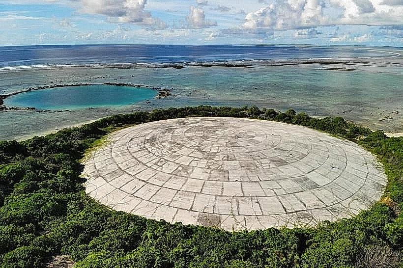
A notable historical oddity is the presence of the "Runit Dome," a concrete sarcophagus built over nuclear waste on nearby Runit Island, a consequence of post-war testing. Local lore sometimes speaks of unexploded ordnance, though official access routes are generally considered safe.
Nearby Landmarks
- Enewetak Island (main settlement): 0.1km West
- Engebi Island (former Japanese base): 10km North
- Kwajalein Atoll (US military base): 400km Southeast