Landmark: Old Military Harbor Zone
City: Enewetak Atoll
Country: Marshall Islands
Continent: Australia
Old Military Harbor Zone, Enewetak Atoll, Marshall Islands, Australia
The Old Military Harbor Zone is a historical site located within Enewetak Atoll in the Marshall Islands.
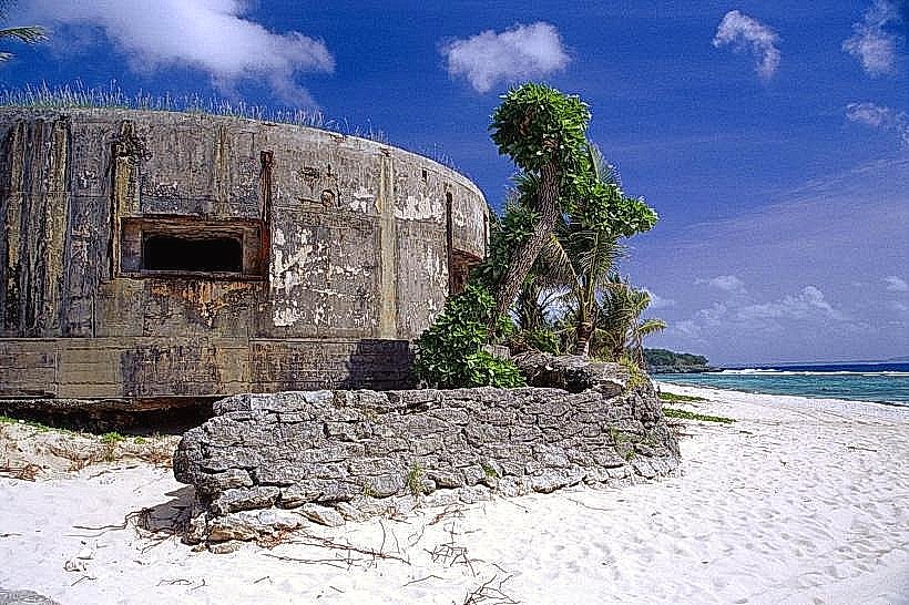
This area encompasses remnants of World War II and subsequent military operations, including concrete structures and submerged debris.
Visual Characteristics
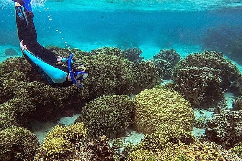
The zone features concrete foundations, blast walls, and scattered metal debris, some of which are partially submerged in shallow, clear water. The water color is typically turquoise, with visibility dependent on tidal conditions. Vegetation is sparse, consisting mainly of low-lying coastal plants on the few exposed landmasses.
Location & Access Logistics
Access to the Old Military Harbor Zone is primarily via boat from the main inhabited islands of Enewetak Atoll. There are no direct road connections. Private boat charters or organized dive tours are the standard methods of transport. The harbor area is approximately 2 kilometers west of the primary airstrip on Enewetak Island.
Historical & Ecological Origin
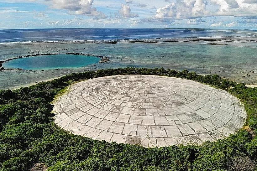
This zone served as a significant naval and logistical base during World War II. Following the war, it was utilized for nuclear testing operations, with some structures dating from this period. The atoll itself is a coral formation, a ring-shaped reef enclosing a lagoon.
Key Highlights & Activities
Activities include snorkeling and diving among the submerged structures and debris. Observation of marine life that has colonized the artificial reef structures is possible. Surface exploration of accessible concrete foundations on the islands is also an option.
Infrastructure & Amenities
There are no permanent infrastructure or amenities within the Old Military Harbor Zone itself. Visitors must arrange for all supplies, including water and food, to be brought with them. Cell phone signal is generally unavailable in this remote location.
Best Time to Visit
The best time for visibility for diving and snorkeling is during the dry season, from January to April. Calm seas are more common during these months. Mid-morning offers optimal sunlight penetration for underwater viewing.
Facts & Legends
A notable historical fact is that the area was a staging point for significant naval operations during the Battle of Enewetak in 1944. Local lore sometimes speaks of unexploded ordnance, though official surveys have addressed known hazards.
Nearby Landmarks
- Runit Island (Dome) - 3km Northeast
- Enewetak Island (Main Settlement) - 2km East
- Engebi Island - 8km Northwest
- Parry Island - 5km Southeast