Landmark: Horton Plains National Park
City: Nuwara Eliya
Country: Sri Lanka
Continent: Asia
Horton Plains National Park, Nuwara Eliya, Sri Lanka, Asia
Horton Plains National Park is a protected area situated on the southern edge of the central highlands of Sri Lanka, near Nuwara Eliya.
This high-altitude plateau is characterized by its montane grasslands and cloud forests, forming a distinct ecological zone.
Visual Characteristics
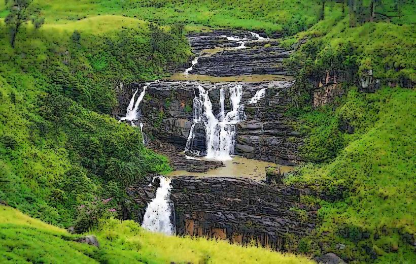
The landscape consists of rolling grasslands interspersed with patches of dense montane cloud forest. Dominant vegetation includes various grasses, rhododendrons, and endemic flora. Rock outcrops and small streams are common features. The elevation ranges from approximately 2,100 to 2,300 meters above sea level.
Location & Access Logistics
The park entrance is located approximately 8 kilometers south of Nuwara Eliya town. Access is via the B140 road (Ambewela Road) towards Pattipola. The final 4 kilometers to the park entrance are unpaved and may require a 4WD vehicle, especially during the rainy season. Public transport to the park entrance is limited; visitors typically arrange private transport or hire tuk-tuks from Nuwara Eliya. Parking is available at the main entrance facility.
Historical & Ecological Origin
Horton Plains was designated a national park in 1988 to protect its unique biodiversity and watershed. Ecologically, it is a montane grassland ecosystem, a rare habitat type in Sri Lanka, formed by a combination of altitude, climate, and historical land use patterns. The area is a critical watershed for several major rivers in Sri Lanka.
Key Highlights & Activities
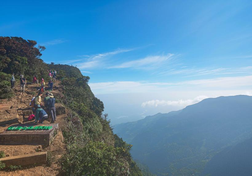
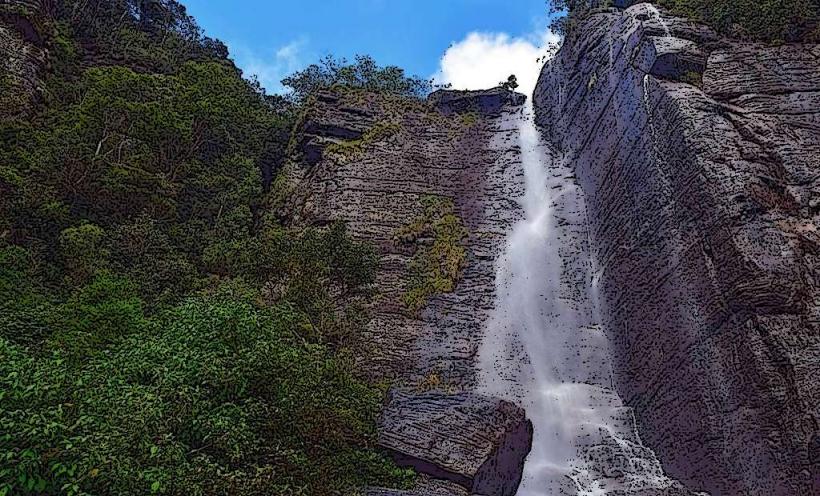
The primary activity is hiking. The most popular trail is the 9.2 km circular route to World's End, a sheer cliff with a 4,000-foot drop, and Baker's Falls, a 20-meter waterfall. Shorter trails are also available. Birdwatching is a significant activity due to the park's endemic avian species. Observation of sambar deer and other mammals is common.
Infrastructure & Amenities
A visitor center is located at the park entrance, providing information and basic facilities. Restrooms are available at the entrance. Limited shade is present along the main trails, primarily from forest cover. Cell phone signal is intermittent within the park. No food vendors operate inside the park; visitors must bring their own provisions.
Best Time to Visit
The best time of day for photography, particularly at World's End, is early morning (between 6:00 AM and 9:00 AM) before cloud cover typically obscures the view. The dry season, from December to March, offers the most favorable weather conditions with less rainfall and clearer skies. The park is accessible year-round, but heavy rains can make trails muddy and slippery.
Facts & Legends
The name "Horton Plains" was given in honor of Sir Robert Wilmot-Horton, the British Governor of Ceylon from 1831 to 1837. A local legend suggests that the sheer drop at World's End was once a gateway to the underworld.
Nearby Landmarks
- Ambawela Farm (2.5km Northwest)
- Moon Plains (3.0km West)
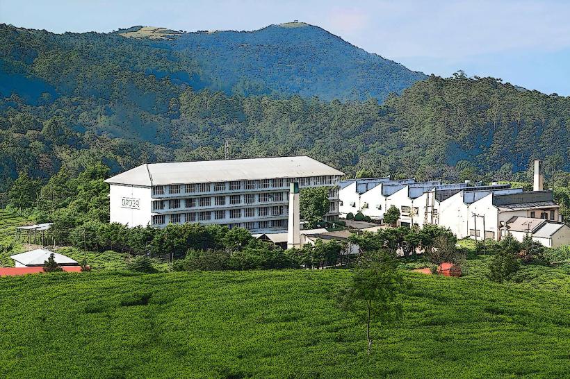
- Pedro Tea Estate (4.0km North)
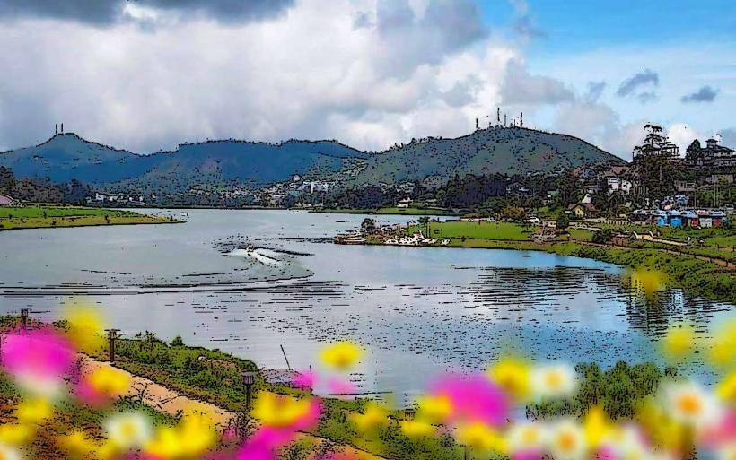
- Gregory Lake (6.0km North)