Landmark: Marsascala Bay
City: Marsascala
Country: Malta
Continent: Europe
Marsascala Bay, Marsascala, Malta, Europe
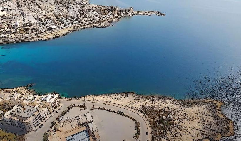
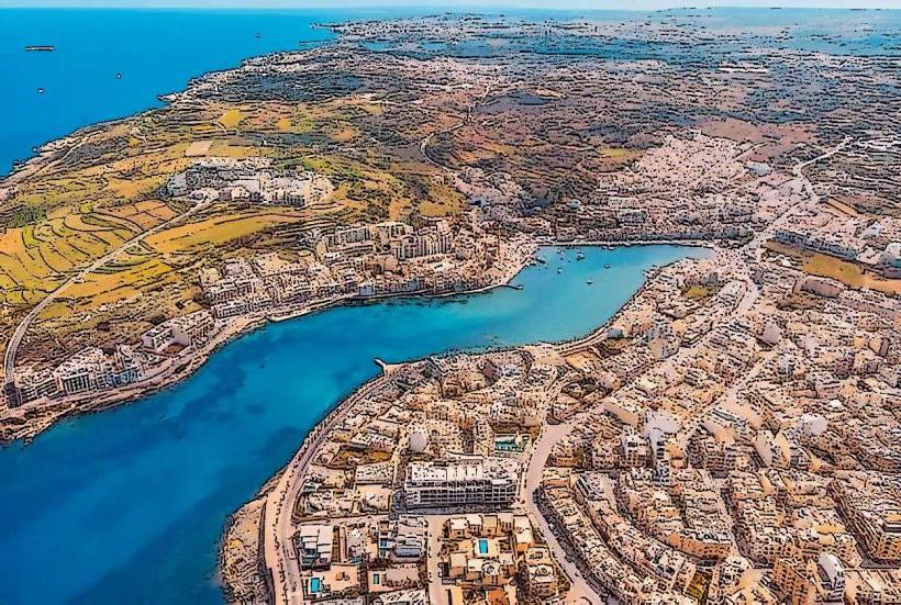
Marsascala Bay is a natural harbor and a prominent coastal feature located in the town of Marsascala, on the southeastern coast of Malta. It serves as a central point for local maritime activity and recreation.
Visual Characteristics
The bay is characterized by its elongated shape, protected by two headlands. The water is typically clear, exhibiting shades of blue and green, especially in calmer conditions. The shoreline consists of a mix of rocky outcrops, concrete promenades, and small patches of shingle beach. Traditional Maltese fishing boats, known as luzzu, with their distinctive eyes painted on the bow, are often moored within the bay. The surrounding area features low-rise residential buildings and commercial establishments.
Location & Access Logistics
Marsascala Bay is situated at the heart of Marsascala town. It is approximately 12 km southeast of Valletta, Malta's capital. Access is primarily via Triq Sant' Antnin and Triq ix-Xatt, which run along the bay. Public parking is available in designated areas along the promenade and side streets, though it can be limited during peak season. Several bus routes serve Marsascala, including lines 91, 92, and 93 from Valletta, and line 124 from Marsaxlokk, with stops directly adjacent to the bay.
Historical & Ecological Origin
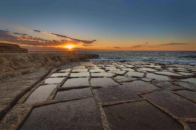
Marsascala Bay is a natural geological formation, an inlet carved into the limestone coast of Malta. Its sheltered nature has made it a strategic harbor since ancient times, providing natural protection for boats. The bay's formation is a result of millennia of erosion by sea and weather on the soft Globigerina Limestone.
Key Highlights & Activities
Swimming is possible from designated points along the promenade. Sunbathing can be done on the rocky ledges. Walking along the extensive promenade that encircles the bay is a common activity. Fishing from the shore is practiced. Small boat rentals are available seasonally. Several restaurants and cafes line the waterfront.
Infrastructure & Amenities
Public restrooms are available at various points along the promenade, particularly near the main square. Shade is limited to areas under trees or awnings of establishments; direct sun exposure is prevalent along much of the bay. Cell phone signal (4G/5G) is consistently strong throughout the area. Numerous food vendors, restaurants, and cafes are directly adjacent to the bay.
Best Time to Visit
The best time for general visitation and water activities is from May to October, when temperatures are warm and the sea is calm. For photography, early morning or late afternoon provides softer light, minimizing harsh shadows. The bay is not significantly affected by tides for general access, but calmer waters are typically found on days with less wind.
Facts & Legends
Local lore suggests that the bay's name, Marsascala, derives from "Marsa" (Arabic for port) and "Sqalli" (Sicilian), indicating its historical ties to Sicilian trade and influence. A verified historical oddity is the presence of several ancient salt pans carved into the rock formations along the bay's edges, remnants of traditional salt harvesting.
Nearby Landmarks
- St. Thomas Bay: 1.5km South
- Zonqor Point: 2.0km North
- Marsaxlokk Fishing Village: 4.5km Southwest
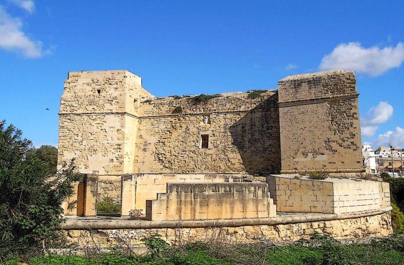
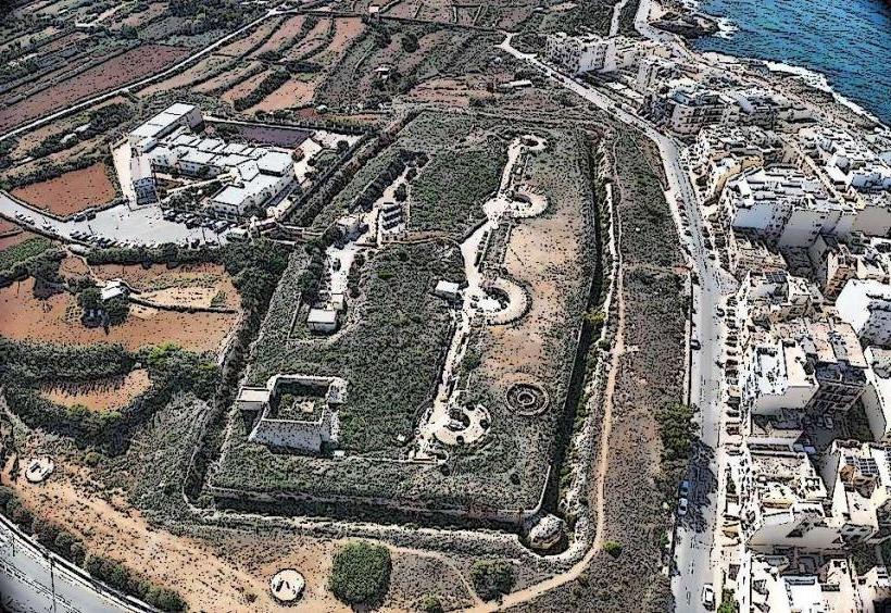
- Fort Leonardo: 3.0km North
- San Tumas Watch Tower: 1.8km South