Information
Landmark: Morne Sion Nature TrailCity: Dennery
Country: Saint Lucia
Continent: North America
Morne Sion Nature Trail, Dennery, Saint Lucia, North America
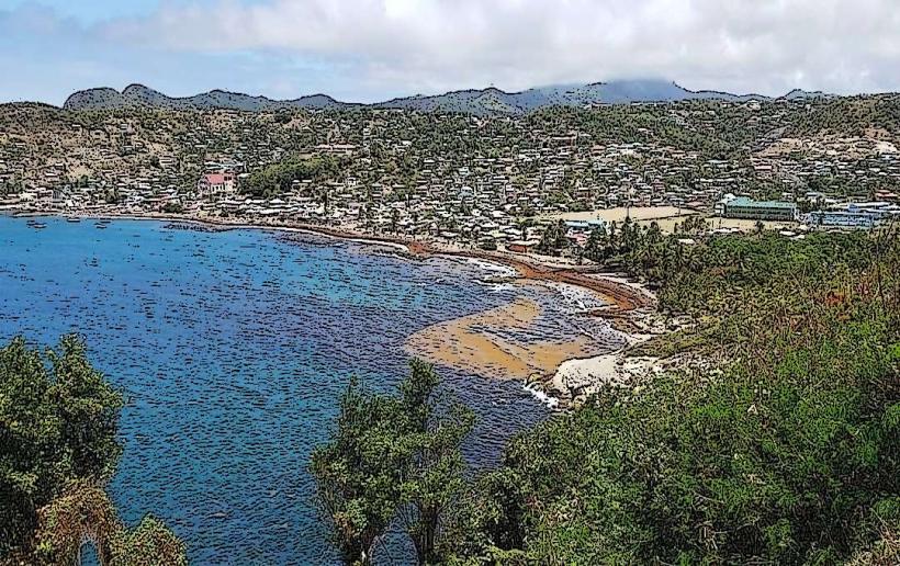
The Morne Sion Nature Trail is a marked walking path located in the vicinity of Dennery, Saint Lucia. It offers a route through the island's natural landscape.
Visual Characteristics
The trail traverses a tropical forest environment. Dominant vegetation includes mature trees, dense undergrowth, and various flowering plants. The terrain is uneven, with sections of exposed earth and rock. The path width varies, generally accommodating single-file passage.
Location & Access Logistics
The trailhead is situated approximately 3 kilometers west of Dennery town center. Access is via the B1 secondary road. Turn off the B1 onto an unpaved access track, marked by a small sign. Parking is available for approximately 5-7 vehicles at the trailhead. No public transport directly serves the trailhead; nearest bus stops are in Dennery town.
Historical & Ecological Origin
The Morne Sion area is characterized by volcanic geology, with the trail passing through areas of eroded volcanic rock. The forest is a secondary growth tropical rainforest, regenerating after historical agricultural use. Specific ecological classification is lowland tropical rainforest.
Key Highlights & Activities
Hiking the marked trail is the primary activity. The trail loop is approximately 2.5 kilometers in length. Observation points along the route provide views of the surrounding valleys and coastline. Birdwatching is possible due to the diverse avian population.
Infrastructure & Amenities
The trailhead has a small, unpaved parking area. No restrooms or designated seating areas are present. Cell phone signal (4G) is intermittent along the trail, with better reception near the trailhead. No food vendors are located at or near the trailhead.
Best Time to Visit
The best time for hiking is during the dry season, from December to May. Early morning (07:00-09:00) offers cooler temperatures and optimal lighting for photography. Midday sun can be intense due to canopy cover limitations in some sections.
Facts & Legends
Local folklore suggests that certain large, ancient trees along the trail are imbued with protective spirits. A specific large Ceiba tree, approximately 1 kilometer into the loop, is often cited in these narratives. Visitors are advised to stay on the marked path to avoid disturbing the ecosystem.
Nearby Landmarks
- Dennery Town (3km East)
- Praslin Bay (4km Southeast)
- Grand Etang National Park (12km Northwest)
- Diamond Falls Botanical Gardens (15km Southwest)