Landmark: Mount Nlonako
City: Nkongsamba
Country: Cameroon
Continent: Africa
Mount Nlonako, Nkongsamba, Cameroon, Africa
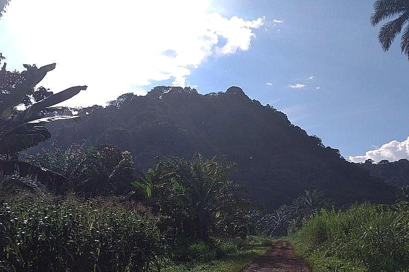
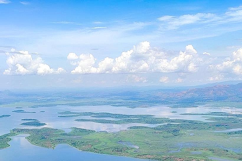
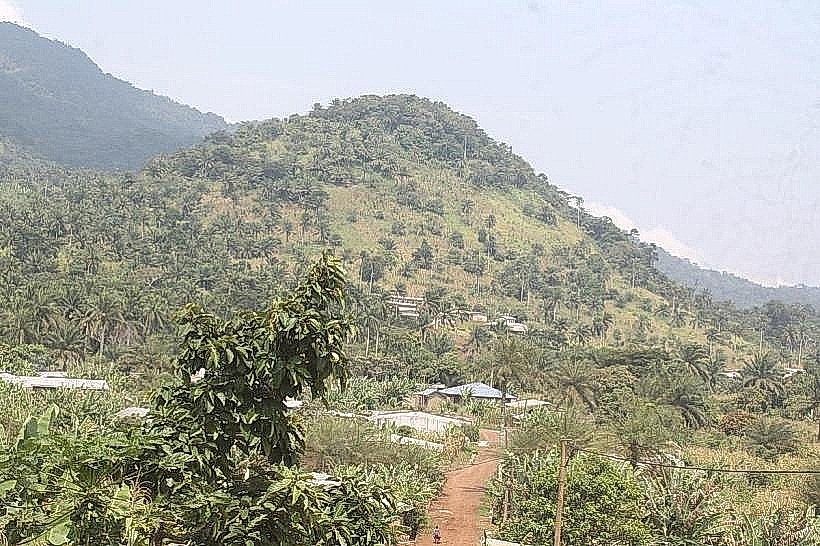
Mount Nlonako is a stratovolcano located near Nkongsamba in the Littoral Region of Cameroon.
It is part of the Cameroon Line, a chain of volcanoes extending across the country.
Visual Characteristics
Mount Nlonako presents a conical shape with steep slopes. Its summit is often obscured by cloud cover. The lower slopes are covered in dense tropical rainforest, transitioning to montane forest at higher elevations. Volcanic rock formations are visible in certain exposed areas.
Location & Access Logistics
The base of Mount Nlonako is approximately 15 kilometers southwest of Nkongsamba. Access is via the N5 national road towards Melong, then turning onto a local track. The track is unpaved and can be challenging for standard vehicles, particularly during the rainy season; a 4x4 vehicle is recommended. There is no designated parking area at the trailhead; vehicles are typically parked at the nearest village. Public transport to Nkongsamba is available via bus from major cities like Douala. From Nkongsamba, local taxis or shared minibuses can reach the vicinity of the mountain's base, but further access requires walking or arranging local transport.
Historical & Ecological Origin
Mount Nlonako is a Quaternary volcanic edifice, part of the larger Cameroon Volcanic Line. Its formation is attributed to intraplate volcanism, with its last known eruption estimated to be in the Holocene epoch. The mountain's ecosystem is characterized by high biodiversity due to its elevation and rainfall patterns.
Key Highlights & Activities
Hiking to the summit is the primary activity. The ascent involves navigating dense forest trails. Observation of diverse flora and fauna, including various bird species, is possible. The summit offers panoramic views of the surrounding landscape when visibility permits.
Infrastructure & Amenities
There are no formal facilities at Mount Nlonako. Restrooms, shade, and food vendors are not available at the mountain itself. Cell phone signal is intermittent and generally poor on the slopes and at the summit.
Best Time to Visit
The dry season, from November to March, offers the most favorable conditions for hiking, with reduced rainfall and clearer visibility. The best time of day for photography is generally in the early morning before cloud cover typically forms around the summit.
Facts & Legends
Local folklore suggests that the mountain is inhabited by spirits, and certain areas are considered sacred. A specific tip for visitors is to carry sufficient water and food, as no services are available along the trail.
Nearby Landmarks
- Ekomo Waterfalls (10km Northeast)
- Mount Manengouba (25km East)
- Nkongsamba Central Market (15km Northeast)
- Melong (10km Southeast)