Landmark: Reserva Nacional Eduardo Avaroa
City: Uyuni
Country: Bolivia
Continent: South America
Reserva Nacional Eduardo Avaroa, Uyuni, Bolivia, South America
Reserva Nacional Eduardo Avaroa is a protected natural area located in the Potosí Department of southwestern Bolivia, near the border with Chile and Argentina.
Visual Characteristics
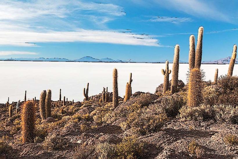
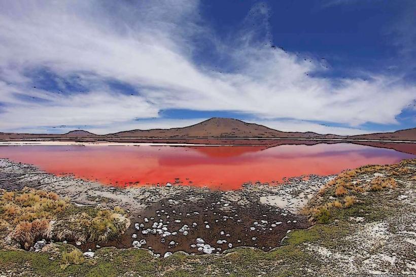
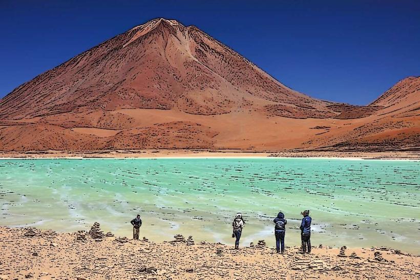
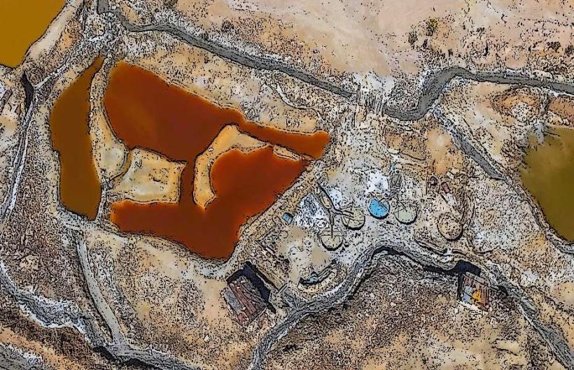
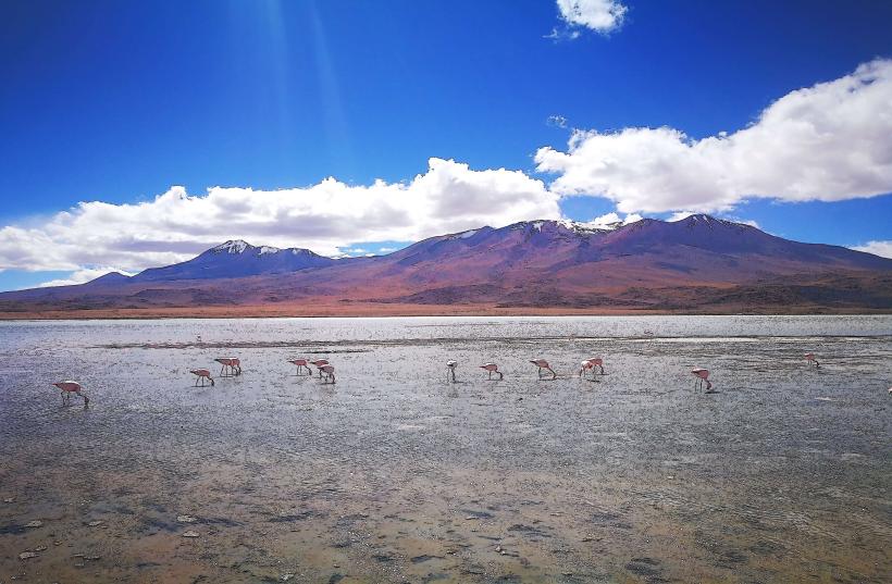
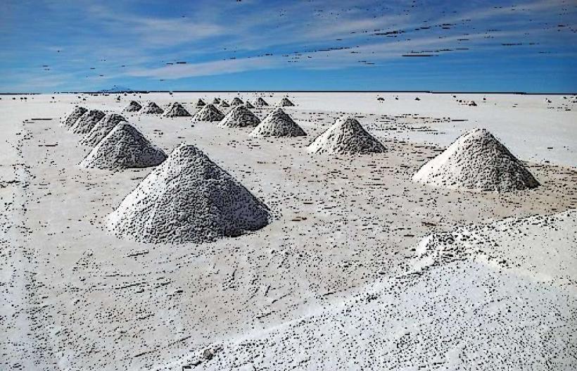
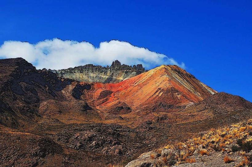
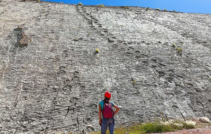
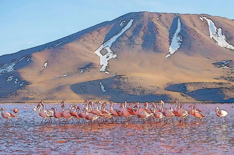
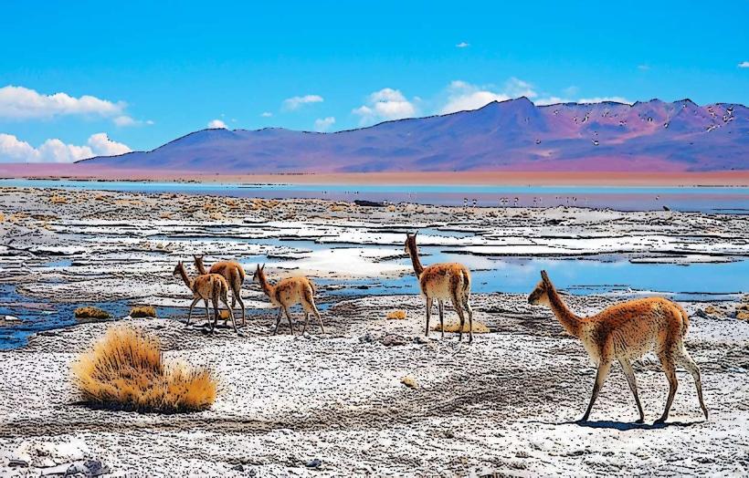
The reserve encompasses high-altitude Andean landscapes characterized by volcanic formations, salt flats, geysers, hot springs, and numerous lagoons. Lagoon colors vary from deep red (Laguna Colorada) due to algae and sediment, to turquoise and emerald green. Rock formations include basaltic lava flows and tuff cones. Vegetation is sparse, dominated by ichu grass (Stipa ichu) and cushion plants adapted to arid, high-altitude conditions.
Location & Access Logistics
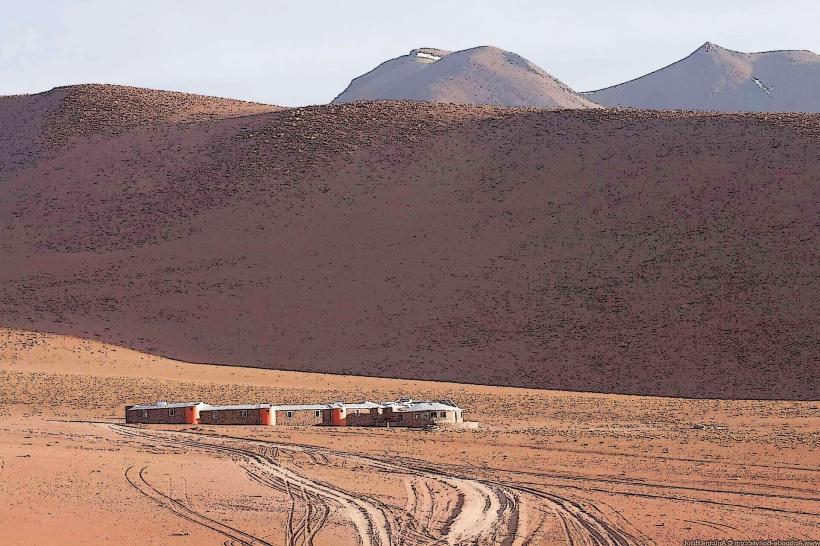
The reserve is situated approximately 200 kilometers southwest of Uyuni. Access is primarily via unpaved, rough tracks requiring a 4x4 vehicle. Travel from Uyuni typically involves multi-day organized tours, often departing from Uyuni town. No public transport directly serves the reserve. Parking is generally unmanaged and available at designated viewpoints or near accommodation sites.
Historical & Ecological Origin
Reserva Nacional Eduardo Avaroa was established on November 14, 1973, to protect its unique geological features and diverse wildlife, particularly flamingo populations. Ecologically, the area is part of the Altiplano-Puna dry grasslands ecoregion, shaped by volcanic activity and arid climatic conditions. The lagoons are hypersaline, with some being endorheic basins.
Key Highlights & Activities
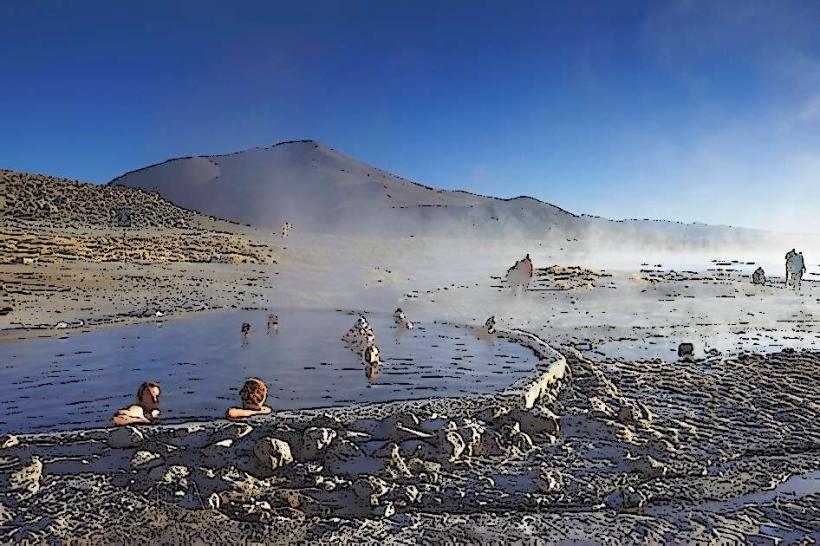
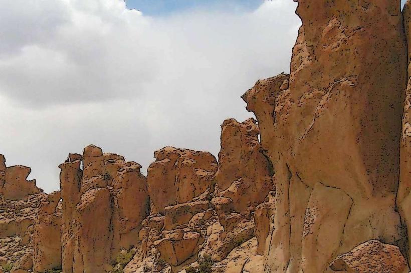
Activities include observing wildlife, primarily flamingos (Andean, Chilean, and James's), vicuñas, and rheas. Visiting geyser fields (Sol de Mañana), hot springs (Termas de Polques), and unique rock formations (Arbol de Piedra) are primary attractions. Photography of the varied lagoon colors and volcanic landscapes is a significant activity. Hiking is possible in designated areas, but altitude sickness is a consideration.
Infrastructure & Amenities
Basic infrastructure is limited. Restrooms are available at some tour stops and basic refuges, often rudimentary. Shade is minimal, provided by natural rock formations or basic shelters. Cell phone signal is generally absent within most of the reserve. Food vendors are not present; visitors rely on provisions brought by tour operators.
Best Time to Visit
The dry season, from April to October, offers clearer skies and more stable weather. The best time of day for photography is typically early morning or late afternoon for softer light and enhanced landscape colors. High tide is not a relevant factor for visiting the lagoons. Temperatures can drop significantly below freezing at night year-round.
Facts & Legends
Laguna Colorada's red hue is caused by red-colored sediments and algae, influenced by mineral content and sunlight. A local legend suggests that the vibrant colors of the lagoons are the result of spilled paint from the gods during a celestial battle.
Nearby Landmarks
- Salar de Uyuni (Salt Flats) - 100km Northeast
- Laguna Hedionda - 30km North
- Villazón Border Crossing - 150km Southeast
- San Pedro de Atacama (Chile) - 200km West (via border crossing)