Landmark: Rocky Point Recreation Area
City: Belle Fourche
Country: USA South Dakota
Continent: North America
Rocky Point Recreation Area, Belle Fourche, USA South Dakota, North America
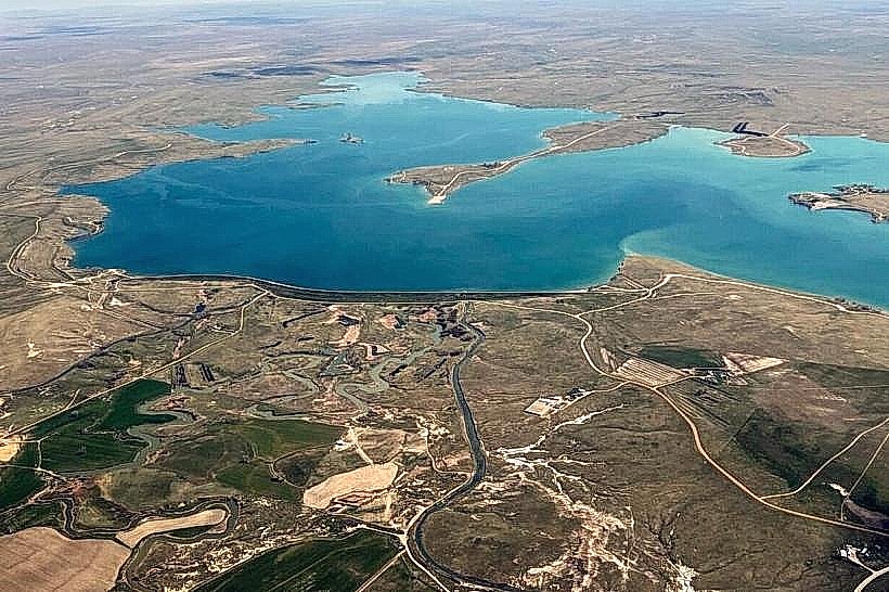
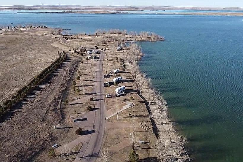
Rocky Point Recreation Area is a public park situated on the western shore of Belle Fourche Reservoir in Butte County, South Dakota.
Visual Characteristics
The area features a shoreline composed of exposed sedimentary rock formations, primarily sandstone and shale, exhibiting layered strata. Vegetation consists of sparse prairie grasses and low-lying shrubs adapted to arid conditions. The reservoir water color varies from a murky brown to a greenish hue depending on sediment load and depth.
Location & Access Logistics
Rocky Point Recreation Area is located approximately 16 kilometers (10 miles) west of Belle Fourche, South Dakota. Access is via State Highway 79 South, turning west onto County Road 18 (also known as Rocky Point Road). The road is paved to the park entrance. Parking is available in designated gravel lots near the reservoir shoreline and the campground. No public transport services this location.
Historical & Ecological Origin
The geological formations at Rocky Point are part of the Pierre Shale formation, dating back to the Late Cretaceous period. The Belle Fourche Reservoir itself was created by the construction of the Belle Fourche Dam, completed in 1952, as part of the Belle Fourche Irrigation Project to provide water for agricultural use.
Key Highlights & Activities
Activities include boating, fishing, and shoreline exploration. Designated areas allow for swimming. Primitive camping is available in the campground. Hiking trails are not formally established, but exploration of the shoreline is possible.
Infrastructure & Amenities
Restrooms are available at the campground and day-use areas. Limited shade structures are present in day-use zones. Cell phone signal is intermittent and generally poor. No food vendors operate within the recreation area; visitors should bring their own supplies.
Best Time to Visit
The best time for water-based activities is from May through September, when water temperatures are suitable for swimming and boating. Mid-morning and late afternoon offer the most favorable lighting conditions for photography of the rock formations. Reservoir water levels can fluctuate significantly based on irrigation demands and precipitation, impacting shoreline access.
Facts & Legends
The exposed rock layers at Rocky Point are known to contain fossilized marine life from when the area was covered by the Western Interior Seaway millions of years ago. Visitors have reported finding small fossil fragments along the shoreline.
Nearby Landmarks
- Belle Fourche Reservoir Dam (10km East)
- Devil's Tower National Monument (Wyoming) (45km Southwest)
- Bearlodge National Forest (Wyoming) (40km Southwest)
- Redwater River Recreation Area (15km Northeast)