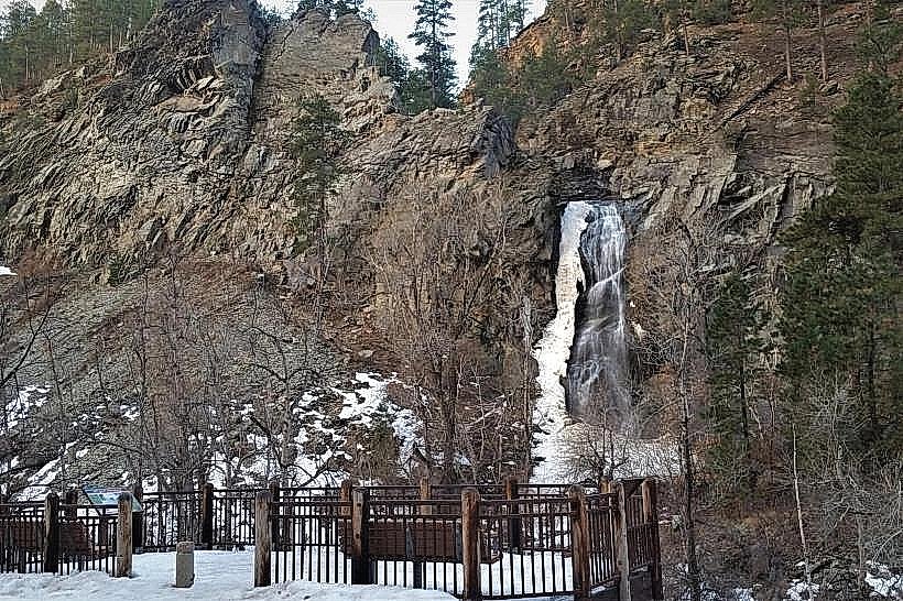
Landmark: Roughlock Falls
City: Spearfish
Country: USA South Dakota
Continent: North America
Roughlock Falls, Spearfish, USA South Dakota, North America
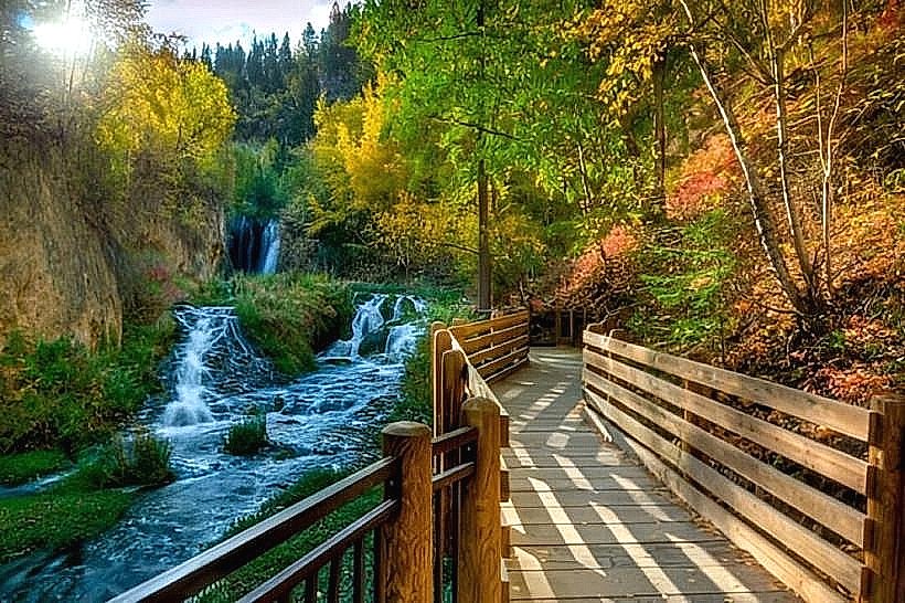
Roughlock Falls is a waterfall located in Spearfish Canyon, South Dakota, USA.
Visual Characteristics
The falls consist of multiple cascades over limestone formations, with water flowing from a series of springs. The rock faces are primarily gray and tan limestone, often covered with green moss and ferns. The water is clear, with a white foam where it tumbles over the rocks. The total drop is approximately 50 feet (15 meters) over several tiers.
Location & Access Logistics
Roughlock Falls is situated within Spearfish Canyon. Access is via Spearfish Canyon Scenic Byway (US Forest Service Road 101). The falls are approximately 14 miles south of Spearfish, South Dakota. A paved parking area is available directly adjacent to the falls. No public transport services reach this specific location.
Historical & Ecological Origin
The falls are a natural formation, created by the erosion of Spearfish Canyon's limestone bedrock over millennia. The water originates from springs that emerge from the canyon walls, a common geological feature in the Black Hills region. The area is part of the Black Hills National Forest.
Key Highlights & Activities
Observation of the falls from the viewing platform. Photography of the cascades and surrounding canyon environment. Hiking on the Roughlock Falls Trail, which connects to other trails within Spearfish Canyon. Fishing is permitted in Spearfish Creek downstream from the falls, subject to state regulations.
Infrastructure & Amenities
A paved viewing platform is present. Restrooms are located at the parking area. Picnic tables are available. Cell phone signal is generally unreliable in Spearfish Canyon.
Best Time to Visit
For photography, early morning or late afternoon light provides optimal illumination of the falls and canyon walls. The best months for visiting are typically May through October, when the scenic byway is clear of snow. Water flow is consistent year-round, though it may be reduced in late summer.
Facts & Legends
The name "Roughlock" is believed to derive from the rough, churning appearance of the water as it descends the multiple tiers of the falls.
Nearby Landmarks
- 1.5km North: Spearfish Falls
- 3.0km North: Bridal Veil Falls
- 10.0km North: Roughlock Falls Nature Area
- 12.0km North: Latchstring Inn