Information
Landmark: Sabino Canyon Recreation AreaCity: Tucson
Country: USA Arizona
Continent: North America
Sabino Canyon Recreation Area, Tucson, USA Arizona, North America
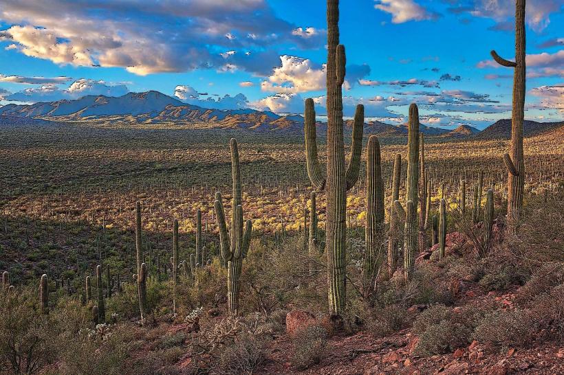
Sabino Canyon Recreation Area is a protected natural area located in the Santa Catalina Mountains, northeast of Tucson, Arizona.
Visual Characteristics
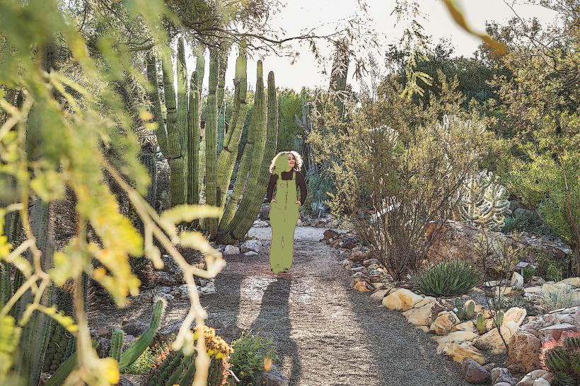
The canyon features steep, rocky walls composed primarily of Precambrian granite. The canyon floor is characterized by a riparian corridor with a dense concentration of desert vegetation, including saguaro cacti, palo verde trees, and mesquite trees. Sabino Creek, a seasonal watercourse, flows through the canyon, its appearance varying significantly with rainfall. Rock formations exhibit erosion patterns from water and wind.
Location & Access Logistics
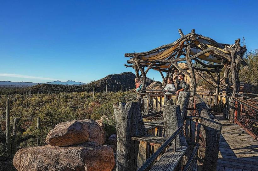
The main entrance to Sabino Canyon Recreation Area is located at 5900 N Sabino Canyon Road, Tucson, AZ 85750. This is approximately 10 miles northeast of downtown Tucson. Access is via East Sunrise Drive, turning north onto Sabino Canyon Road. A paved road extends 3.8 miles into the canyon. Parking is available at the Visitor Center lot, which can fill quickly during peak hours. A fee is required for vehicle entry. Alternatively, the Sun Tran bus system operates Route 12, which stops near the canyon entrance. From the Visitor Center, a narrated tram service operates on the paved road into the canyon, providing access to various trailheads.
Historical & Ecological Origin
Sabino Canyon is a product of geological processes, primarily erosion acting on the granite of the Santa Catalina Mountains over millions of years. The riparian ecosystem is sustained by Sabino Creek, which originates in the higher elevations of the mountains. The area has been utilized by indigenous peoples for millennia. The establishment of the Recreation Area is a modern conservation effort to preserve its natural state.
Key Highlights & Activities
Hiking is a primary activity, with numerous trails of varying difficulty. The paved road itself is accessible for walking and cycling. The tram service offers a narrated tour of the canyon's features. Sabino Creek offers opportunities for wading during periods of sufficient water flow. Birdwatching is common due to the diverse habitat. Photography is possible, particularly of the rock formations and desert flora.
Infrastructure & Amenities
Restrooms are available at the Visitor Center and at designated stops along the tram route. Shaded areas are limited, primarily found at the Visitor Center and tram stops. Cell phone signal (4G/5G) is intermittent within the canyon. Food vendors are not present within the recreation area; visitors are advised to bring their own provisions. Water is available at the Visitor Center.
Best Time to Visit
For hiking and outdoor activities, the cooler months of October through April are recommended. Mornings between 7:00 AM and 10:00 AM offer the best light for photography of the canyon walls. Sabino Creek's water flow is most consistent during the monsoon season (July-September) and after winter rains, but can be dry for extended periods. Tram service operates daily, with hours varying seasonally.
Facts & Legends
Sabino Canyon is known for its flash flood potential. During heavy rainfall, Sabino Creek can rise rapidly, making certain areas impassable and potentially dangerous. A specific geological feature known as "The Punchbowl" is a popular, though often dry, pool area within the canyon.
Nearby Landmarks
- Bear Canyon Trailhead (0.8km Northeast)
- Mount Lemmon Scenic Byway (Access point 3km North)
- Tanque Verde Falls (4km East)
- Saguaro National Park East (7km Southeast)